
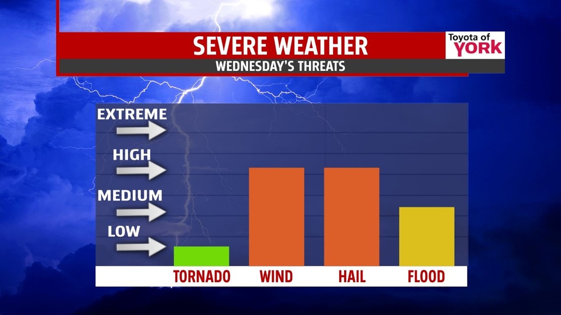
HEAT & STORMS: It’s another hot one for us, but today we add more clouds and strong to severe storms. We start warm and hazy, and we’ll heat up quickly to the low 90s. Humidity is up a tad too, which will make it feel like 100° later in the day. A stalled front will help to fire and organize afternoon storms. This will result in numerous showers and storms, which may contain flooding downpours, frequent lightning, damaging winds, and hail. Stay alert today as we’re under a slight risk for severe storms. Most rain will taper overnight as we drop to the low 70s.


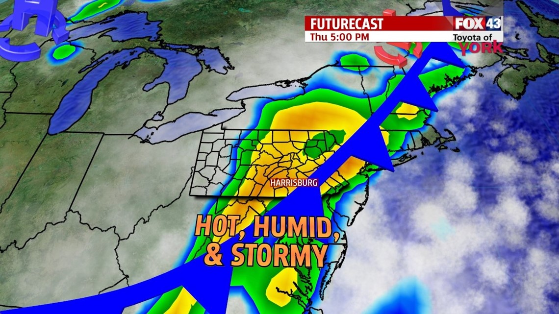
MORE STORMS: Thursday, a stronger cold front pushes through the state. Plus moisture from Arthur will be added to it. While the coastal states will see the most rain, this combination will help to fire showers and thunderstorms for the afternoon through the overnight. It’s warm with highs in the upper 80s and it’s still muggy. Showers and storms may turn severe, but bank on heavy downpours at the least. The rain tapers overnight. The cold front will help steer the tropical system away from the region.

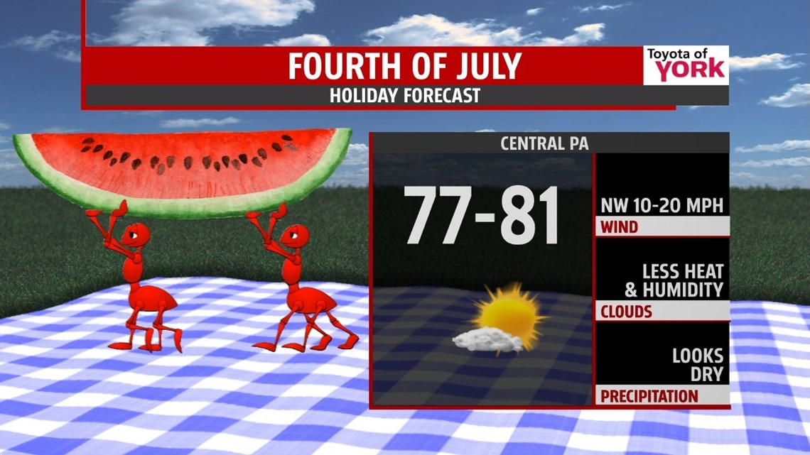
4th OF JULY: With high pressure building in and a tropical system right off the coast, we expect a breezy day. Sinking air should help clear out the skies through the day and keep us dry after a morning shower chance to the east. It’s a good looking day, and evening for all outdoor plans! Enjoy it. Highs hit the low 80s. If you head toward the beach, it will be stormy, with winds, clouds, and rough seas thanks to Arthur.

WEEKEND: It’s downright amazing! We’re mostly sunny and dry. Humidity drops off for Saturday with just a touch of it for Sunday. Highs are in the middle 80s Saturday and Sunday. Please find a way to enjoy a few hours outdoors this weekend. It gets hot to start next week.
TROPICS: Arthur is expected to start moving northward today, picking up speed overnight tonight. The track graces the North Carolina coast on Thursday and then puts it just east of the Jersey coast by Friday night. Locally, impacts would be limited to an added breeze and some dry air on its back side. Closer to the beach you may get a wet and stormy holiday, with rough seas. Stay alert if you’re hitting the shores this weekend.


Have a wonderful Wednesday!
“It takes a great deal of bravery to stand up to our enemies, but just as much to stand up to our friends.” – J.K. Rowling
– Jeff Jumper, WPMT FOX43 Morning Meteorologist
Follow me on Twitter: @JeffJumperWX
Like me on Facebook: Jeff Jumper FOX43