
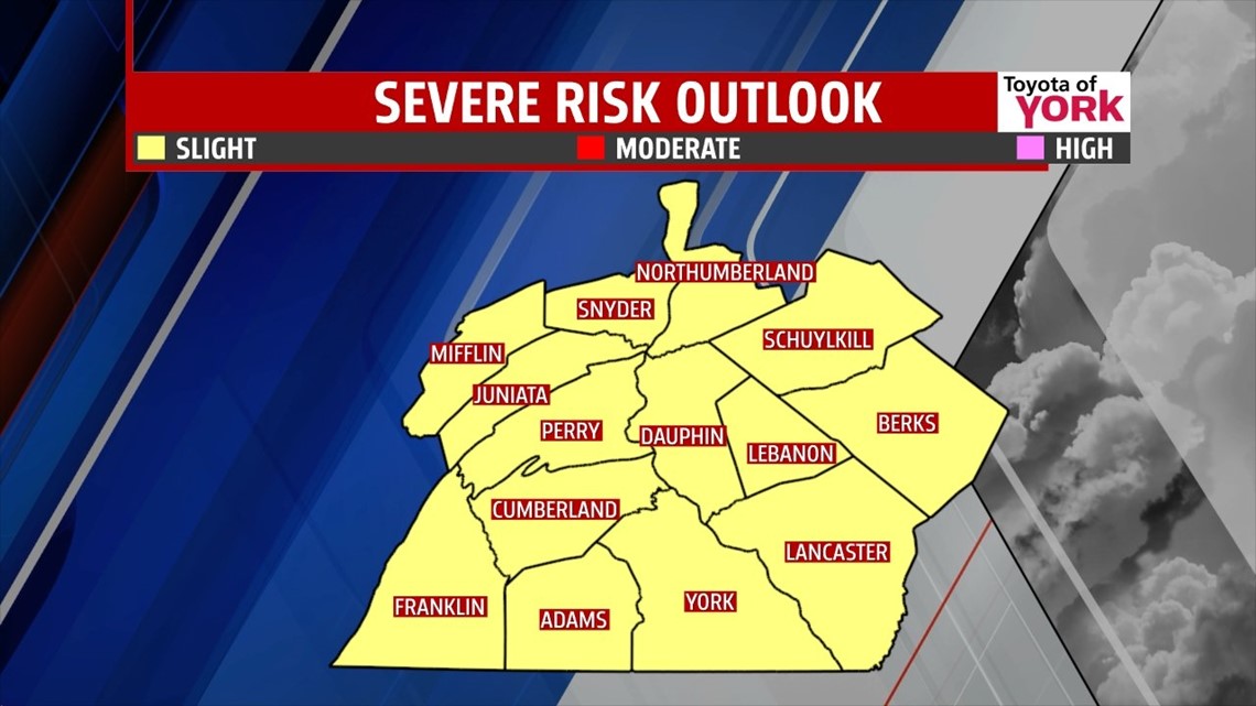
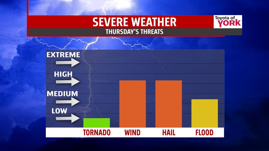
SLIGHT RISK for severe storms once again tomorrow. A cold front will slam into a warm and humid airmass triggering showers and thunderstorms. Some storms may contain damaging winds and hail along with very heavy rainfall. The best chance and when you should be keeping an eye on things is in the afternoon and evening. We’ll keep you posted through the day.

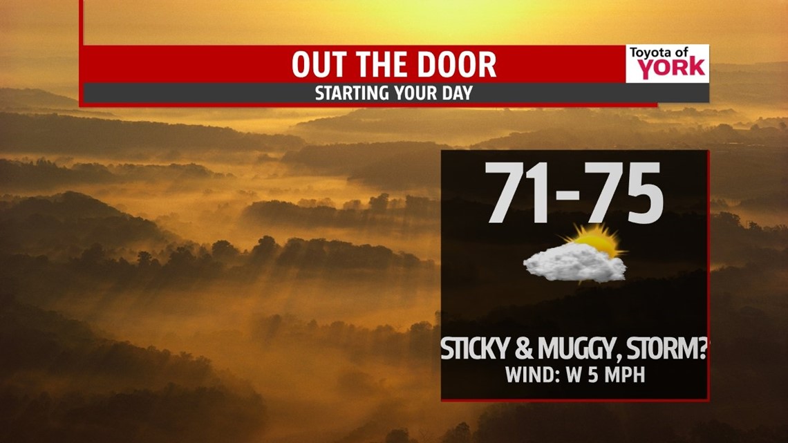
OVERNIGHT: Partly cloudy skies with just a stray shower or storm chance. It will remain very muggy and warm with haze and patchy fog by morning. Lows will be in the low 70s.

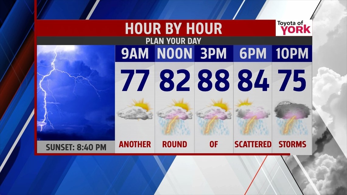
TOMORROW: A deepening upper level trough over the Midwest and a stalled out cold front overhead will keep the chance for scattered showers and thunderstorms around for Thursday and Thursday night. The Storm Prediction Center has put us in a SLIGHT RISK for severe storms once again. Main threat will be damaging winds and hail.

It will be another humid day but not as hot with highs in the mid to upper 80s.

OUTLOOK: There could be a few early morning showers for the Fourth of July holiday in our eastern counties as Tropical Storm Arthur skirts away from the coast. The upper level trough and cold front on Thursday should help to steer the tropical storm system away from us. Friday night looks great for fireworks. Dry and less humid air settles in with cooler more comfortable temperatures for a few days. Big bubble of high pressure overhead will bring another fabulous weekend to us with plenty of sunshine and highs near seasonal averages in the low to mid 80s.
MaryEllen Pann, Chief Meteorologist
Like me on Facebook: maryellenpannfox43
Follow me on Twitter: @MaryEllenFox43