
THIS EVENING: A breezy evening but the strong wind gusts should quiet leaving winds out of the northwest 10 to 15 mph. The puffy cumulus clouds that dot the sky will dissipate once the sun sets this evening around 8:40pm. Winds may be a concern for fireworks this evening but hopefully the breeze eases enough so areas can celebrate this Independence Day Holiday evening. You may want to bring a jacket as temps fall out of the 70s to the 60s.


OVERNIGHT: Clear skies, dew points in the 40s and lighter winds will lead to a cool night in the low to mid 50s.

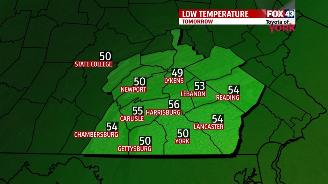
TOMORROW: High pressure will bring a sunny start to the weekend. After a cool morning, highs will reach the low 80s.

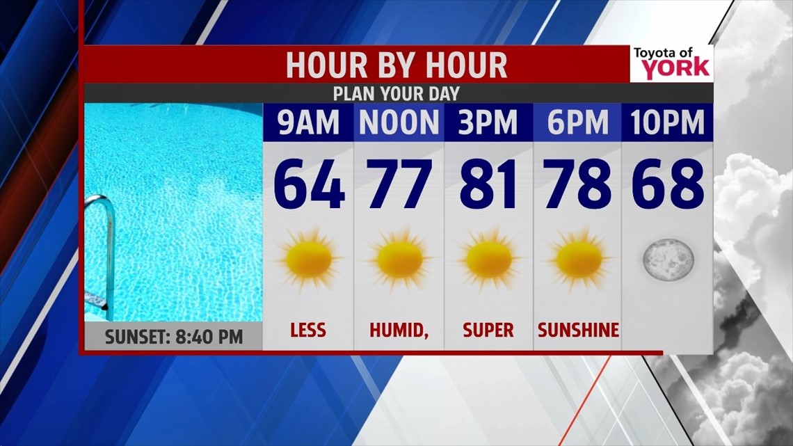
OUTLOOK: The winds will shift to the south as high pressure moves eastward. The milder flow will boost temps to the mid 80s. Expect a great day to be by the pool with mostly sunny skies. Heading into next week, the humidity returns, temperatures get even warmer and a daily storm threat returns for much of week.
BEACHES: Much improved weather along the beaches from New Jersey down to Maryland as Hurricane Arthur continues to speed away. Waves will still be pretty high but should subside as the day goes on tomorrow.


MaryEllen Pann, Chief Meteorologist
Like me on Facebook: maryellenpannfox43
Follow me on Twitter: @MaryEllenFox43