

BEAUTIFUL AGAIN

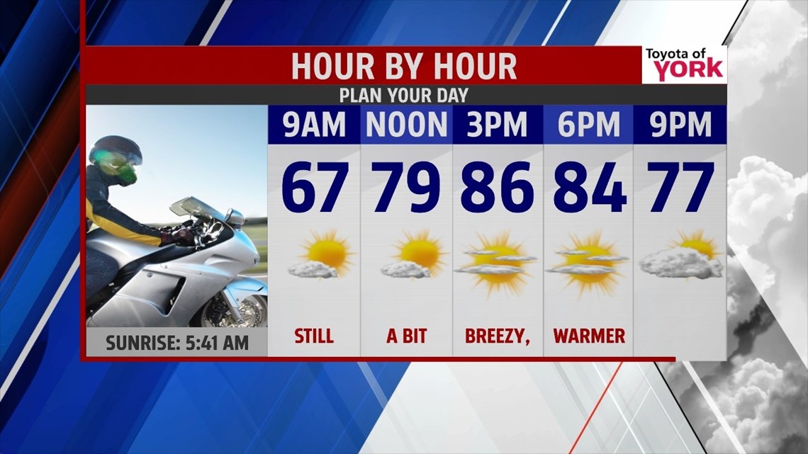
High pressure stays locked in place through the rest of the weekend. This means we can expect the sunshine, low humidity, and dry conditions to stick around. You can expect another clear and comfortable night. Overnight lows are in the 50s to lower 60s. It’s yet another night where we can crack the windows open. Plenty of sunshine continues for Sunday, but some clouds do roll in during the afternoon. It’s a little warmer and a bit breezy once again. Highs are in the lower to middle 80s.
HEAT & STORMS RETURN
The humidity returns and temperatures warm up once again next week. Monday is dry, but there’s a chance late day thunderstorms, especially to the northwest. Isolated thunderstorm chances continue for Tuesday and Wednesday. Thursday looks drier, but there is still a small thunderstorm chance. Highs are in the lower 90s on Monday and in the upper 80s to 90 on Tuesday. Temperatures Wednesday and Thursday are in the middle to upper 80s.
END OF WEEK
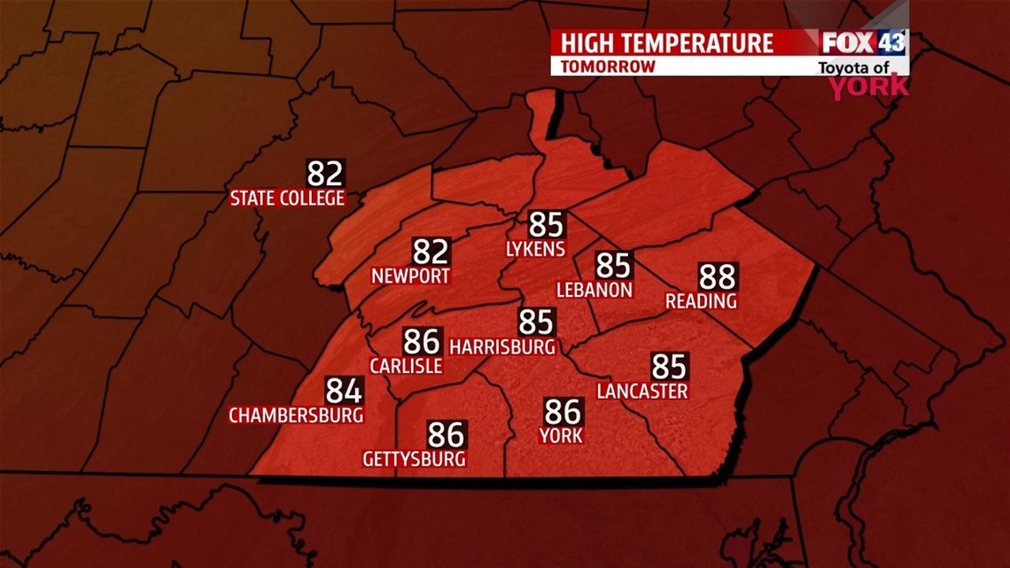
The end of the week leading and leading into next weekend looks fairly dry, but still warm. There’s plenty of sunshine Friday, with highs in the upper 80s. Saturday brings more clouds and an isolated thunderstorm chance with highs near 90 degrees.
Enjoy the rest of the holiday weekend!
-Andrea Michaels