
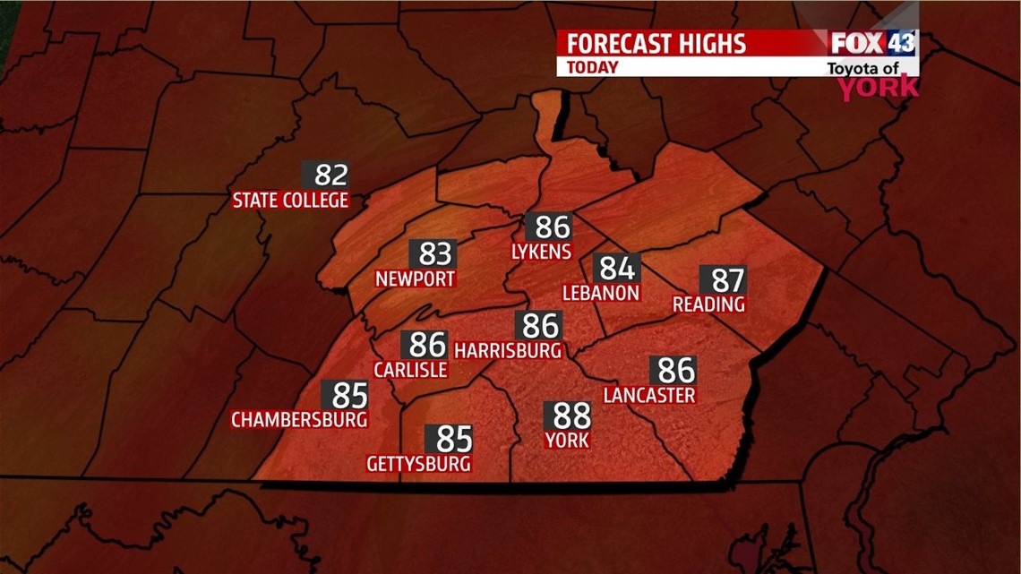
UP WE GO: The thermometer continues to rise over the next few days. Warm and humid air builds today, with highs hitting the upper 80s. We’re partly cloudy after a foggy start. Heat from the day may help to bubble a few thunderstorms as the day progresses. Lows tonight drop to the upper 60s.

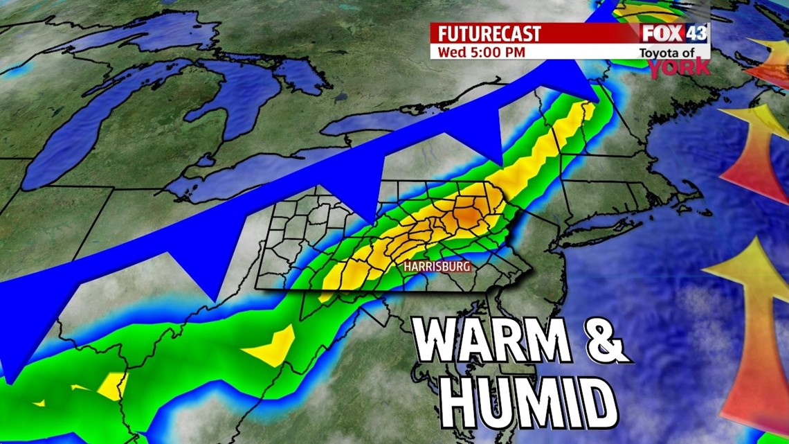
FRONT ARRIVES: A cold front pushes through the state on Wednesday. Ahead of the front, we see our hottest day of the week as warm and humid air squeezes into the region. Highs will hit the low 90s today with plenty of muggy air making it feel even hotter. Showers and storms fire later in the day as the front moves in to our area. Storms could produce some heavy rain and locally damaging winds. The showers and storms taper overnight, with only a few leftover for the first half of the day Thursday. Clouds are slow to clear Thursday as cooler, and drier air slips into the state. Highs Thursday are in the low 80s.


WEEKEND: Well start the weekend on Friday with less heat and less humidity. Highs are in the low 80s with sunshine returning. Saturday, it’s a seasonably warm day with highs in the middle 80s. We’ll enjoy another sunny day. Bu Saturday night, a quick moving system pushes in and will bring the return of clouds and storm chances which linger into Sunday and Monday. Highs are in the low to middle 80s.
Make it a terrific Tuesday!
“The best way to cheer yourself is to try to cheer someone else up.” – Mark Twain
– Jeff Jumper, WPMT FOX43 Morning Meteorologist
Follow me on Twitter: @JeffJumperWX
Like me on Facebook: Jeff Jumper FOX43