
THIS EVENING: After a beautiful weekend the clouds are streaming in and thickening up as the next storm system heads our way. A warm from advancing towards us will bring showers as early as 6pm in the west but much later as they spread eastward. Heading into the overnight, they may be heavy at times. Clouds will thicken up in the next few hours as conditions stay dry for a bit. Temperatures will fall to the lower 70s.
MORNING: It will be a wet ride for the morning drive as occasional rain dampens the commute. Lows will start out in the mid 60s.


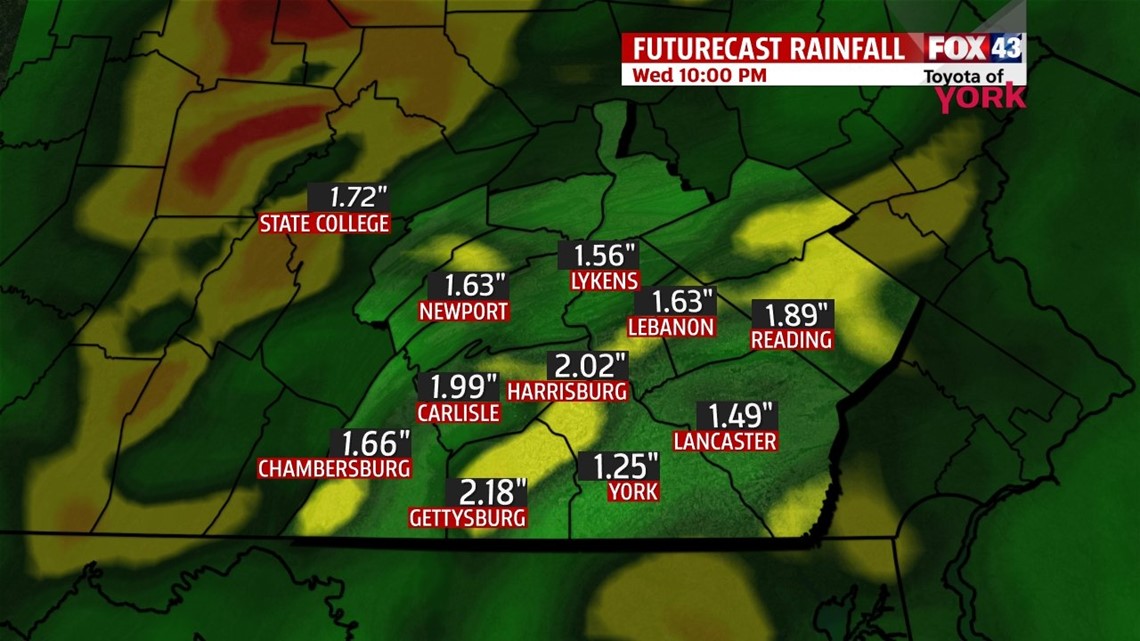
Where the heavy rain bands set up is not certain so keep an eye out for rapidly rising waters if you live nearby a creek or stream which may flood easily. Rain should move out by the early morning hours of Wednesday.

OUTLOOK: Upper level trough moves in for Wednesday, which will keep temps cool and clouds around along with an isolated shower threat. Highs will be in the upper 70s. We are back to the 50s Thursday morning and despite a mix of clouds and sunshine, it will be the coolest day with highs in the mid 70s thanks to a closed low that situates itself just to our north. High pressure at the surface will bring a stretch of dry weather through Monday. Upper level trough and closed low starts to exit by Friday afternoon allowing for a ridge to build in. It will still be cool in the morning Friday with lows in the 50s and highs will once again stay in the upper 70s but over the weekend warmer air returns. Highs will get back to the low to mid 80s as sunshine continues both days.
MaryEllen Pann, Chief Meteorologist
Like me on Facebook: maryellenpannfox43
Follow me on Twitter: @MaryEllenFox43