

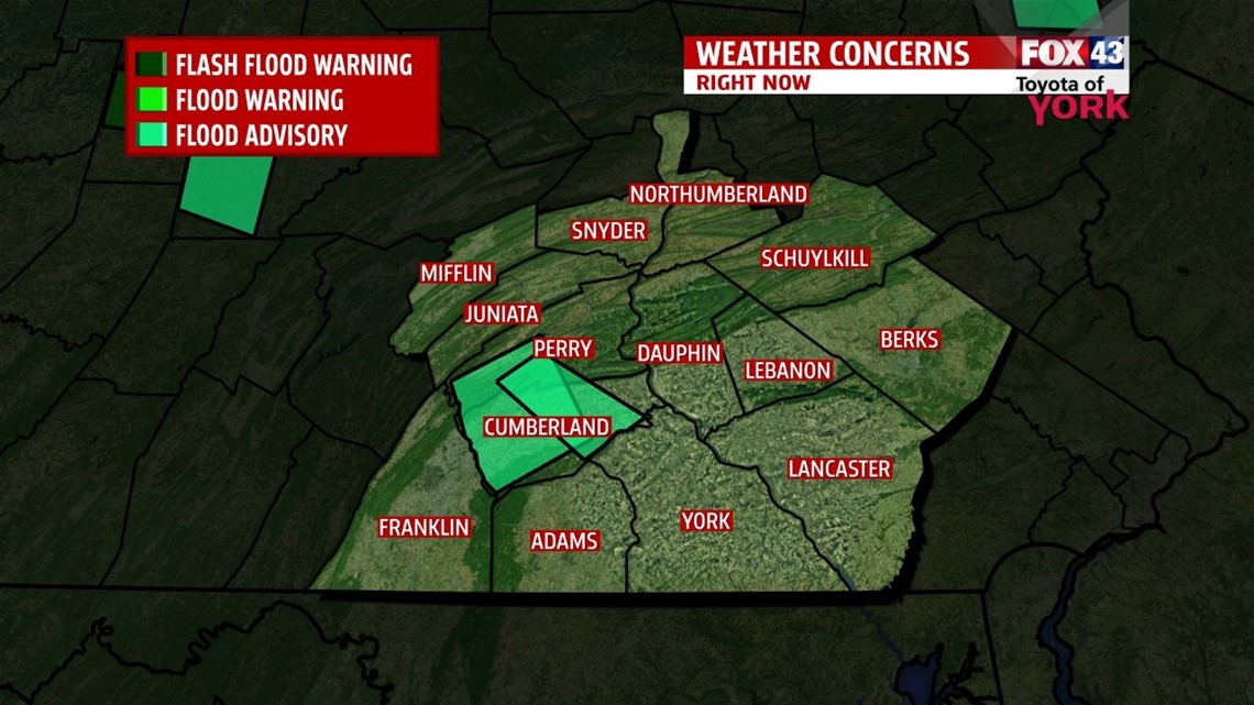
STRONG STORMS ARE LEADING TO FLOODING ISSUES AROUND THE AREA. BE AWARE OF RISING WATERS ALONG THE CREEKS AND STREAMS, AS WELL AS, PONDING ON ROADWAYS.

THIS EVENING: There will be a chance for isolated to scattered showers and thunderstorms. They may briefly produce a heavy downpour but winds aloft are out of the northwest and strong which will aide in cutting down amount of precipitation. Temps are very warm and humidity is apparent! Temps will fall from the 80’s to the low 70’s later tonight.
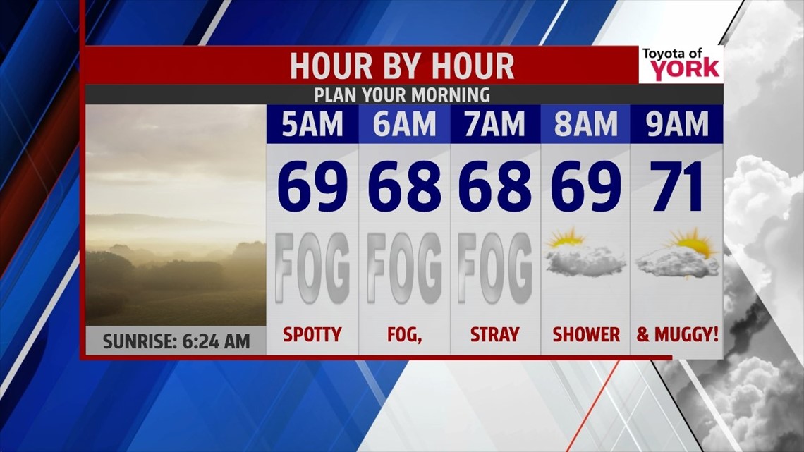
MORNING: We’ll start the day again with patchy dense fog which may cut down on visibility. A stray shower can’t be ruled out and temperatures will once again start in the mid to upper 60’s. It will certainly feel pretty muggy out.

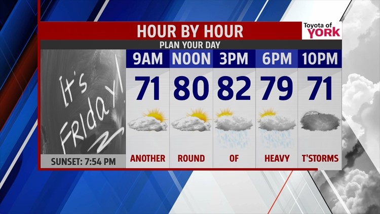
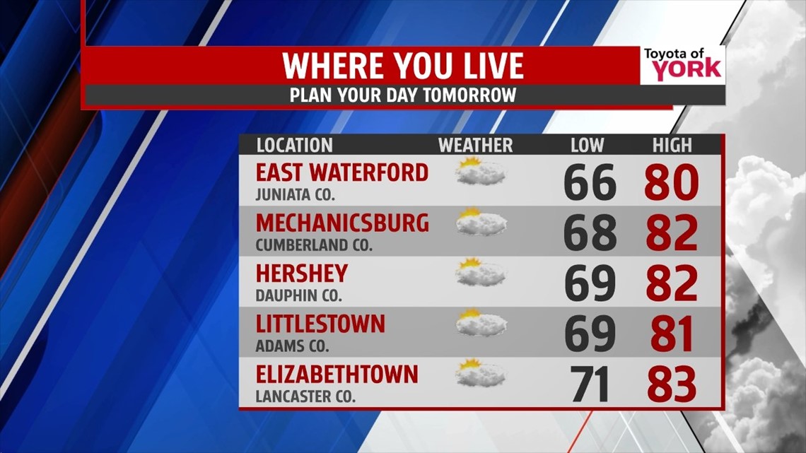
TOMORROW: Tomorrow with the front still nearby and a piece of energy tracking through by afternoon, we see the threat for showers and thunderstorms return to end the week. Some of the storms may produce very heavy downpours. Flooding may be an issue and we’ll certainly keep an eye on things. Highs should still get close to seasonal averages in the lower 80’s before the rain cools things off into the 70’s.

OUTLOOK: High pressure at the surface will try and nose in from the northeast and push the stalled front further south but it means winds will set up out of the east. Showers will be possible in the early part of Saturday. Clouds will try and break up allowing skies to brighten late in the day. By the second half of the weekend, we should improving weather. Highs will warm to near 80. We get even warmer heading into the week thanks to a ridge of high pressure parked over us and high pressure at the surface. Temperatures will feel like summer as the heat and humidity build back in. Highs should have a chance to warm to the mid and upper 80s Tuesday and Wednesday. A weak front is forecasted to push through Wednesday and may trigger an isolated thunderstorm.
TROPICAL UPDATE: Still watching for the development of our next tropical system midweek next week. Looks like the track may take it right into Miami Florida. The National Hurricane Center is keeping an eye on the development of disturbed weather east of the Antilles which now has a 50 percent chance of strengthening and becoming more organized.
MaryEllen Pann, Chief Meteorologist
Like me on Facebook: maryellenpannfox43
Follow me on Twitter: @MaryEllenFox43
