

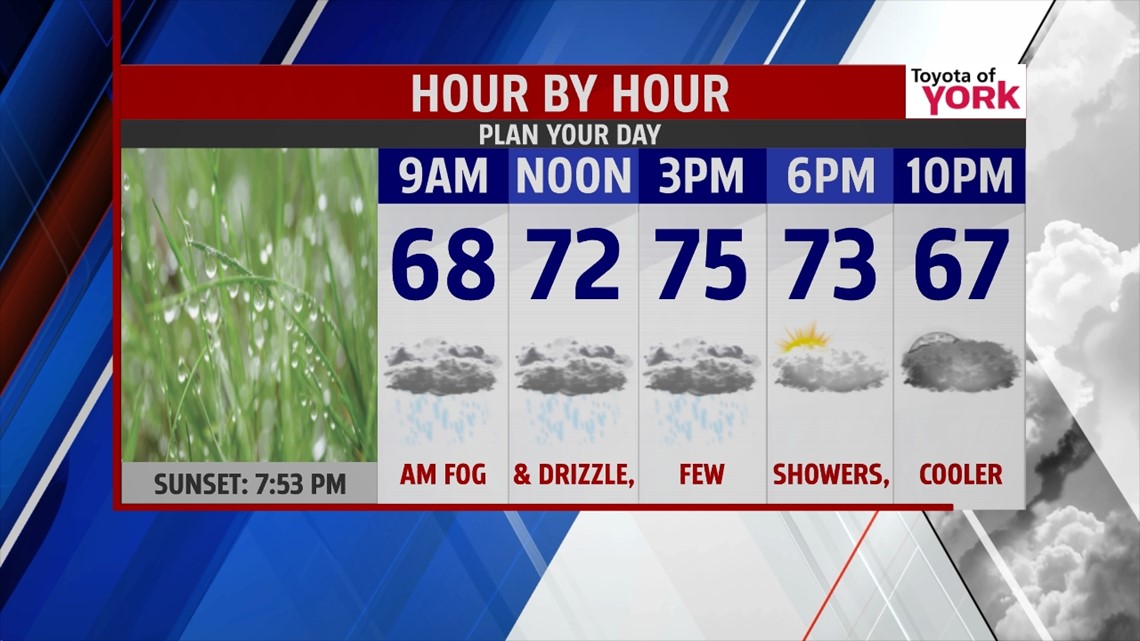
THIS EVENING: Stationary boundary remains draped nearby resulting in showers remaining in the forecast this evening. A few rumbles of thunder can’t be ruled out either. Temperatures will fall from the mid to upper 70s to the upper 60s.
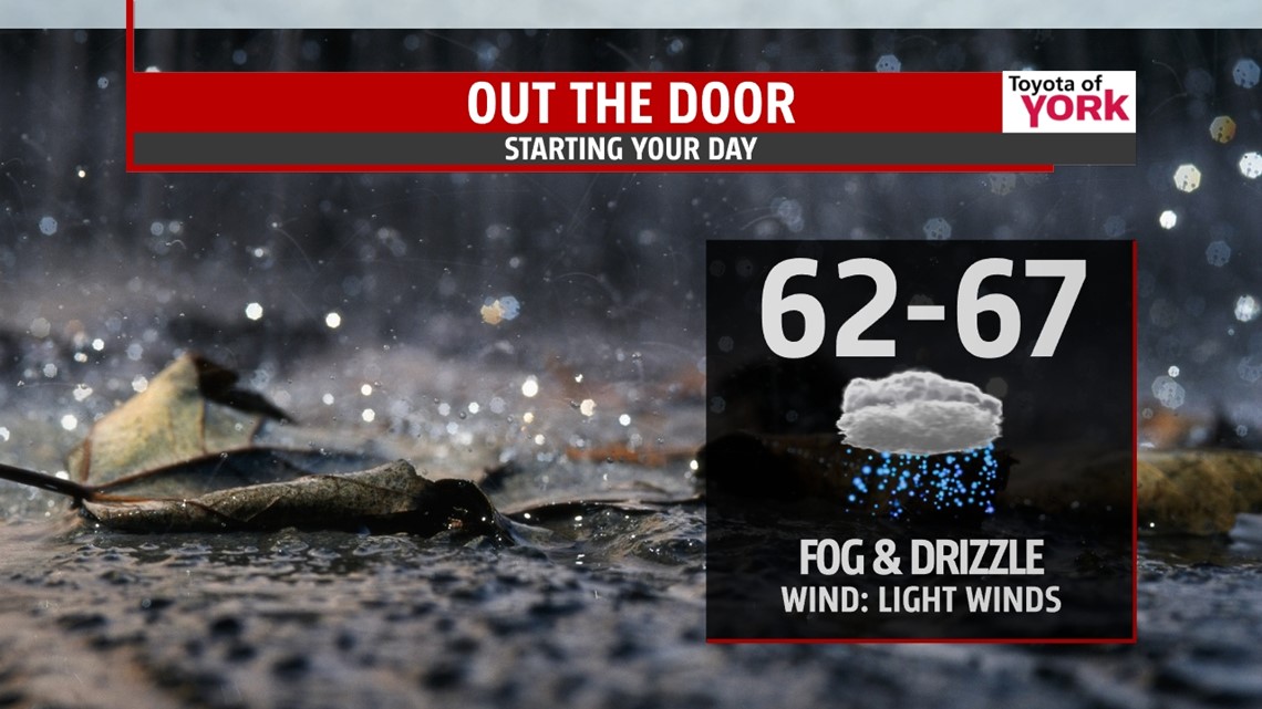
MORNING: Easterly flow continues and will result in fog and drizzle to start the day. A few showers will be possible and lows will drop to the low to mid 60s.

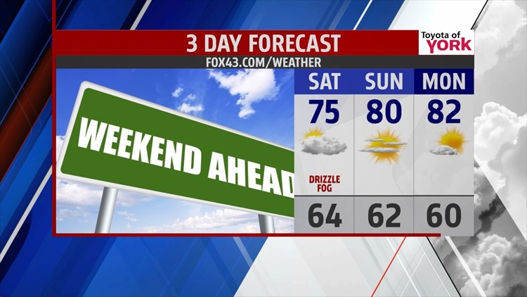
TOMORROW: Clouds will be stubborn but may thin out as the day wears on to allow for the sun to try and peak out before setting. I can’t rule out a few showers until afternoon. Highs will be much cooler in the low to mid 70s.

OUTLOOK: High pressure at the surface will nose in from the northeast and push the stalled front further south. It is looking like the second half of the weekend will improve with clouds in the morning giving way to plenty of sunshine for the rest of the day. Highs will still be running below average in the upper 70s to around 80 degrees. We get even warmer heading into the week thanks to a ridge of high pressure parked over us and high pressure at the surface. Temperatures will feel like summer as the heat and humidity build back in. Highs should have a chance to warm to the low to mid 80s Tuesday and Wednesday. We could flirt with 90 by Thursday. Temperatures will get a nice bump ahead of our next frontal system which may also trigger a few showers and thunderstorms. Cooler with showers still a threat for Friday and highs in the low 80s.
MaryEllen Pann, Chief Meteorologist
Like me on Facebook: maryellenpannfox43
Follow me on Twitter: @MaryEllenFox43
