


WARM & SOUPY NIGHT
The mugginess continues across our region into the night. Expect the spotty showers to dwindle into the early evening, and the clouds break up a bit as well. Skies stay partly clear through the overnight period. A stray shower is possible, but most will be dry. It’s just a warm and soupy night, with lows mostly in the lower to middle 70s. A few places could fall into the upper 60s.
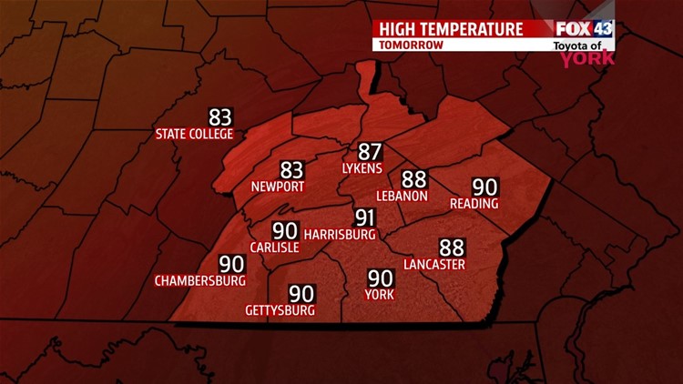
STAYING HOT & HUMID

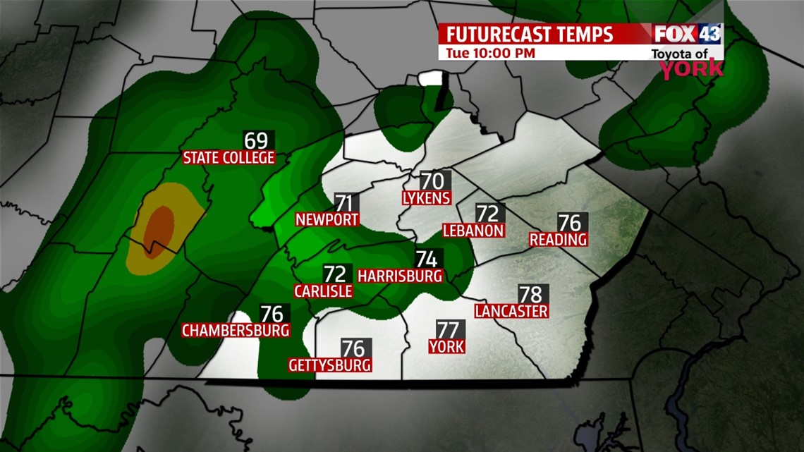
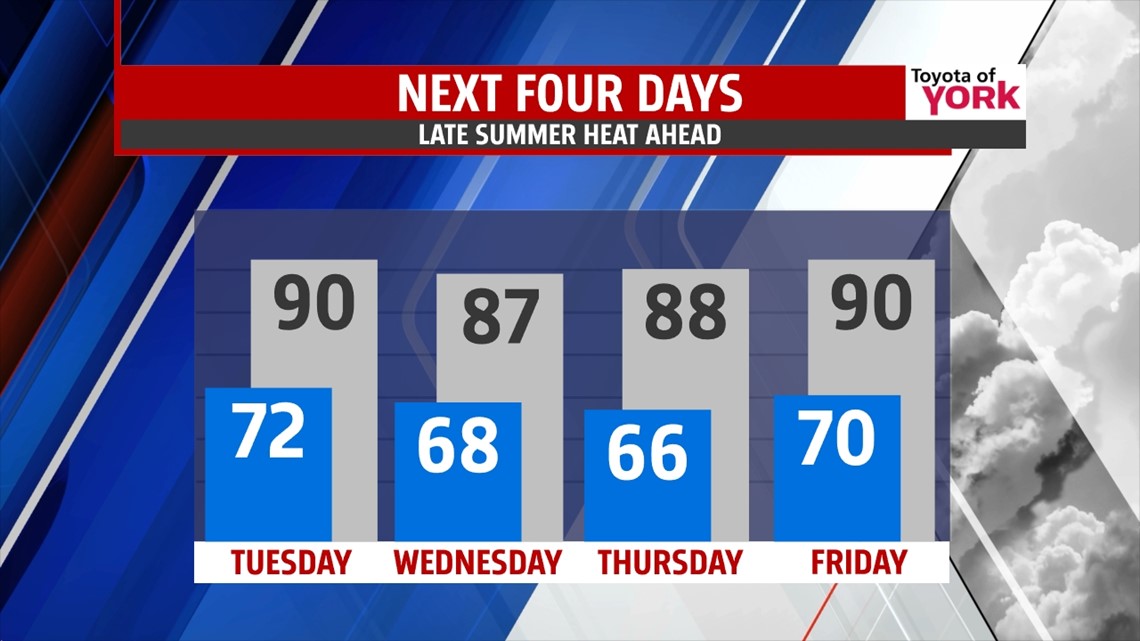
Tuesday our next system approaches. It’s a cold front, and it brings a better chance for thunderstorms during the late day and evening hours. A few storms could be in the stronger side with some strong winds possible, but that threat fades into the evening. It’s hot and humid, with highs near 90 degrees. The sun is back on Wednesday, and this continues into Thursday and Friday. Highs remain above seasonal averages through the rest of the week. Readings hover in the upper 80s to near 90 degrees.
WEEKEND COOL DOWN
Our next thunderstorm chance comes on Saturday as a potent cold front approaches. It is still warm and sticky, with highs reaching the middle 80s. Sunday clears out, with noticeably cooler and less humid air sliding into the region. Highs are in the upper 70s, and by Monday, temperatures are in the lower to middle 70s!
Have a great night!
-Andrea Michaels
