


WEEKEND WARMTH CONTINUES
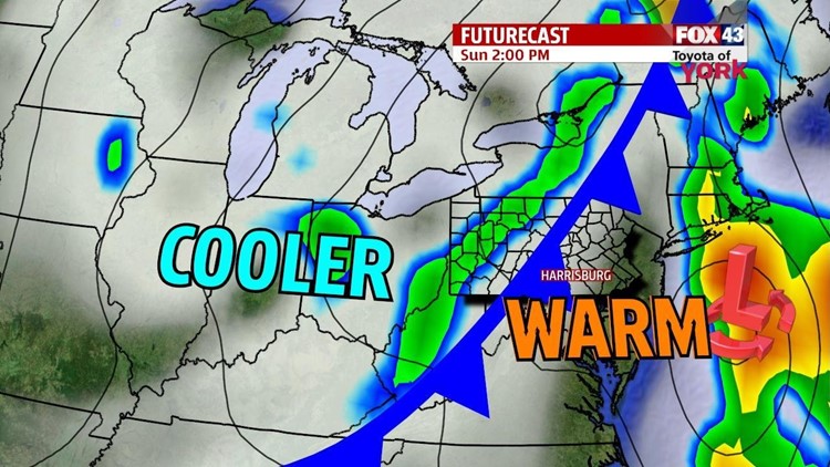
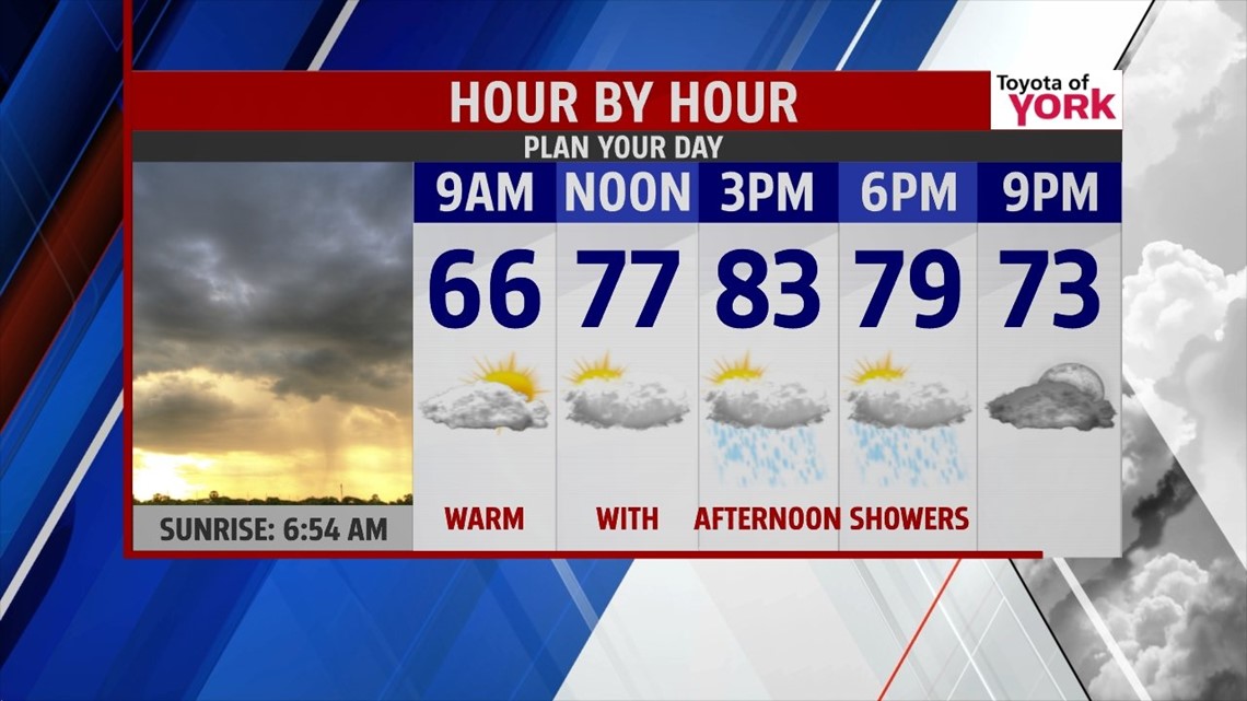
The last weekend of summer is upon us, and it continues to feel warm through the rest of the weekend. Overnight expect partly clear skies throughout our area. Some patchy fog develops late. Low temperatures fall into the upper 50s to lower 60s. Our next shower and thunderstorm chance comes Sunday with an approaching cold front. Expect the rain chances to increase through the afternoon from west to east. It’s an unseasonably warm day, with highs in the upper 70s to lower 80s.
COOL AGAIN

The cold front brings another cool burst of air in its wake just in time for the arrival of fall! Overnight Sunday, the cool air comes rushes into the region. Cooler air in the upper levels of the atmosphere helps to bubble up plenty of clouds during the afternoon. Some sprinkles are possible, especially to the northwest. Highs are cool as well, with readings in the middle to upper 60s.
SLOW WARMING
Tuesday brings more sunshine, but the unseasonably cool temperatures linger. By Wednesday and Thursday, temperatures begin to moderate closer to seasonable averages with the sunshine continuing. A ridge of high pressure continues to intensify, and this bumps temperatures back into the 80s for Friday and Saturday.
Enjoy the rest of your weekend!
-Andrea Michaels
