
STAYING WARM & DRY

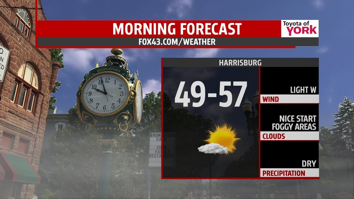
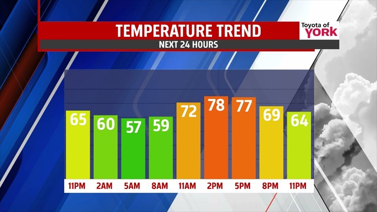
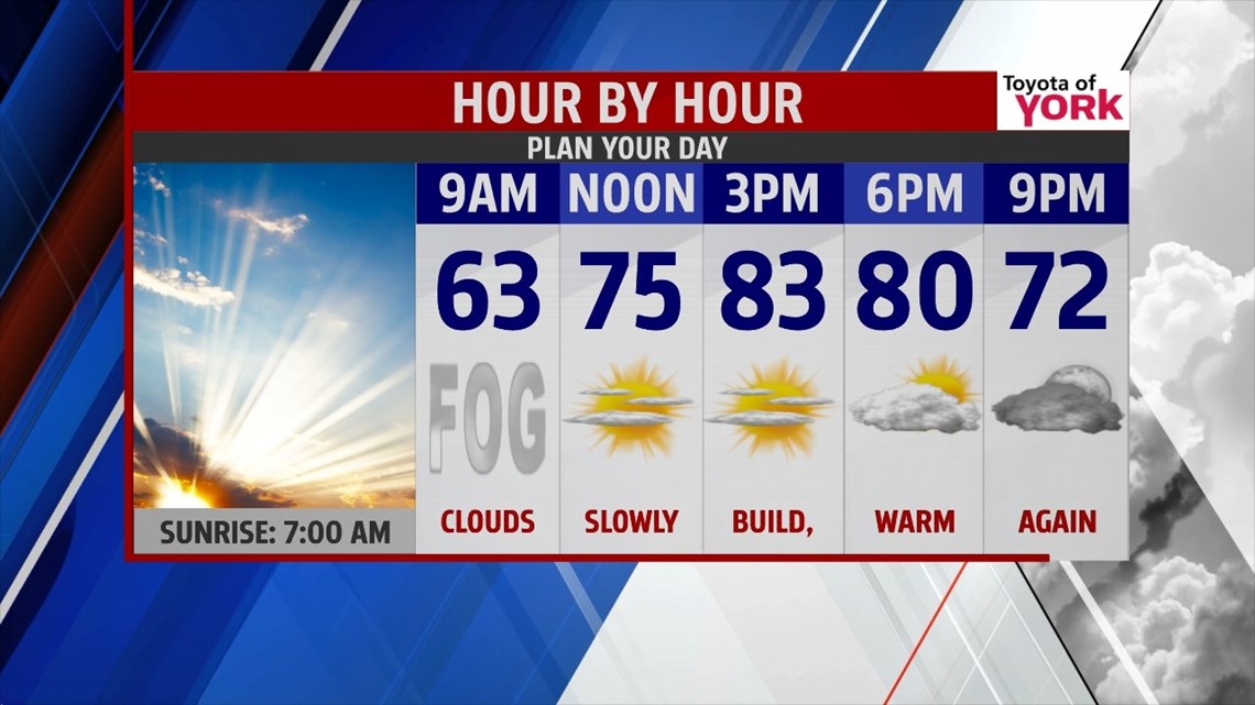
After an unseasonably warm Saturday, Sunday is basically a repeat with temperatures a little warmer and some extra clouds. Into the night, high pressure keeps skies mostly clear and quickly cools our temperatures. Readings fall into the 50s, with some foggy spots developing once again. The fog burns off through mid morning, leading way to sunshine. Through the afternoon, the clouds begin to build. It’s another nice and unseasonably warm day, with highs in the upper 70s to lower 80s.
TURNING COOLER
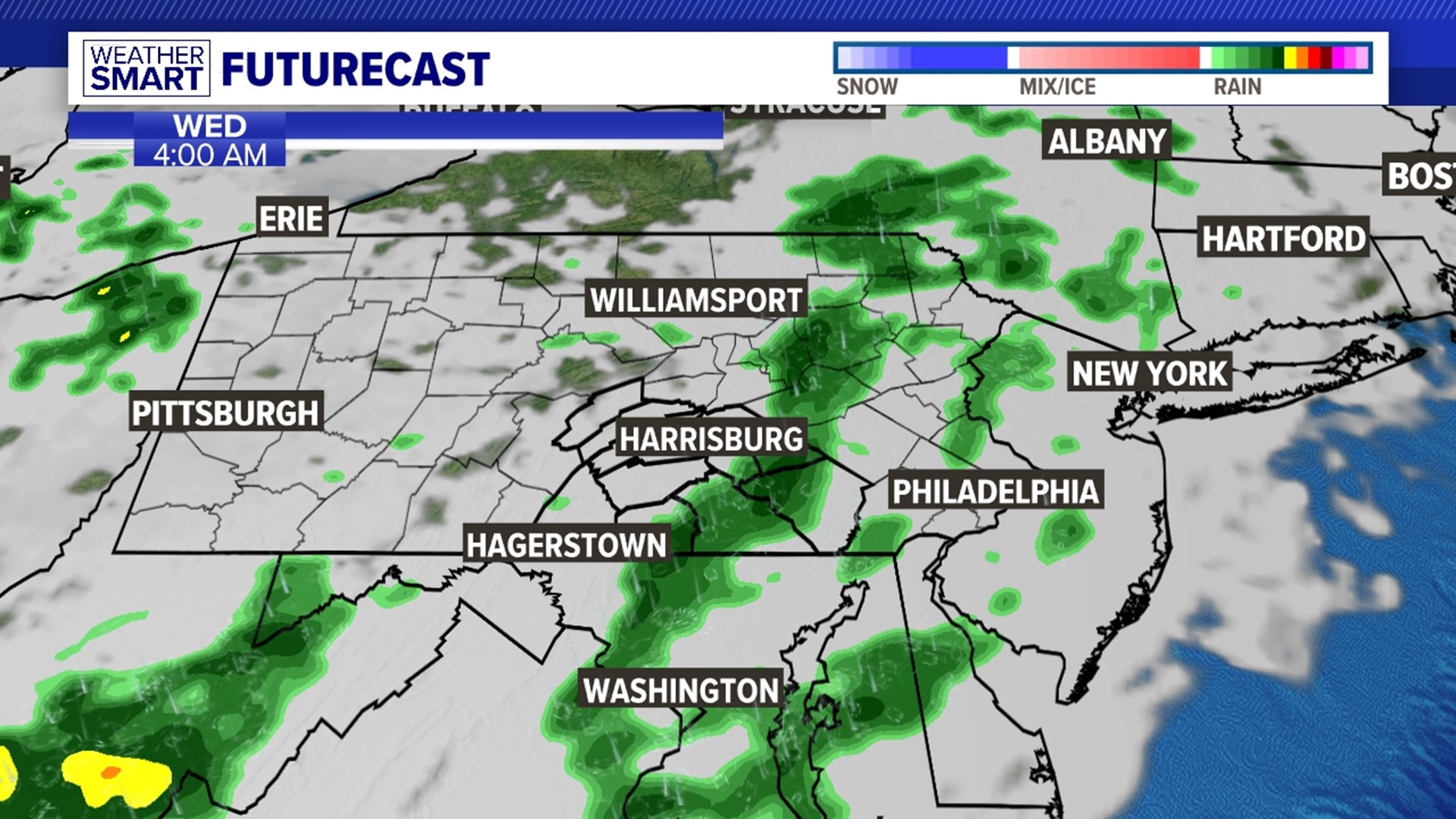
Some moisture tries to stream in from the south early next week. A disturbance tracks to our southeast, and will bring added clouds Monday through Wednesday. A few showers could try to creep into the forecast Tuesday and Wednesday as this system helps build an easterly flow. This is depending on how organized the disturbance becomes, and how close to our region it tracks. We’ll monitor it and adjust the forecast as needed. Regardless, temperatures are cooler and have more of an autumn feel.
LATE WEEK
Thursday brings more sunshine with highs in the lower 70s. Our next cold front brings more clouds Friday and the chance for some showers Saturday. Temperatures reach the lower to middle 70s.
Enjoy the rest of your weekend!
-Andrea Michaels