
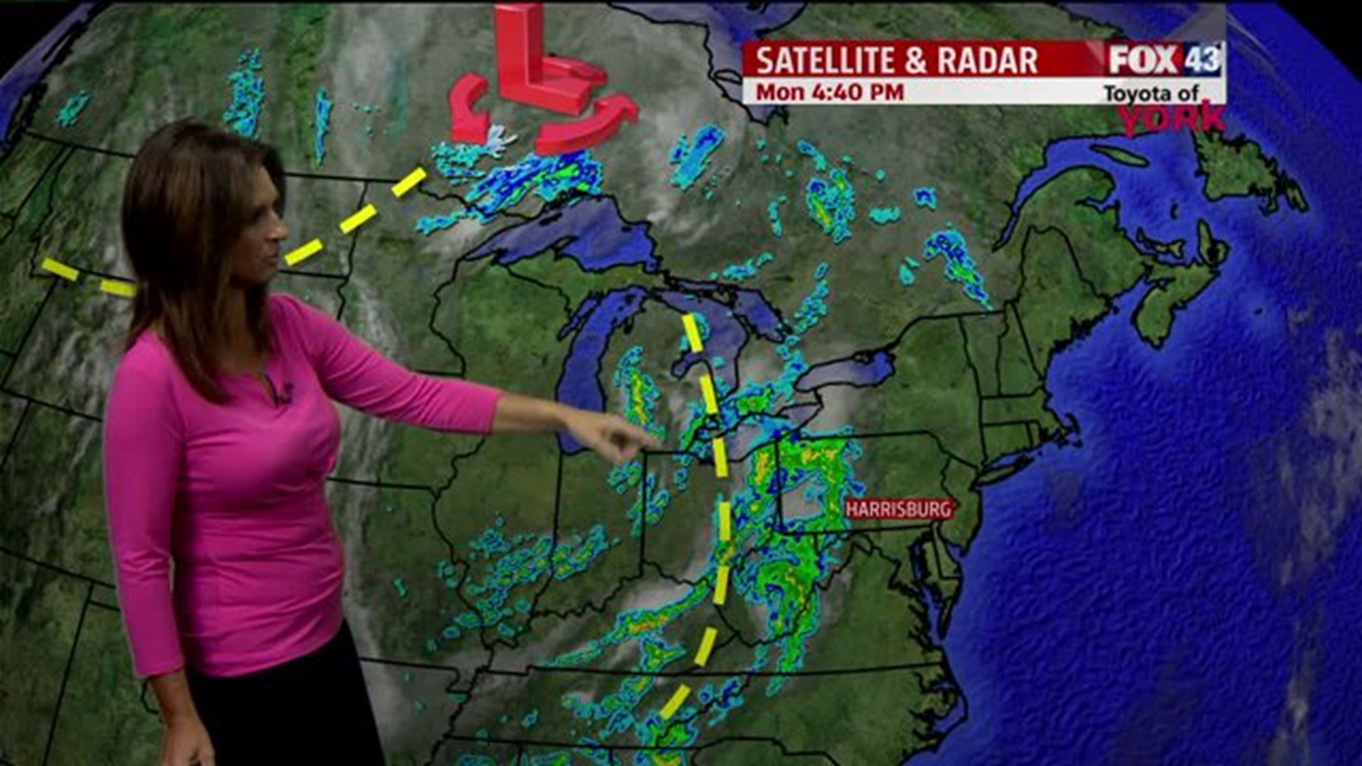
THIS EVENING
Pretty nice evening under way but the clouds will be approaching and thickening across the area. There may be a few showers moving in as well in our western counties later this evening. Scattered showers will be possible overnight as a weak disturbance passes by but most of the wet weather should exit the area by morning. Temps will fall through the 60s this evening to around 59 at 10pm.
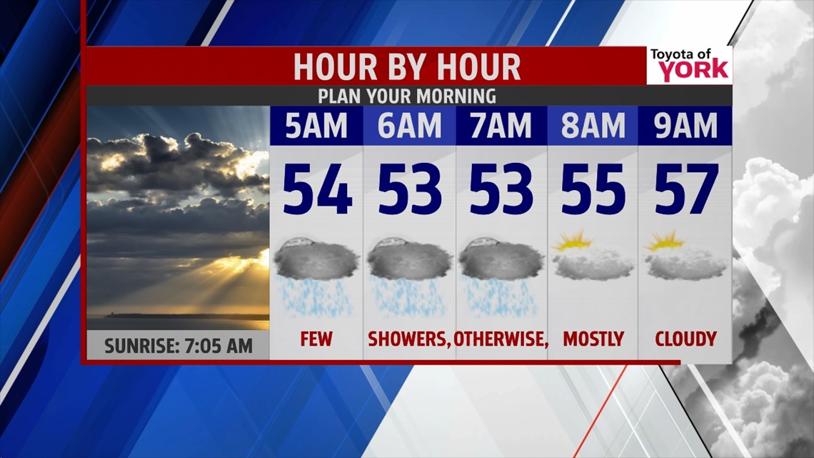
MORNING
We’ll start the day mostly cloudy, a few isolated showers may be around until about 6am mainly north and northeast but the trend will be for the area to be dry for much of the late morning hours. Lows will not be as cold in the low to mid 50s as the past few mornings.

TOMORROW AFTERNOON
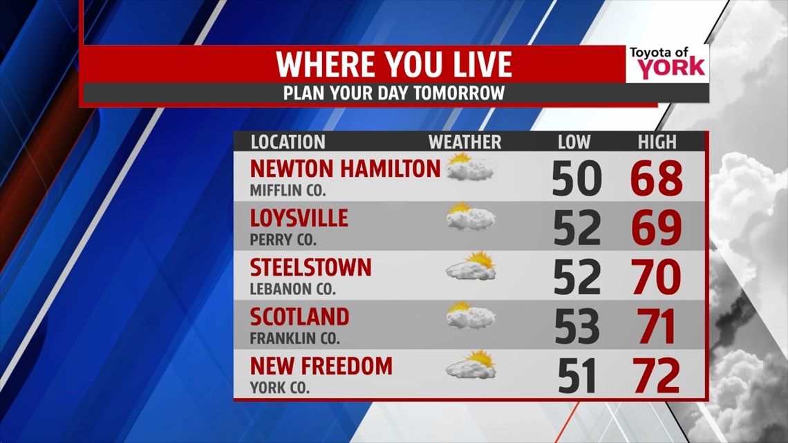
Clouds break up some and allows for sunny breaks before the next disturbance arrives towards evening. We remain dry for much of the day but heading home, there may be showers as early as 7pm for some parts of the area. Most of the rain threat once again will be overnight into very early Wednesday morning. Highs may be able to make it into the upper 60s and low 70s with the sunny burst through the clouds.

OUTLOOK
Wednesday looks like a great day once the clouds clear early thanks to high pressure building in. Highs should warm to near 70. Clear skies and high pressure overhead will lead to a chilly start Thursday morning and we’ll start the day with sunshine but the clouds will be returning later in the day as the system approaches. Highs will be cooler in the mid 60s. It looks like right now with high pressure still in control we remain dry for the day light hours but come Thursday night, especially into Friday; we will see our rain chances going up as a wave of low pressure develops along a frontal boundary that will be draped south of the area. Right now it looks as if high pressure to the north will battle this front to keep it south of us over the weekend. Some models have it returning for early Saturday with yet another wave along it but for now we have kept Saturday dry. Highs Friday will be held in the low 60s thanks to the clouds and showers. Weekend looks mainly dry and in the low to mid 60s. Ridge starts to build in for second half of the weekend allowing milder air to slip in and we'll be watching for an area of low pressure and associated warm front to approach bringing the chance for showers overnight into Monday. Temperatures on Monday also look to remain in the 60s.
MaryEllen Pann, Chief Meteorologist
Like me on Facebook: maryellenpannfox43
Follow me on Twitter: @MaryEllenFox43