

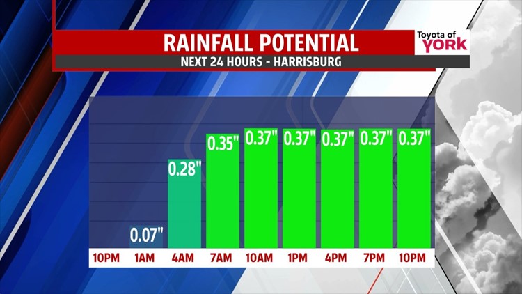

STEADY SHOWERS TONIGHT
A stalled boundary to our south will continue to bring batches of showers through the evening hours. The brunt of the moisture is still located to our west, however during the evening, expect the activity to become steadier and more numerous in nature. Be ready with the umbrella and rain boots if you have any Friday evening plans! The rain continues through the night. It’s a chilly rain, with overnight low temperatures in the upper 40s to lower 50s.
BRIEF DRYING

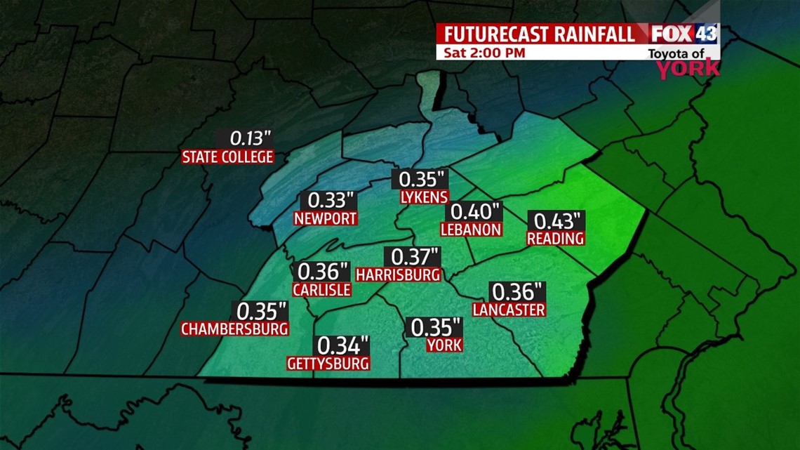
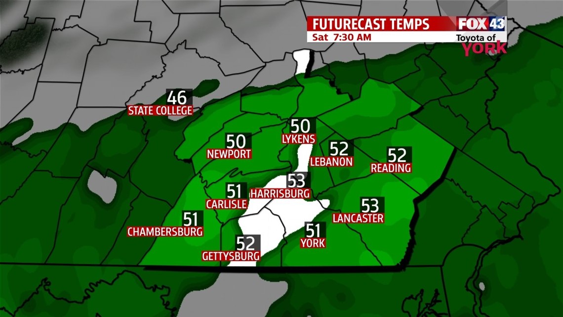
Saturday morning begins with a chilly, raw feel and some showers. High pressure building in from the northwest pushes the stalled boundary a bit to the south, and this pushes the showers out of the region by noon for most. Skies clear partially through the afternoon. Temperatures are still below seasonable averages, in the upper 50s to lower 60s. Sunday, another wave of energy pushes back north, bringing a return to clouds through the afternoon. Showers should hold off until Sunday night.
RAIN CHANCES CONTINUE
The pattern early next week looks unsettled but mild to start. There’s a daily shower chance Monday and Tuesday, but only a few showers are expected each day. Highs will be in the upper 60s Monday, and the lower to middle 70s Tuesday. By Wednesday, our next storm system approaches and brings a chance for a good soaking. Highs are near 70 degrees. Thursday and Friday look drier, with temperatures close to seasonable averages.
Have a great weekend!
-Andrea Michaels
