

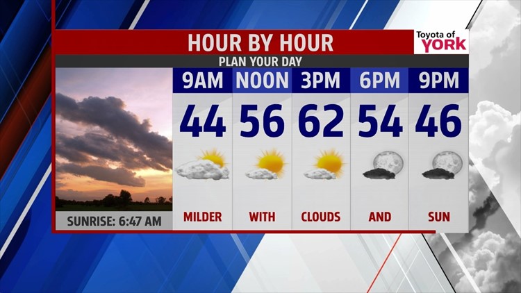
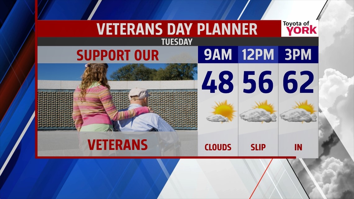
WARM EARLY: We’ll keep the mild upward trend going for the start of the week. Today, we climb into lower 60s with mostly sunny skies. Tonight, we drop to near 40° with scattered clouds. For Tuesday, we warm up to the lower 60s again. Clouds thicken through the afternoon on this Veterans Day as a coast system incher closer. Enjoy the pleasant weather.

TRANSITION: Wednesday, we’ll be watching a front slipping closer to us. We’ll stay seasonal for the day with highs in the middle to upper 50s. We may see some drops to start the day, but most are dry. But, as we move into the night hours, an arctic chill settles into the state.

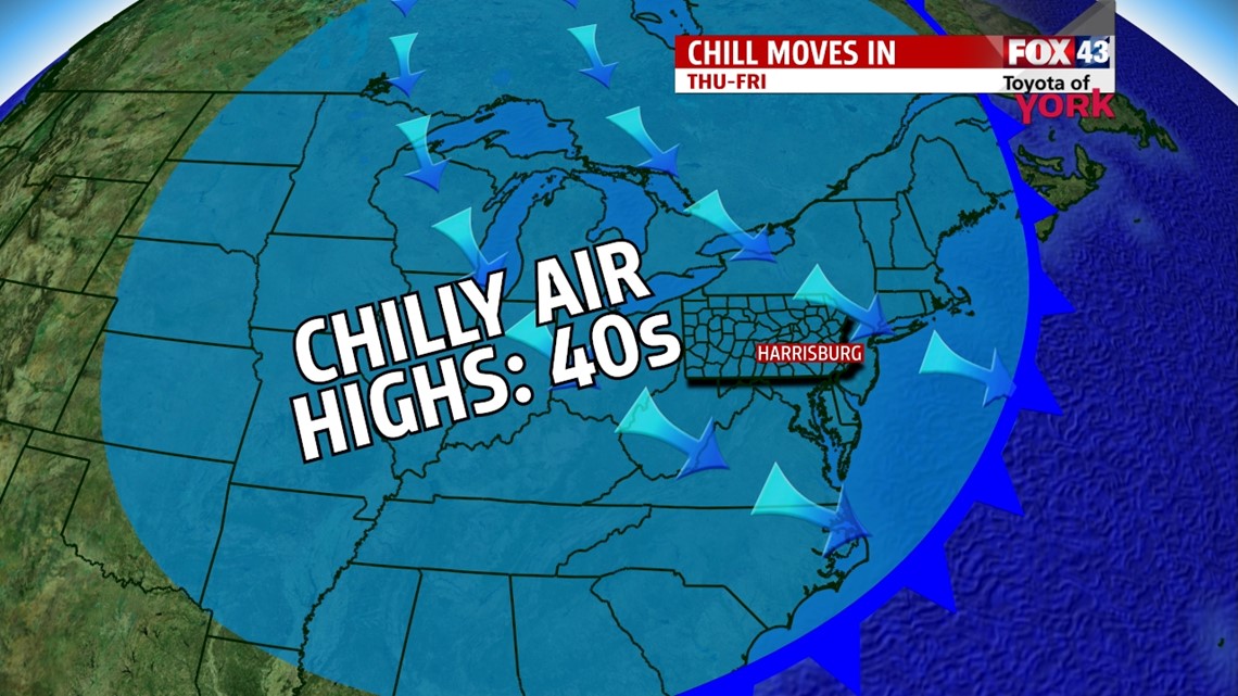
COLD BLAST: We’ll start Thursday near freezing and only make it to the middle 40s for highs. Friday, we start in the upper 20s and end in the lower 40s. It’s breezy both days with the shot at some flurries to start Friday.

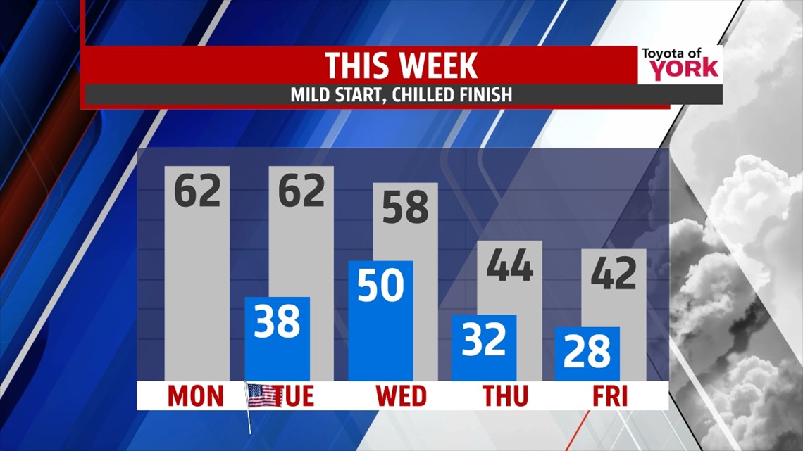
WEEKEND: The cold air stays in play for Saturday and Sunday. We’re mostly sunny Saturday with highs in the lower 40s. Sunday, clouds thicken as we await our next system with highs in the middle 40s.
Make it a marvelous Monday!
“Greater dooms win greater destinies.” – Heraclitus
- Jeff Jumper, WPMT FOX43 Morning Meteorologist
Follow me on Twitter: @JeffJumperWX
Like me on Facebook: Jeff Jumper FOX43
