

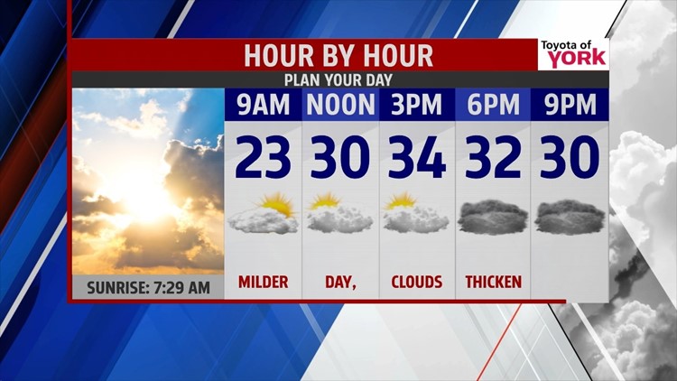

NOT AS COLD SUNDAY
The arctic air continues to sit across the region this evening, but it slowly lifts through Sunday. Tonight temperatures are quick to drop early. They fall a few degrees into the teens. Clouds move in late as a disorganized disturbance out west approaches. Temperatures remain in the teens through the rest of the night. Sunday, expect a mixture of sunshine and clouds to start, but the clouds thicken through the day. It’s not as cold too, with highs in the lower to middle 30s.
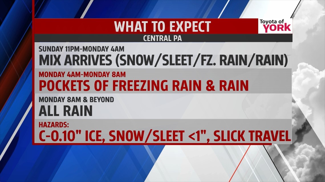
WINTRY MIX MONDAY

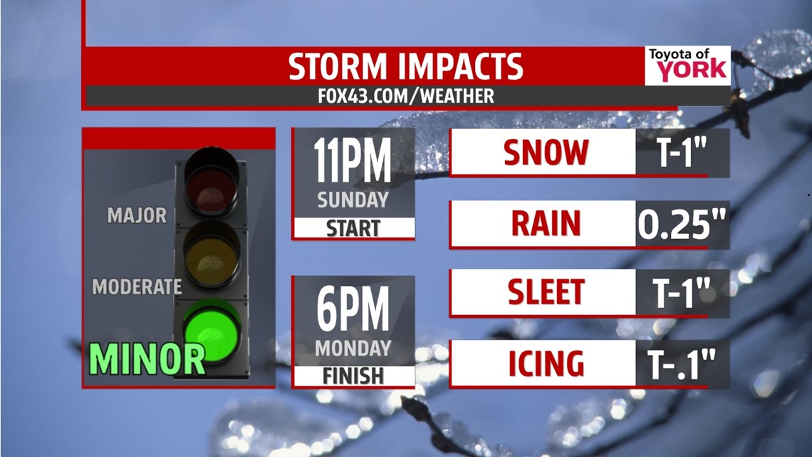
Late Sunday evening a wintry mix approaches as the disturbance edges closer to the area. Around midnight, a light wintry mix of snow, sleet, freezing rain, and rain moves in. Through the overnight period, it becomes mainly pockets of freezing rain and rain. By about 8 A.M. Monday, the precipitation should transition completely to rain. There could be icy areas before the complete transition over to rain, so use caution during the morning commute. Otherwise, expect spotty, light showers through the rest of the day. High temperatures reach the middle 40s.
COLD LINGERS
Tuesday we catch a bit of a break from the wintry weather with more sunshine. However, frigid air manages to slip back into the area. Expect high temperatures in the middle 20s. Wednesday and Thursday are cold as well with partly sunny skies. Highs are near 30 on Wednesday and in the middle 30s on Thursday. Friday temperatures fall back a few degrees with passing clouds. As we look to next weekend, a warm up finally looks on tap!
Enjoy the rest of your weekend!
-Andrea Michaels
