


ARCTIC AIR SLIDES IN

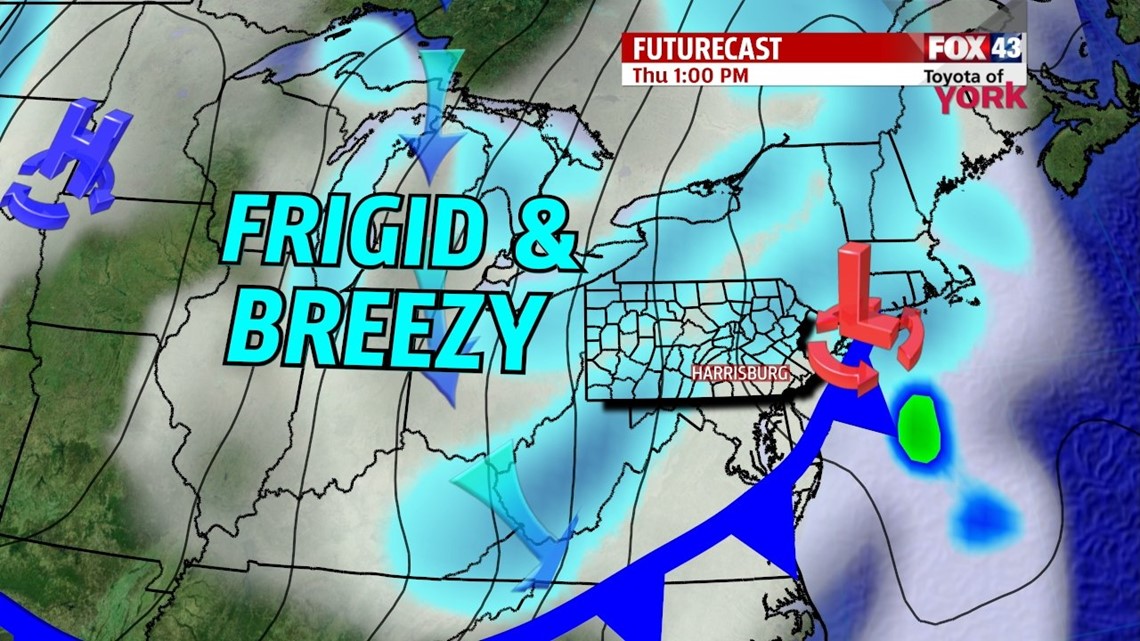
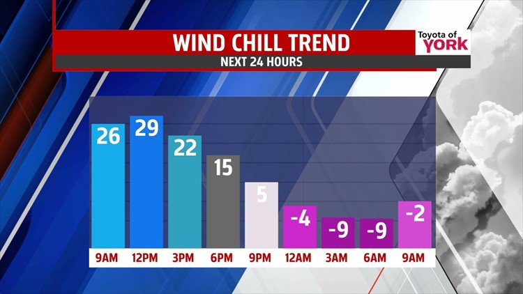
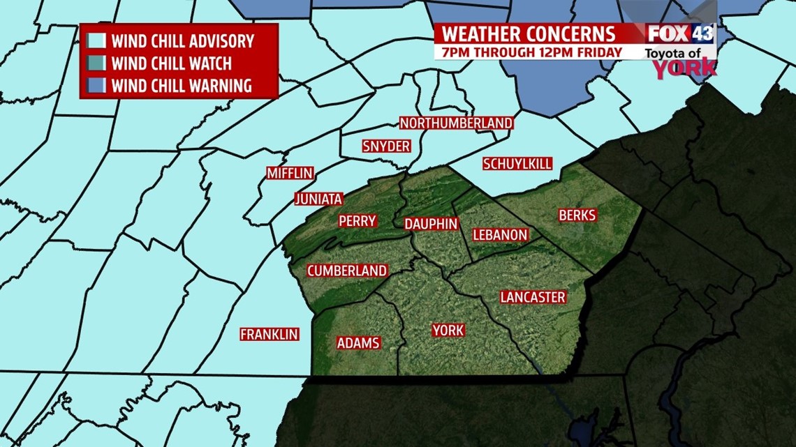
A weak clipper system continues to clear the region this morning, bringing with it a few flakes. In its wake, conditions turn breezy through the afternoon, and a few snow showers are still possible. Temperatures peak around midday in the lower to middle 30s before dropping as an arctic air mass starts sliding into the area. Breezy winds make wind chill values feel like the 20s. Those numbers continue to fall overnight. Skies clear, the winds stay breezy, and temperatures plummet into the single digits. Wind chill values feel like negative single digits, even negative teens at times. Friday is the coldest day since last winter season. There’s plenty of sunshine, but it does little to warm us. Highs are in the teens. Breezy winds make it feel like single digits at times.
VALENTINE’S DAY SNOW SHOWERS
Yet another clipper system approaches Valentine’s Day. This brings the chance for snow showers, mainly during the afternoon and evening. Accumulations look minor, a spotty 1 to 2 inches at best. Highs are a bit milder, in the upper 20s to near 30 degrees. However, this “warm up” is short-lived.
BRUTAL COLD STAYS
Another reinforcement of arctic air pummels into the area Saturday night. Sunday is a very blustery day, with afternoon high temperatures only in the lower to middle teens, making it even colder than tomorrow! Low temperatures are near 0 Sunday night. Though the pattern remains quiet Monday, it is still frigid. Highs are less cold, but still in the teens. Our next storm system looks to bring a wintry mix Tuesday into Wednesday as temperatures moderate. We’ll keep you posted on the development of this one!
Have a great Thursday!
-Andrea Michaels
