

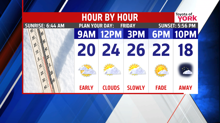
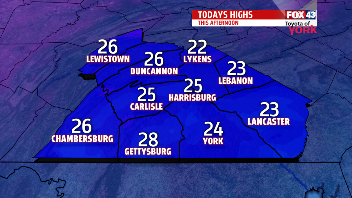
FLAKES & CHILL: We’re starting with some light snow showers in spots which could make for a few slick spots. Expect clouds to fade slowly today with highs only driving into the middle 20s. By evening, we’re back to the teens with more clearing. Overnight, single digit lows make for another chilly night.

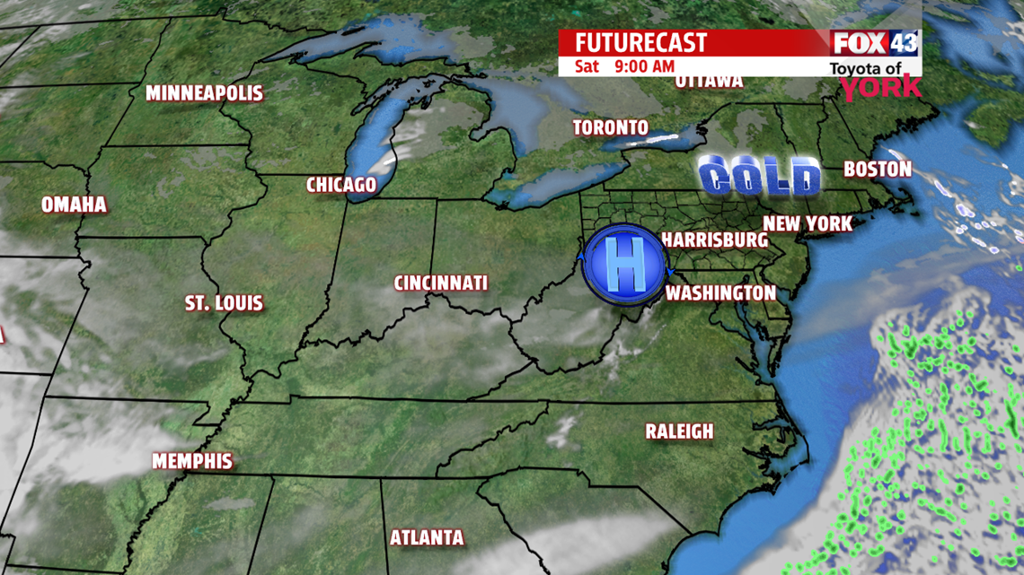
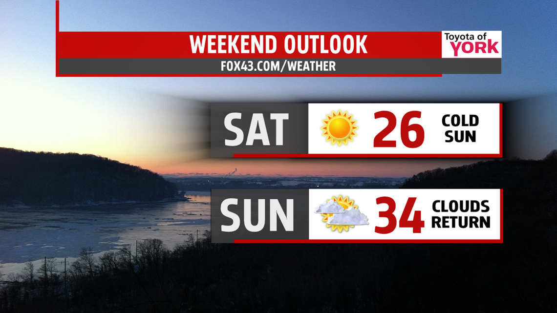
WEEKEND: High pressure keeps the sun in our lives all day Saturday, but it comes at the cost of cold air. Highs are only in the middle 20s. Sunday, we start in the teens with temperatures warming to the middle 30s under mostly cloudy skies. Some icy mix enters toward evening, lasting overnight.


NEXT WEEK: Monday, we’ll see mostly cloudy skies and some drying as highs climb to near 40°. Overnight, we cool off to near 20°. Then, our next system moves in for Tuesday. It’s a cloudy day with some light icing mix later in the day. Milder air will push in by overnight, when we’ll see a change to more rain, lingering into Wednesday. Tuesday, we top out at 36° with highs in the upper 40s for Wednesday. By Thursday, we should start to clear but temps slip back to the upper 30s.
Have a fantastic Friday and a wonderful weekend!
“The function of leadership is to produce more leaders, not more followers.” – Ralph Nader
- Jeff Jumper, WPMT FOX43 Morning Meteorologist
Follow me on Twitter: @JeffJumperWX
Like me on Facebook: Jeff Jumper FOX43
