
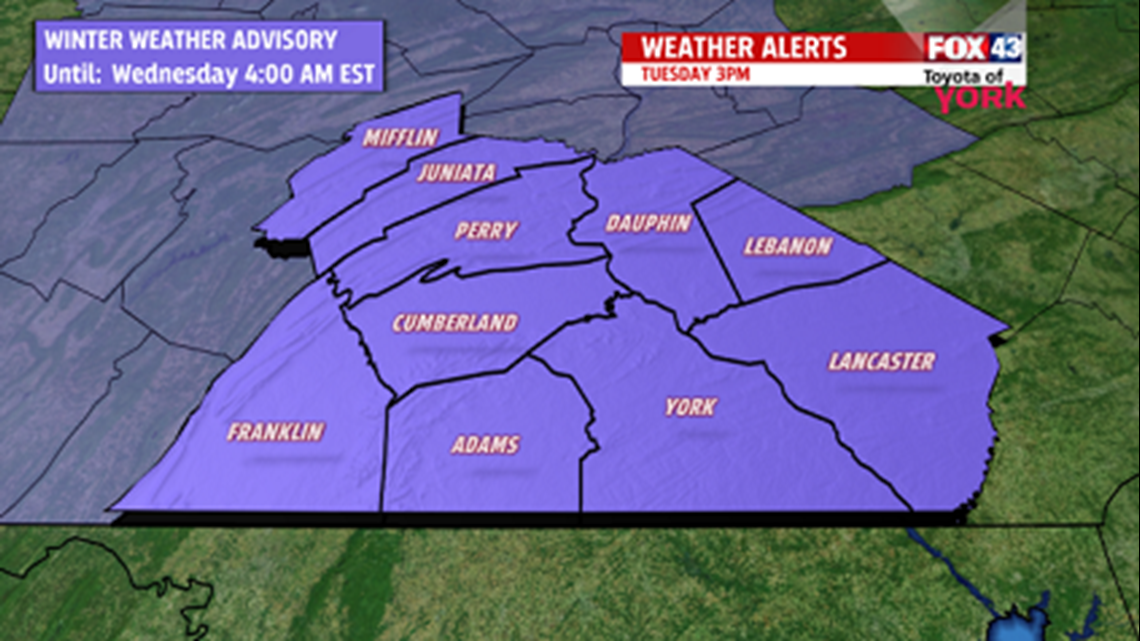
WINTER WEATHER ADVISORY continues this evening because of the dangerous road conditions due to minor ice accumulations.


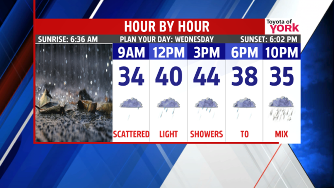
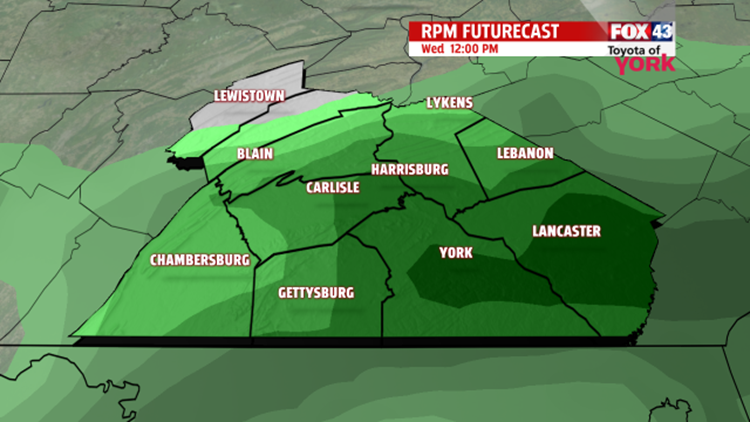
An area of low pressure is expected to develop along it returning moisture to the area but in the form of snow. We could see a period of mixing before it changes to all snow. Preliminary totals are expected around 3 to 6”, with the higher amounts located to the south. Please know snow amounts may change depending on where the front stalls.

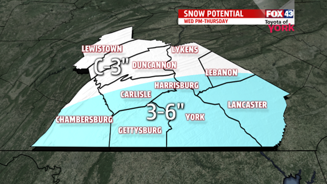
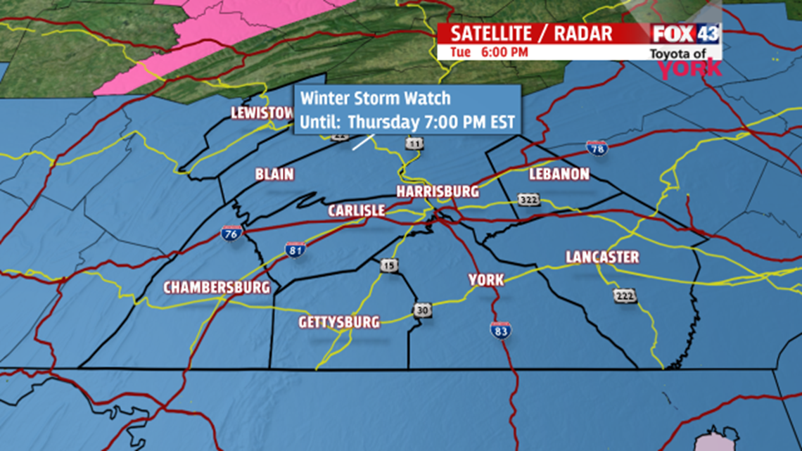
WINTER STORM WATCH goes into effect Wednesday night into early Thursday morning. This could be a significant storm with major impact on the morning commute Thursday.