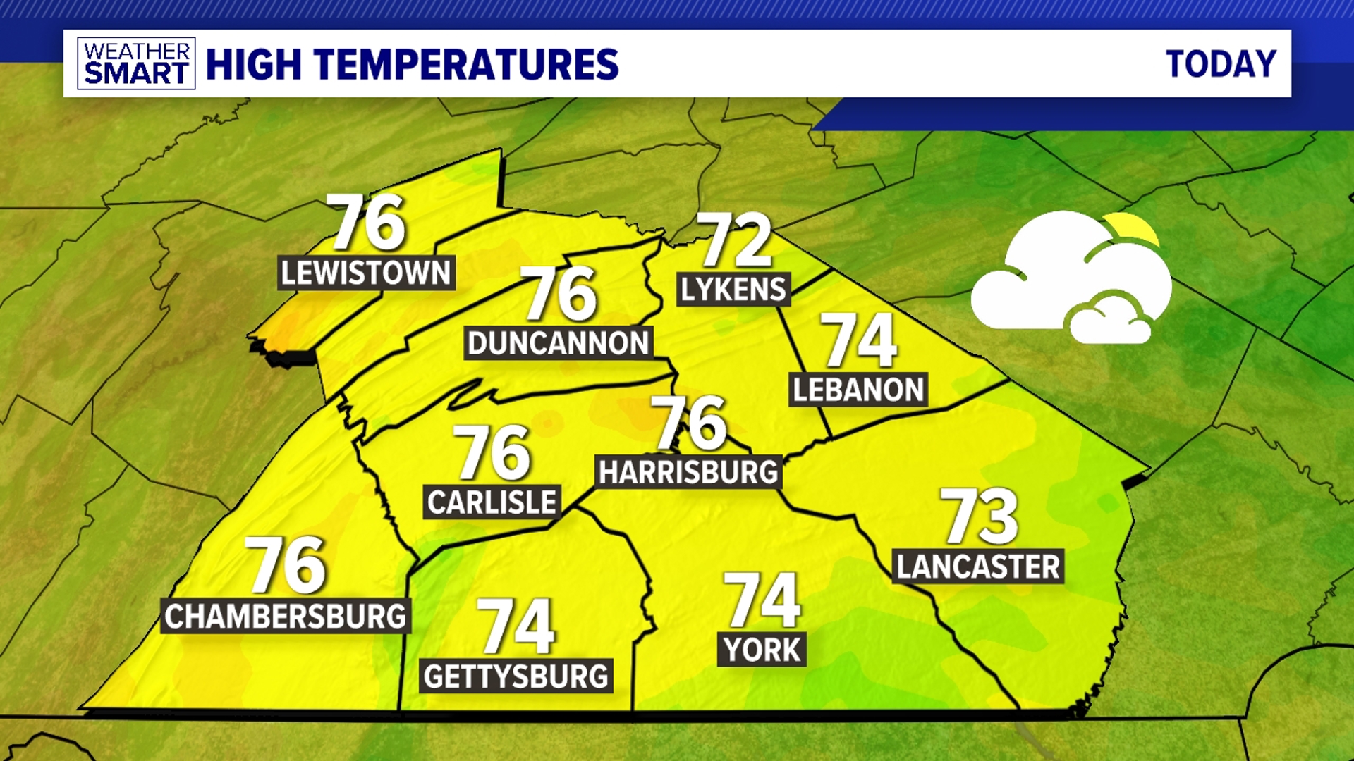

TURNING COOLER
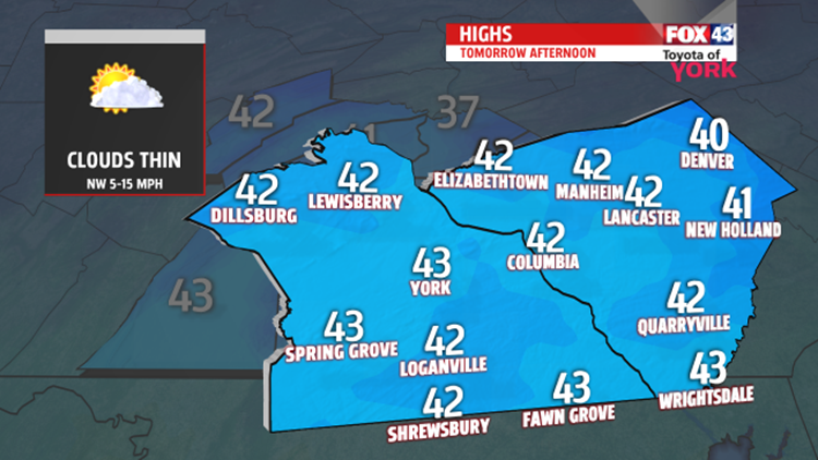
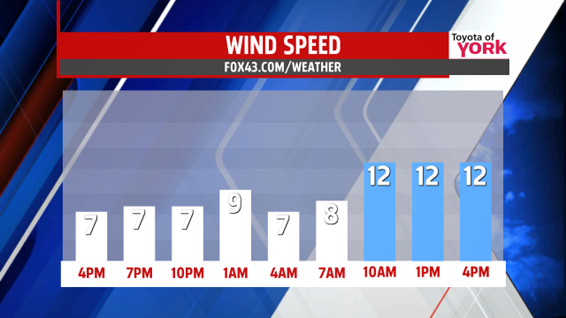
The clouds have broken up throughout our region this afternoon, but they do return a bit later tonight. Until then, mostly clear skies help temperatures plummet to cold readings for this time in March. Expect overnight lows in the 20s. Some clouds are around for a good chunk of the morning, especially to the south, but the clouds fade away during the afternoon. It’s a bit breezy with an unseasonable chill. Temperatures range from the upper 30s to lower 40s.
MORE CHILLY DAYS AHEAD

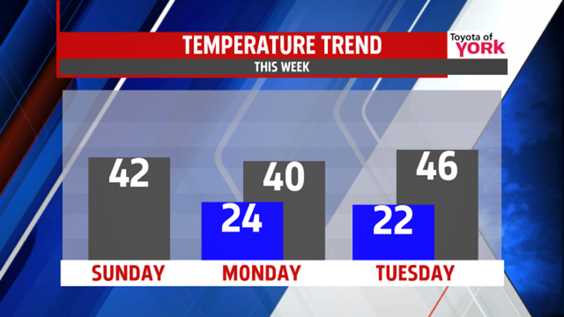
The beginning of next week is dry to start with high pressure in control to the north. However, our region remains under the chilly air, with some frigid nights expected too. Overall, expect more sunshine than clouds Monday and Tuesday. Temperatures are near 40 on Wednesday, and in the lower to middle 40s on Tuesday. Morning lows begin in the 20s Monday, with some teen readings sneaking in for parts of the area Tuesday morning.
NEXT SHOWER CHANCES
Our next cold front approaches Wednesday, quickly increasing the clouds, and bringing the chance for late day showers. The shower chance sticks around through Thursday. It’s milder and more seasonable these days, with temperatures in the 50s. Friday cooler air slips back into the region. Temperatures fall into the upper 40s. We’ll be watching another system closely. There is a lot of discrepancy at the moment, but there is a chance for a few showers. It should clear the region by Saturday, with highs remaining below seasonable averages.
Enjoy the rest of your weekend!
-Andrea Michaels