

OVERNIGHT
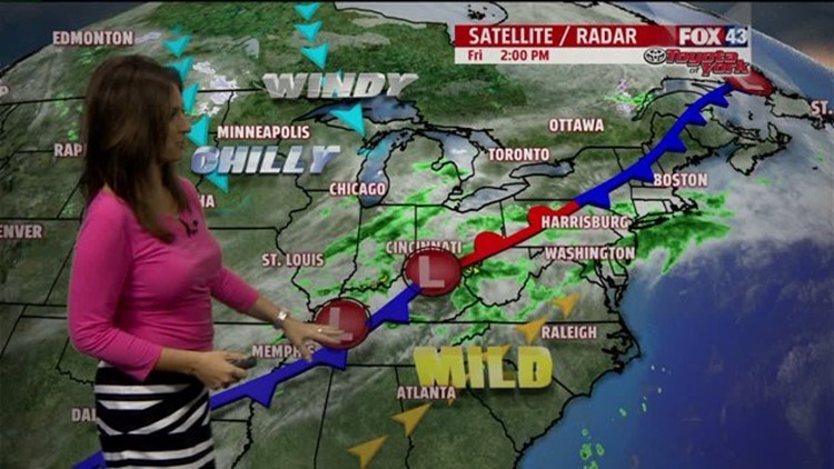
Bands of heavier showers move in this evening and overnight. There may be a rumble of thunder too. Area of low pressure will drag a cold front through by the early morning hours Saturday. Temperatures will fall from the 50s after midnight to the low to mid 40s by morning. As the front pulls away, the winds will be picking up towards morning out of the northwest 10-20 mph.


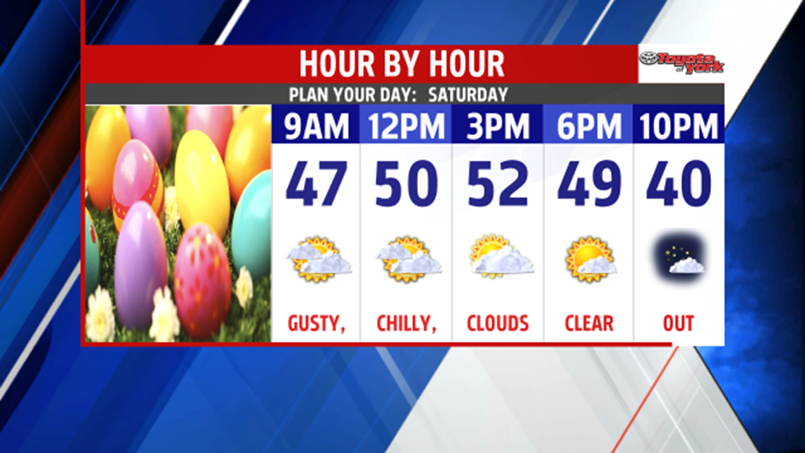
We will get some sunny breaks but plenty of cold air in the upper levels mixing with afternoon sunshine will create mostly cloudy skies in the afternoon. It will be blustery and much chillier with highs in the upper 40s and low 50s. Winds will be quite breezy out of the northwest 15-25 mph with higher gusts. Towards evening, skies will clear and winds will lighten up leading to a cold start Easter morning in the low 30s.


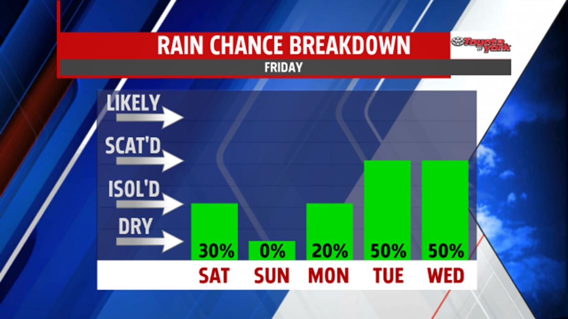
Eventually, a frontal boundary and waves of energy, will keep clouds around for much of the week along with the threat for showers each day. Monday should be dry until late evening but the rest of the week is looking unsettled. Highs should be in the low to mid 60s early in the week. With a persistent easterly wind and showers around, Wednesday is looking gloomy and cool under gray skies. Highs will be held in the 50s. We rebound, despite shower threat, later in the week with 60s returning.

Have a great holiday weekend!
MaryEllen Pann, FOX43 Chief Meteorologist
Follow me on Twitter: @MaryEllenFox43
Like me on Facebook: MaryEllen Pann FOX43
