

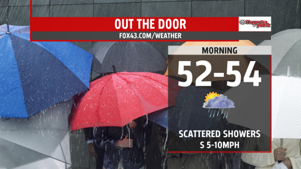
OVERNIGHT
Sunshine will fade this evening as clouds roll in. We will remain dry for the next several hours but later could see a few showers move in. A zonal flow has set up and waves of low pressure will develop along it bringing the threat for showers overnight into the morning and for much of the week. Lows will be mild in the low 50s.

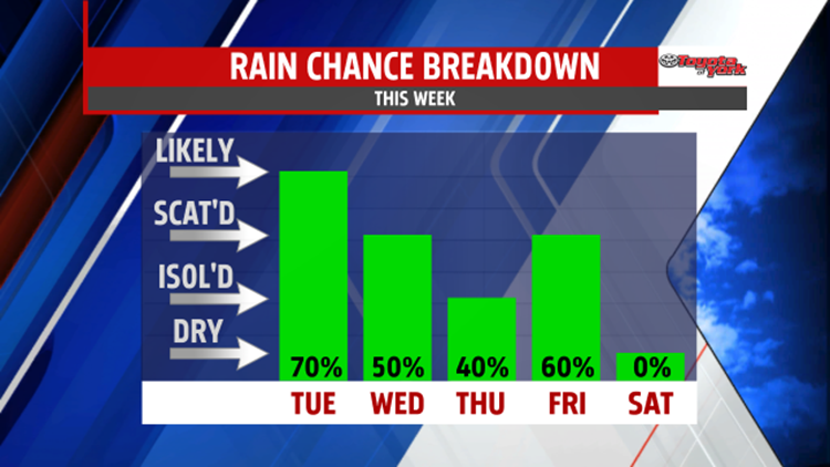
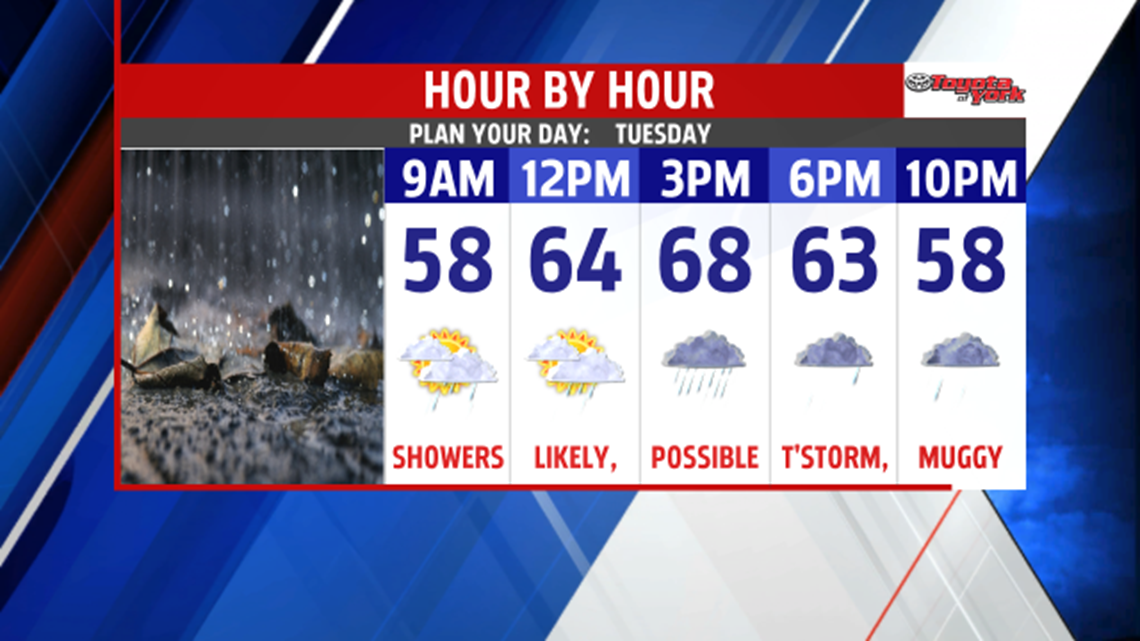
Keep the umbrella handy as showers will be likely anytime during the day. However, a strong shortwave will ride in along a stalled boundary bringing a better threat for showers, possibly a thunderstorm in the afternoon and evening. Highs could still get to the upper 60s despite the clouds and showers. It will also feel a bit muggy as the humidity increases.

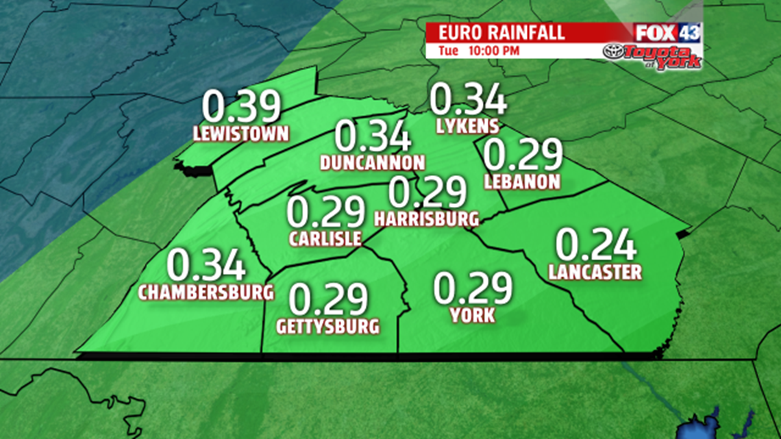
Several waves of low pressure will continue to parade the along the front. We could pick up a .25” to .50” of rain.

OUTLOOK
High pressure to the north will help push the stall front farther south by Wednesday. This will set up an easterly flow for a couple of days keeping skies gray and possible showers around. Temperatures will also be much cooler. By Friday, the zonal flow will be less pronounced as a ridge starts to build in. Cold front approaching by Friday puts us in the warm sector so temps quickly bounce back to the upper 60s to near 70. Showers and thunderstorms will be likely as the front pushes through. The threat for wet weather should be out of here by the early morning hours of Saturday as high pressure builds in for the weekend. Some upper level energy may keep the clouds around Saturday into Sunday and cause morning lows to be a tad chilly but both days look to be dry with highs in the mid 60s. Monday, warms a bit more and should be dry for much of the day. Clouds will increase with the threat for showers returning late in the evening.
MaryEllen Pann, FOX43 Chief Meteorologist
Follow me on Twitter: @MaryEllenFox43
Like me on Facebook: MaryEllen Pann FOX43
