

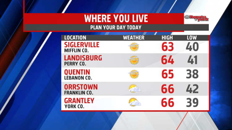

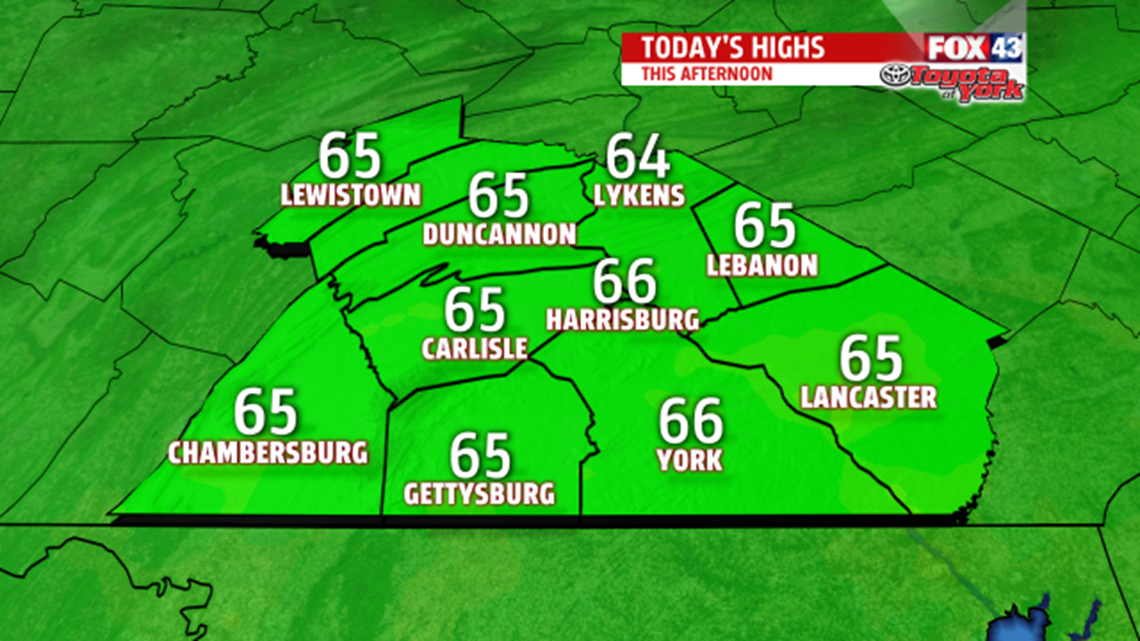
SUNSHINE RETURNS: High pressure is slipping in from north, bringing a return to drier conditions, but clouds to the south are expected to pass through as well. Otherwise, Wednesday is nice day, with temperatures running a bit above seasonable averages, in the lower to middle 60s. The clouds fade away as high pressure temporarily takes full control of the weather tonight. Light northeasterly winds help temperatures to plummet fast. Overnight lows are chilly, ranging from the upper 30s to lower 40s.

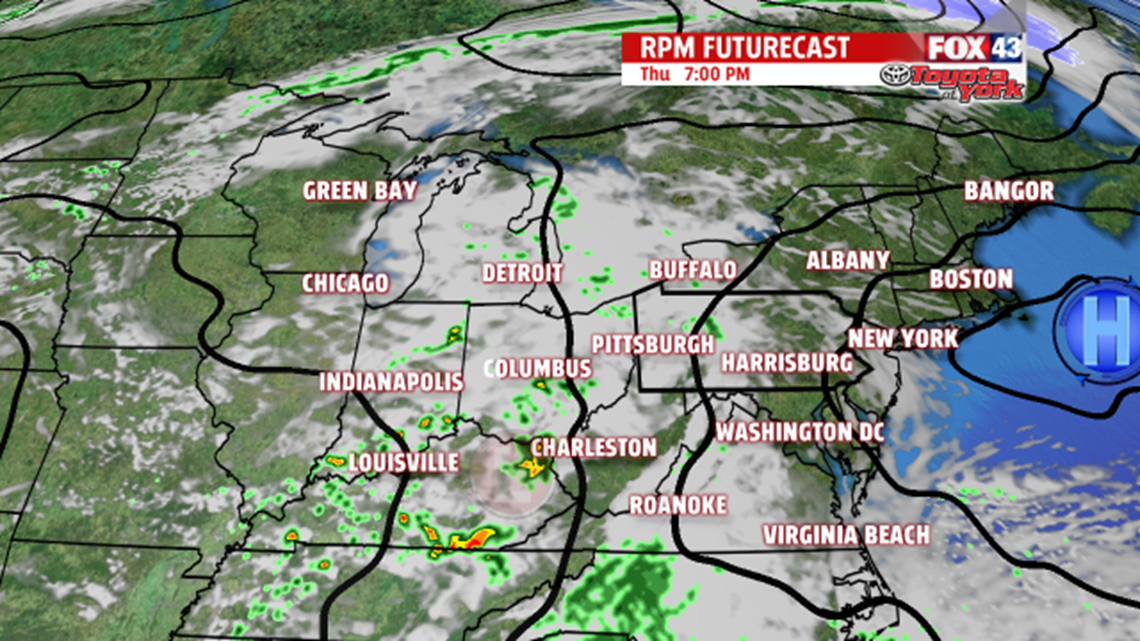
UNSETTLED AGAIN: Thursday remains dry, but moisture creeping in from the south and west helps to increase clouds throughout the day. Expect high temperatures in the upper 50s to lower 60s. This moisture brings the chance for showers overnight Thursday, and a few light showers are leftover for Friday, mainly during the morning hours. Highs Friday are in the lower to middle 60s. Saturday is looking sunnier and milder too, with highs near 70 degrees.
SLOWLY COOLING: Our next storm system approaches Sunday, bringing clouds back to the region. Showers should hold until Sunday night, and they last through the day on Monday. Some sunshine returns on Tuesday. Temperatures fall to near seasonable averages on Sunday, in the upper 50s to lower 60s. Monday, readings fall into the 50s before bumping up a bit on Tuesday.
Have a great Wednesday!
-Andrea Michaels – FOX43 Weekend Meteorologist
Follow me on Twitter: @amichaelswx
Like me on Facebook: Andrea Michaels FOX43
