OVERNIGHT
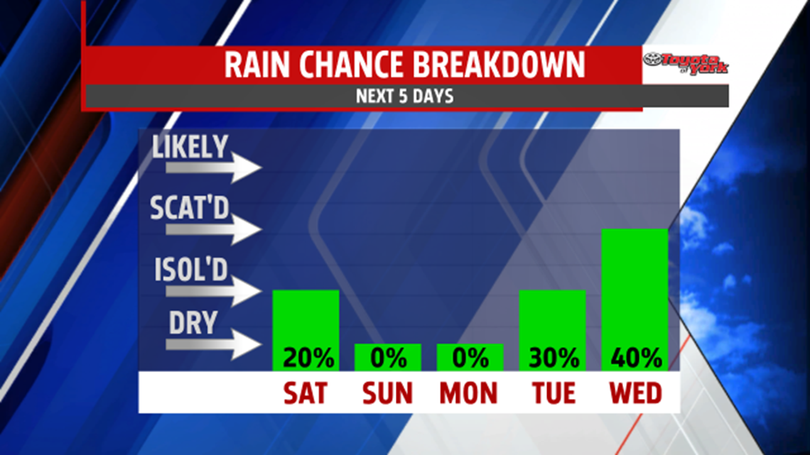
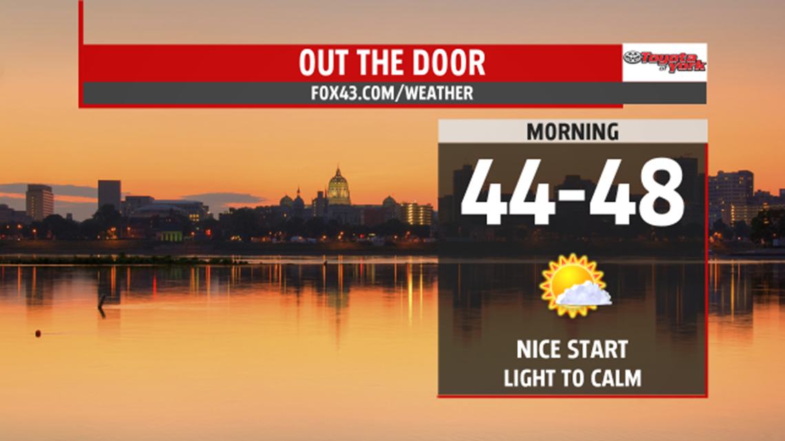
Shower threat ends tonight. Clouds will decrease towards morning. As the skies clear out somewhat, there could be patchy fog that develops in areas. Lows will drop to the mid to upper 40s to near 50.

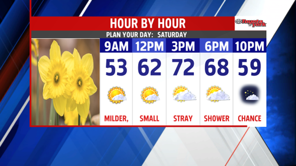
As high pressure builds in, we’ll start the weekend with plenty of sunshine. Still some upper level energy that may trigger clouds and an isolated shower in the afternoon but most areas remain dry. The clouds that do develop will clear in the evening and overnight. The return of sunshine will help to warm temperatures to the low 70s. Mostly clear overnight, and once again lows will drop to the upper 40s.

OUTLOOK
Ridge will build in over the northeast for much of the week with just some weakening mid week. This means much warmer temperatures. Sunday, plenty of sunshine and highs in the upper 70 will end the weekend. Monday, we are greeted with more sunshine and much warmer air moving in, helping to boost temperatures to the low 80s. Showers and thunderstorms will be possible late Tuesday as a frontal boundary nears the area and threat will hang around for Wednesday. Temperatures will drop back to the 70s both days. We quickly warm back up into the low 80s, with plenty of sunshine and strengthening ridge, over the east to end the week.