


80S RETURN MONDAY
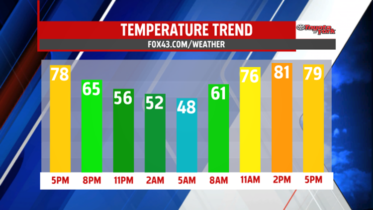
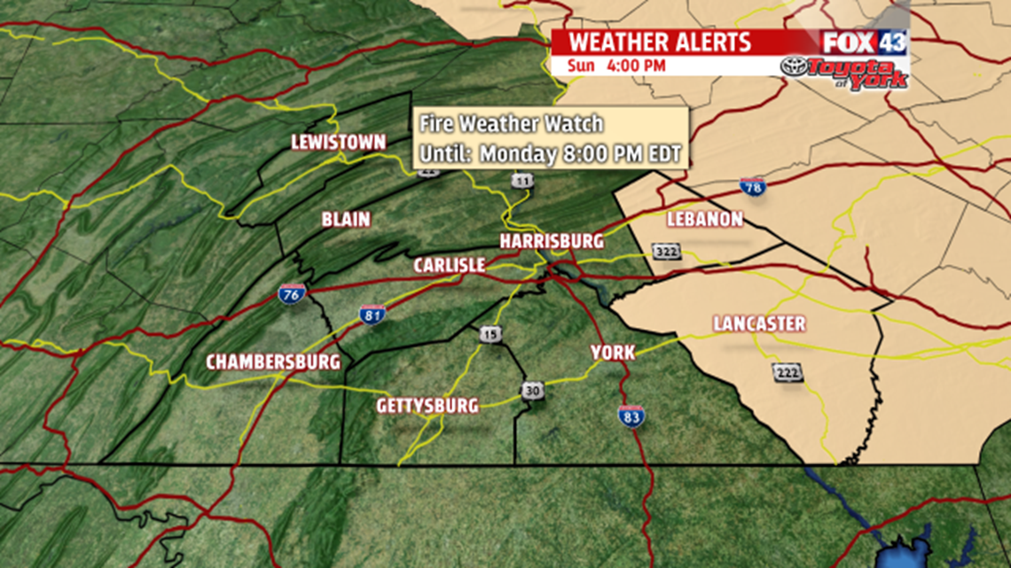
It’s been a warm and summery Sunday, and it’s only the start of what’s to come as the new work week begins. A strong ridge of high pressure further amplifies through Monday. This keep skies mainly clear tonight. It’s a milder night too, with overnight lows in the lower to middle 50s. The warming trend continues through Monday under plenty of sunshine. Temperatures are in lower to middle 80s! Dry and breezy conditions have prompted the issuance of a Fire Weather Watch for Lancaster and Lebanon counties Monday. This means warm and dry conditions in addition to breezy winds could lead to the rapid development and spread of wild fires. Outdoor burning is not recommended.
MIDWEEK SHOWERS
By Tuesday, many areas likely reach 80 again. The only fly in the ointment is the chance for afternoon thunderstorms. Any locations that see showers or a thunderstorm during the early afternoon could stay in the 70s. This shower and thunderstorm chance lasts through the night. Isolated shower chances even linger into Wednesday, with temperatures falling back into the 70s.
SUMMERY FEEL STAYS
It’s back to the summery feel on Thursday, with temperatures back into the lower 80s for many. Expect a mixture of sunshine and clouds, which continues for Friday, Saturday, and Sunday. An isolated thunderstorm may try to sneak in at some point during that timeframe, but there will be plenty of dry time. Highs are in the lower to middle 80s through the weekend.
