OVERNIGHT
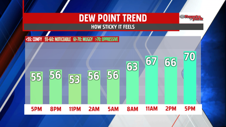
Isolated showers will be possible as a warm front lifts to the north. Temperatures will be mild in the upper 50s to near 60. Plenty of clouds to start the day, in fact, they remain for much of the weekend.


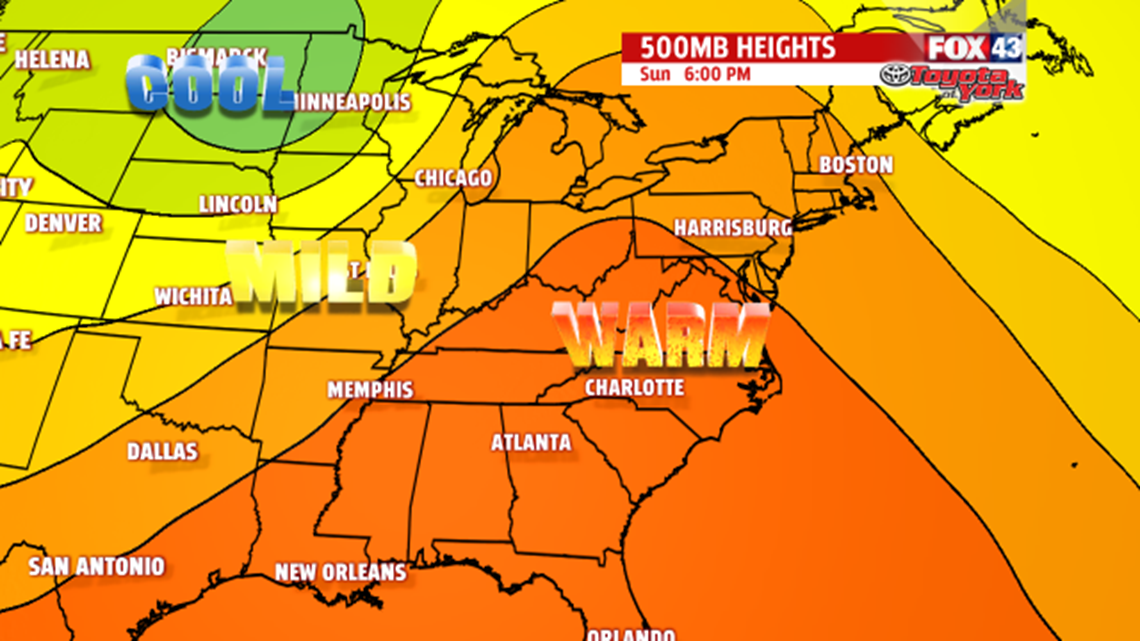
Despite cloud cover mixing with limited sunshine; it will be much warmer in the low 80s and more humid as a south-southwesterly flow increases moisture across the area. Few showers and thunderstorms will be possible too but don’t cancel outdoor plans. Just be prepared to run for cover briefly should one develop.

OUTLOOK
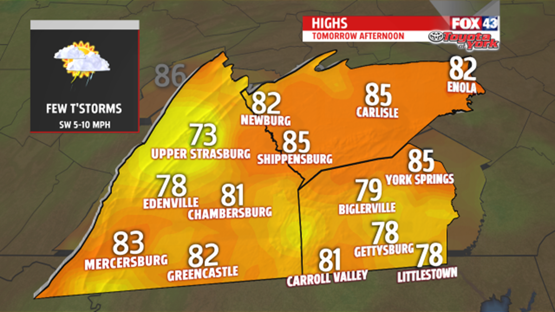
Not much change for Sunday. It remains warm and humid with a few showers and thunderstorms still possible. Highs will warm to the low to mid 80s. The best chance for scattered showers and thunderstorms will be Monday as a cold front inches closer to the area. It will still be summer-like with 80s and high humidity. The front doesn’t push through until early Tuesday so showers will still be possible for the start of the day. With morning lows in the 60s, we could still make a run for 80 on Tuesday before cooler air spills in across the area mid week. High pressure, cooler, more comfortable air expected to return for Wednesday and Thursday. Highs in the upper 60s to near 70.