OVERNIGHT
It’s a warm summer-like evening with temps fall from the low 80s to the mid 70s. It is still feeling quite comfortable as dew points hover in the 50s. Overnight, skies will be partly to mostly clear with mild morning lows in the low to mid 60s.


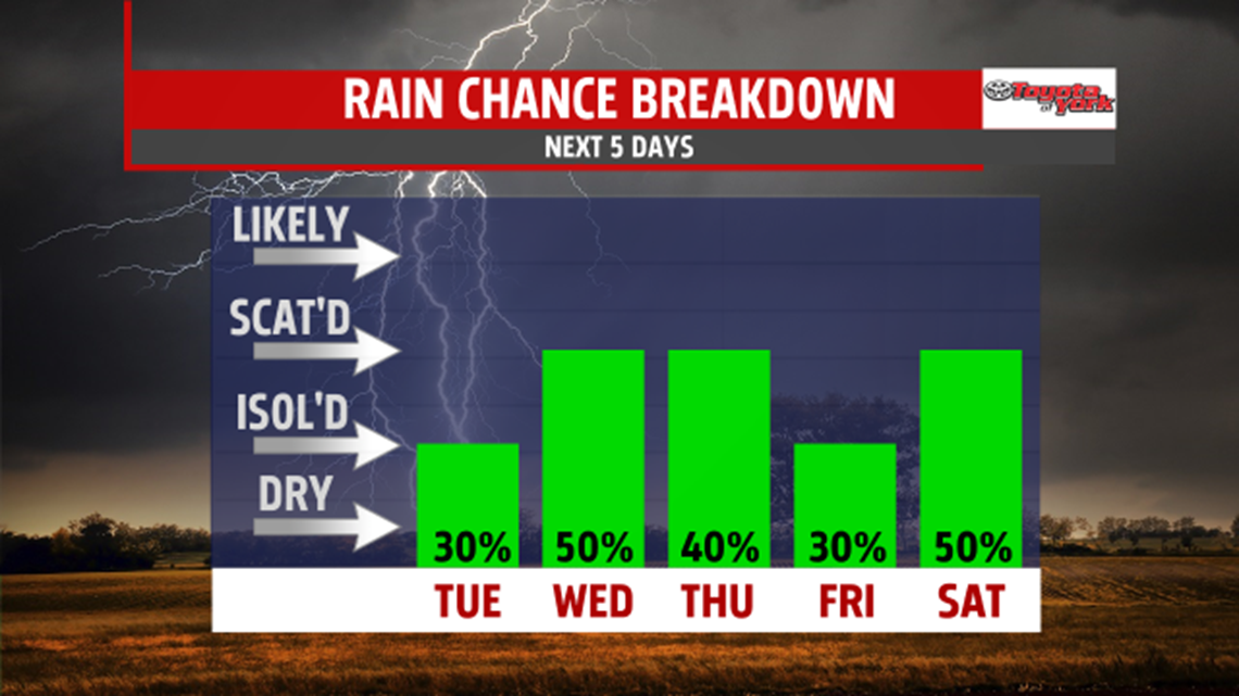
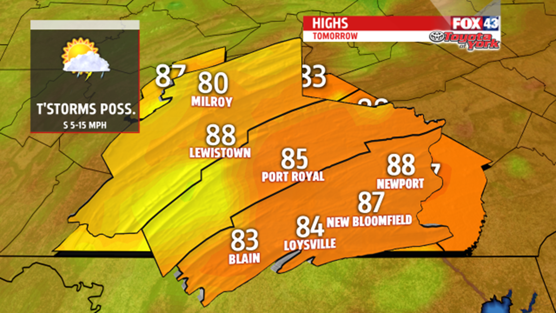
High pressure slips further east allowing for winds to continue flowing from the south-southwest. It will also allow for a frontal system to ease a bit further east. You’ll notice the humidity more as dew points climb during the afternoon. With the warm temperatures and more moisture around, we could see isolated storms bubble up with the heating of the day. A marginal risk for severe weather will be in place for the western part of PA but Mifflin and Juniata may also experience some gusty, strong thunderstorms. Tomorrow night, skies will be partly cloudy, it will be muggy and lows will run well above average in the mid to upper 60s.

OUTLOOK
A better threat for scattered thunderstorms arrives for Wednesday as a front moves closer to the area. The heat and humidity will combine to produce isolated storms during the afternoon and evening. Storms may become strong to severe. The area will be under a marginal risk for severe storms on Wednesday. The main threats will be damaging winds and heavy downpours, which may lead to minor flooding. We are still very warm and humid on Thursday. Weak cold front slides through triggering showers and thunderstorms once again. Highs will be in the mid 80s for much of the week. Friday, while there is still a shower threat, chances drop to about a 30% chance. Highs will be in the low 80s. A stronger cold front will swing through over the weekend. Showers and thunderstorms will be possible for Saturday with some showers lingering into Sunday. It will be warm & humid Saturday, with highs in the mid to upper 80s, but much more comfortable and cooler for the second of the weekend, as temperatures back off to the upper 70s to near 80 degrees. It looks like the first day of June arrives cooler and more seasonal in the mid 70s.