OVERNIGHT
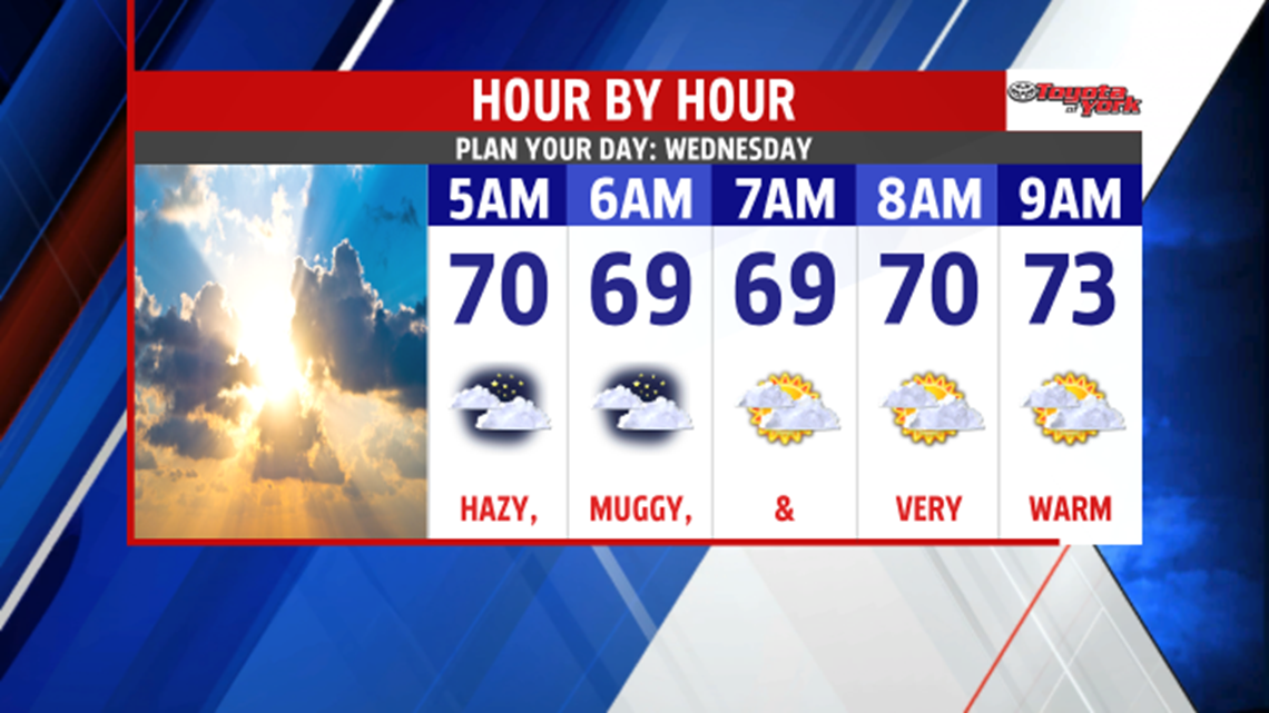
It will be a muggy, warm night. Mostly cloudy skies and a light breeze into the morning will help to keep morning lows well above average in the upper 60s.

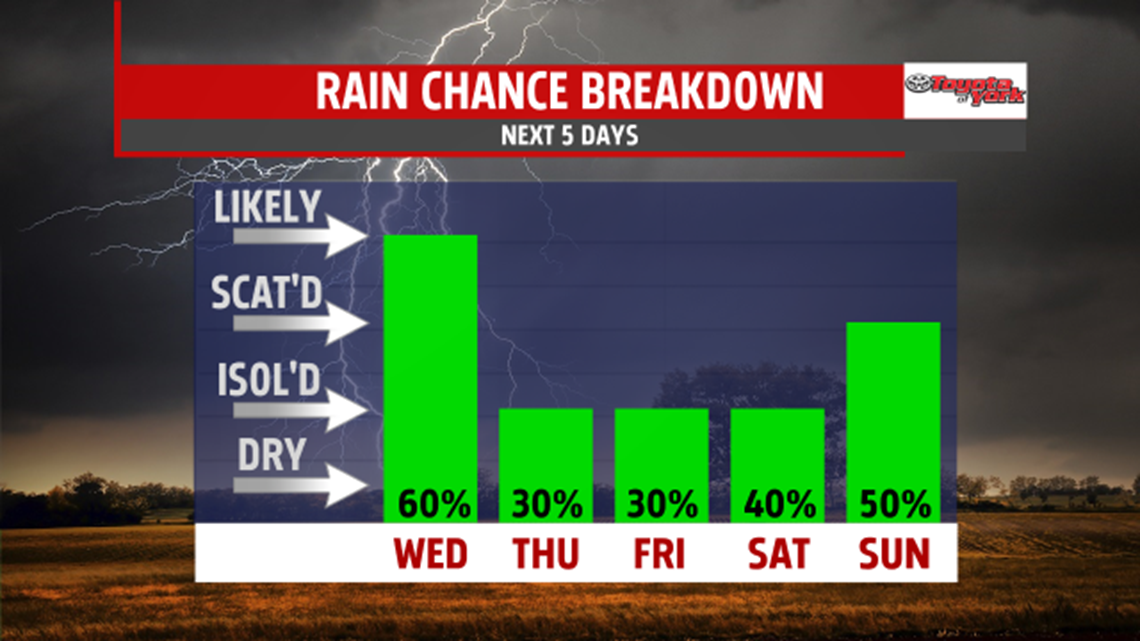
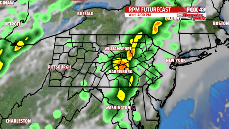
Scattered showers and thunderstorms may develop, as early as noon, in our western counties, then spread east through the early afternoon. Highs will climb to the low to mid 80s. Rain will cool temperatures off into the 70s, but we could see them rebound as the sunshine breaks out. It looks like the best threat for showers and thunderstorms will be between noon and 6pm. Some of the storms that develop may be strong to severe, with wind damage the main threat. It will be another muggy, warm night leading into Thursday morning. Lows will drop to the mid 60s. The Storm Prediction Center has us in a Marginal Risk for severe weather.


OUTLOOK
There will still be a threat for a few showers and thunderstorms as a weakening cold front slides south. There will be more dry hours than not, and it will be warm once again into the mid 80s. The heat and humidity will hang on through Friday with only an isolated thunderstorm threat. For the weekend, Saturday looks to remain mostly dry but very warm and humid as the wind picks up out of the southwest. Highs will rise to the mid and upper 80s with pm storms possible. A strong cold front will approach overnight bringing a better threat for showers and thunderstorms. It will slowly sag south but stalls across the area through early next keeping shower chances around. Temperatures will also fall back to near 80 on Sunday, 70s for early next week.