

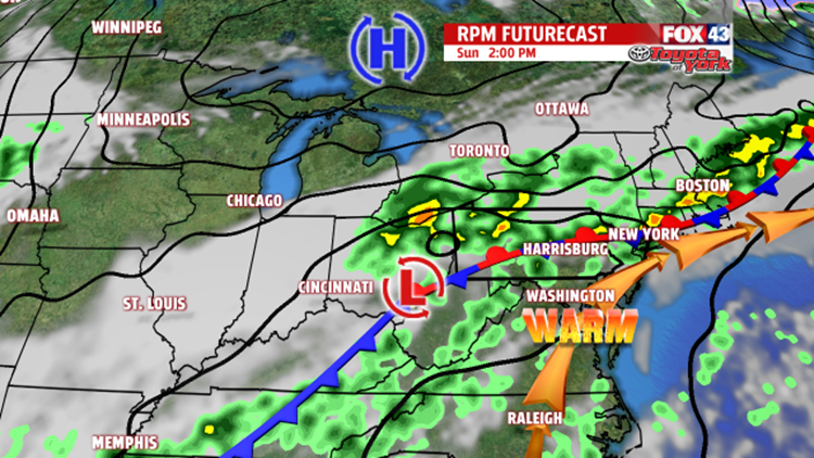

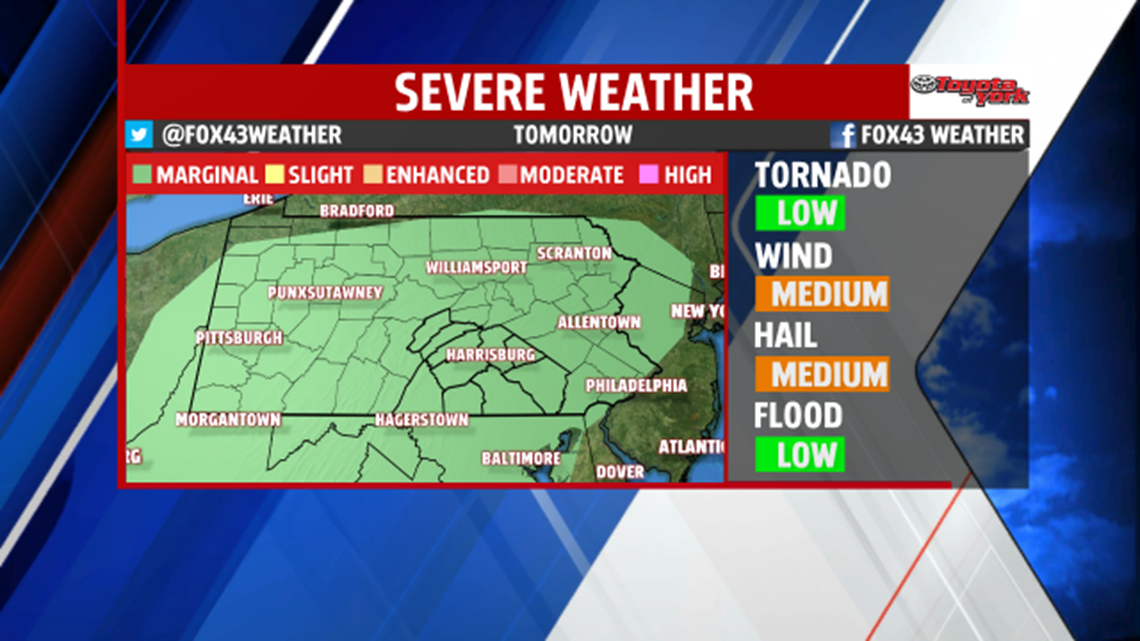
STORMY FOR SUNDAY: A slow moving cold front continues to edge closer to us, and it brings more widespread showers and thunderstorms for Sunday. Tonight, foggy and hazy areas form as skies dry out. An isolated shower is still possible. Overnight low temperatures fall into the middle to upper 60s. After the fog burns off, we could see some sunshine briefly before showers and thunderstorms fire up. A few storms could be on the stronger side, with damaging winds and large hail the main threat. Locally heavy downpours are possible as well. Expect afternoon high temperatures to remain in the lower to middle 80s.

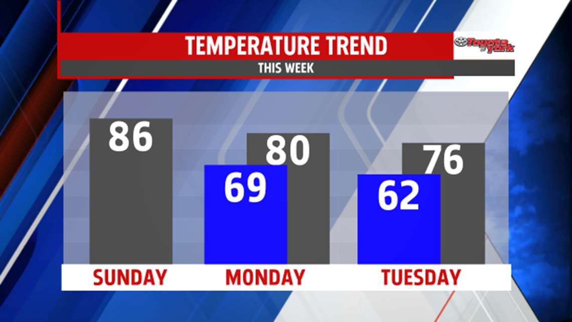
GRADUAL COOLING: Monday there’s still the chance for showers and storms as the front stalls nearby, and this chance lingers into early Tuesday morning. High temperatures are near 80 degrees on Monday. Tuesday looks like the day we finally eradicate the shower and thunderstorm chances. Through the morning, skies dry out after morning showers. It’s cooler and less humid as well, with highs in the 70s.
DRYING OUT: Wednesday and Thursday expect plenty of sunshine, with slowly warming temperatures. Highs are seasonable Wednesday, and near 80 degrees on Thursday. There’s a slight chance for a shower on Friday, but the day should be mainly dry. Saturday looks like our next shower and thunderstorm chance. Highs rise into the lower to middle 80s to close out the week.
Enjoy the rest of your weekend!
