

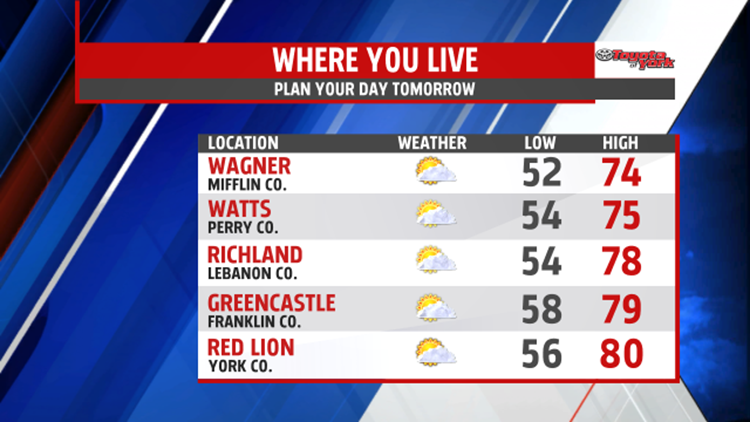

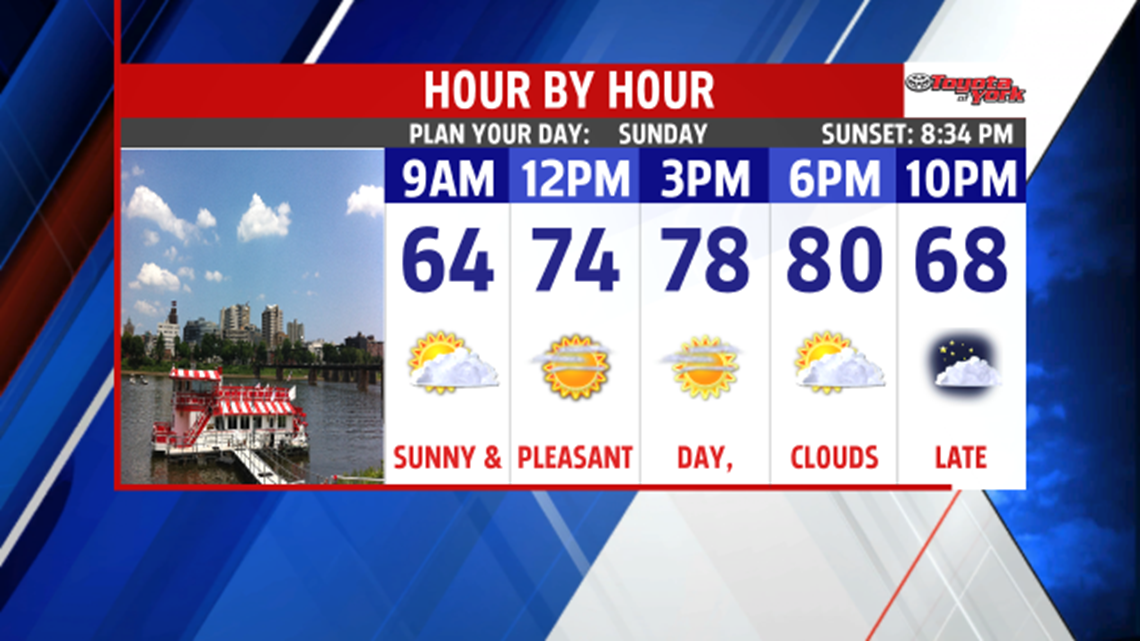
NICE CLOSE TO WEEKEND: High pressure moving in behind a cold front has helped to chase away all of the day’s clouds. As we move into the overnight period, skies are mostly clear. Conditions are comfortable as well, with cool lows in the 50s. Sunday is a mixture of clouds and sunshine as our next cold front approaches slowly from the west. It’s a bit on the breezy side as well, and humidity levels stay low. Afternoon high temperatures are in the upper 70s to near 80 degrees with partly cloudy skies.


SUMMERY FEEL: Wednesday is drier, but a summer like feel builds back into the region. Expect some passing clouds, with highs in the middle 80s. Temperatures turn toastier to close the week. Readings reach the middle to upper 80s with a few isolated thunderstorms possible Thursday and Friday. Locations that stay dry could flirt with the 90 degree mark! Saturday looks like the timing of our next cold front, so scattered showers and thunderstorms are likely.
Enjoy the rest of the weekend!
