

HOTTER
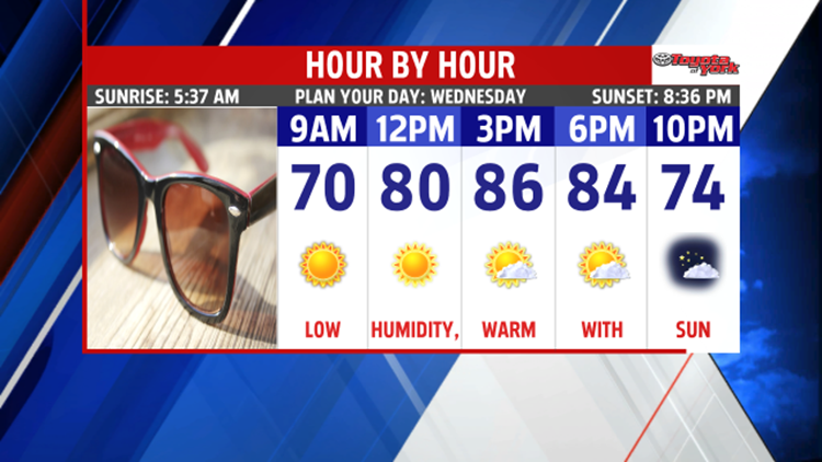
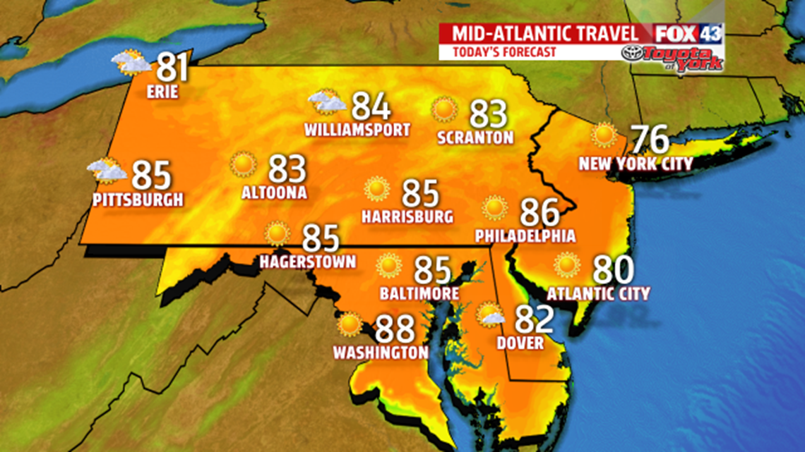
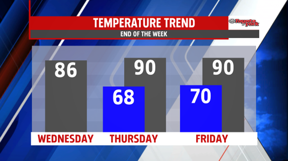
We’ll move into a full summer pattern, one stage at a time. Today, we pump up the heat a tad. Expect highs in the middle 80s under mostly sunny skies. A disturbance passes by to our north, but most of the showers and storms should fade before hitting our northern counties later this evening. Overnight, we drop to the upper 60s.

MUGGIER
Stage two comes Thursday with the addition of humidity. It’s hot and humid with a high at 90° under partly cloudy skies. Friday is hot and humid again! Expect highs near 90° under partly cloudy skies. Each day features isolated afternoon thunderstorm chances.

WEEKEND
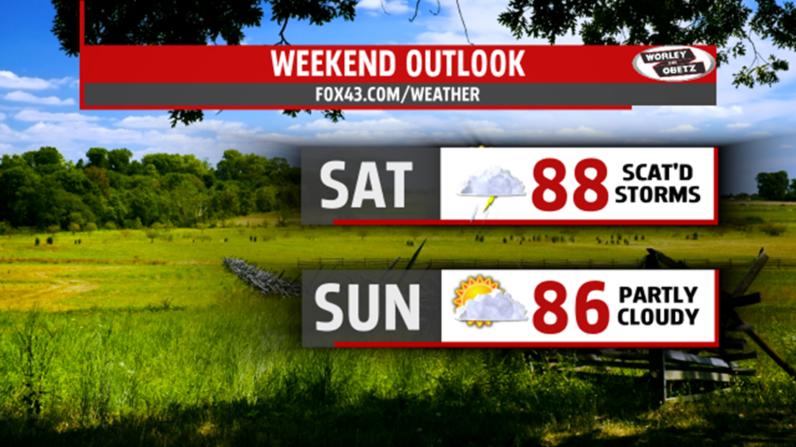
A front nears for Saturday, but we stay hot and humid. It’s partly cloudy with a chance for afternoon and evening t’storms. The high hits 88°. Sunday, we keep the hot and humid air with highs in the middle 80s. Expect partly cloudy skies and an isolated storm or two.

MORE OF THE SAME
The heat and humidity stay in place for the start of the week. Partly cloudy skies and isolated thunderstorms are on deck with highs in the middle to upper 80s.
Make it a wonderful Wednesday!
“It ain't the heat, it's the humility.” – Yogi Berra
