

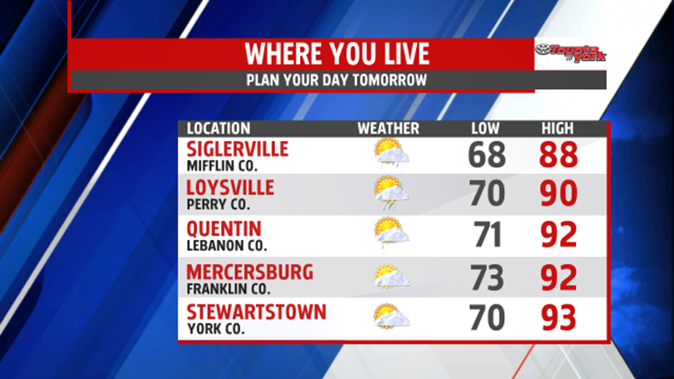

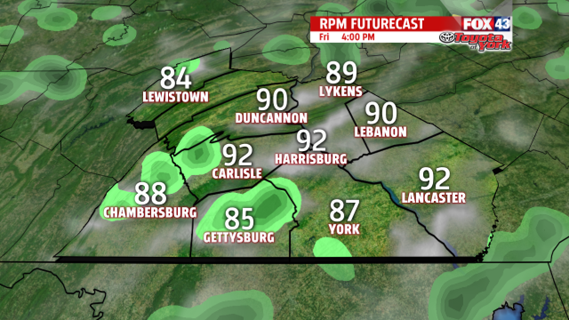

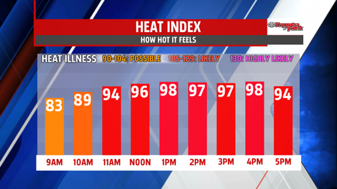
HEAT & HUMIDITY STAYS: A hot and humid pattern has set up throughout the region this afternoon, and it stays in place as the week comes to a close. After a few isolated thunderstorms this evening, skies dry out for the night. It’s warm, soupy, and uncomfortable, with overnight lows in the upper 60s to lower 70s. It’s round two of the heat and humidity for Friday. Afternoon temperatures once again touch the 90 degree mark in many spots. The humidity makes it feel hotter and quite sticky. Afternoon isolated showers and thunderstorms are possible yet again.

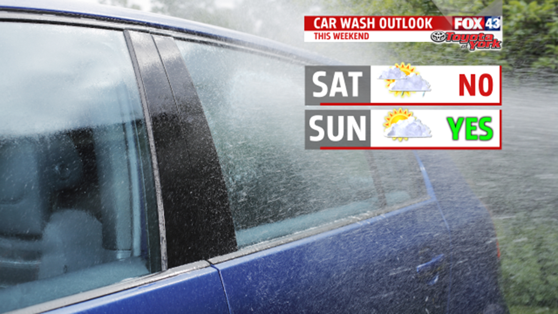
50/50 WEEKEND: Saturday looks like the timing of our next cold front, so scattered showers and thunderstorms are likely, mainly during the afternoon and late day hours. Highs reach the middle to upper 80s. Sunday brings a return to the sunshine, though temporarily. Highs fall into the lower to middle 80s, and the humidity backs off a touch.
NEXT WEEK: Monday yet another front crosses our path, bringing a return to the widespread shower and thunderstorm chances. An isolated thunderstorm chance likely lingers into Tuesday. It’s very warm and humid as well, with highs in the middle to upper 80s. Wednesday is a break from the heat and humidity. Highs are in the lower 80s with low humidity levels. Our next shower and thunderstorm chance arrives on Thursday.
Have a great night!
