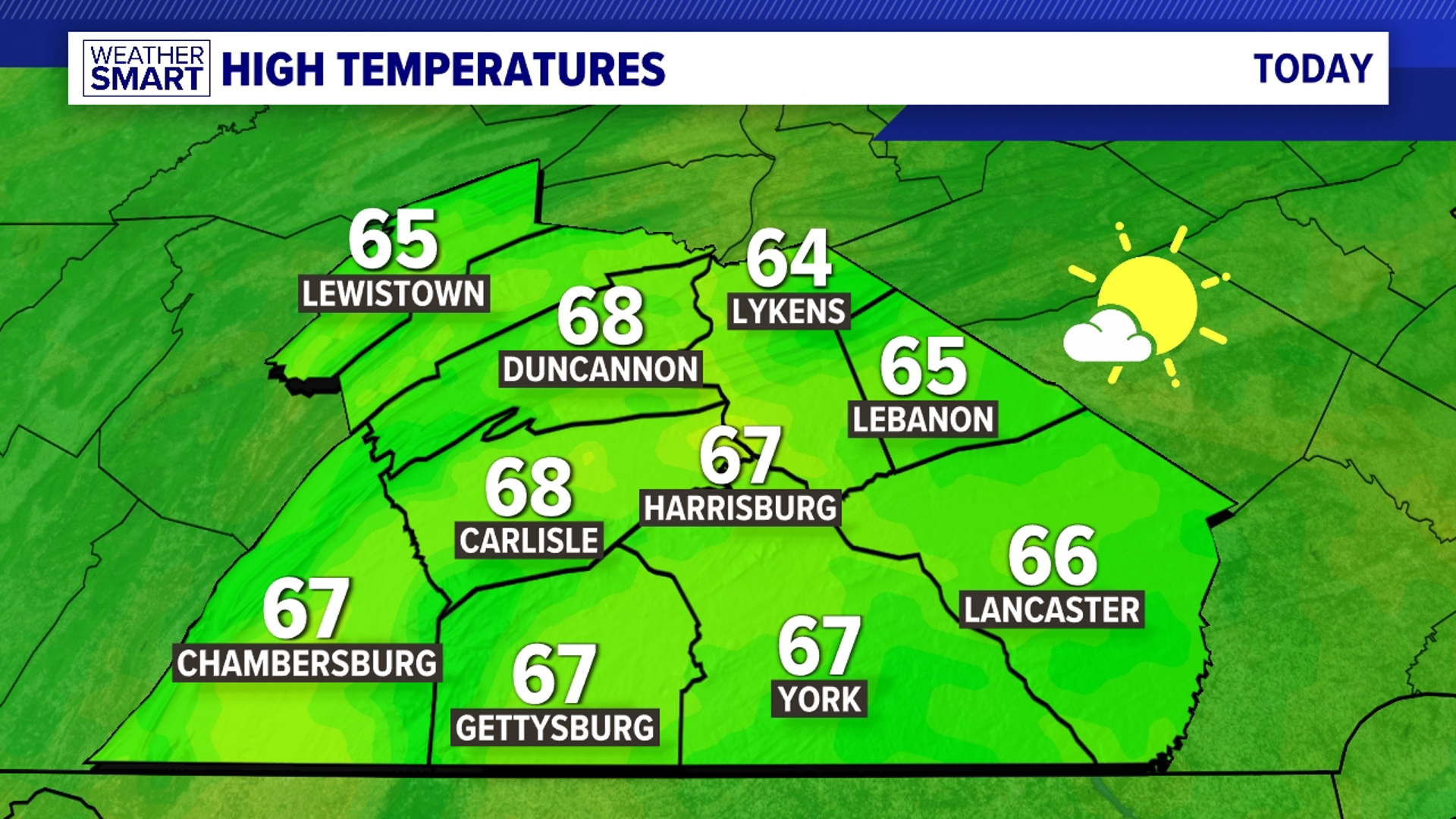

SLOW CLEARING FRIDAY: A cold front continues to slowly drift south this morning, and this keeps showers in the forecast to begin Friday. The worst of the heavy downpours have subsided, but some pockets of moderate rainfall are still possible along with foggy areas. The front clears slowly through Friday afternoon, so skies slowly dry and clear out. Isolated showers cannot be ruled out, especially along counties bordering Maryland, from early to mid afternoons. Some sunshine returns by the mid to late day hours, and the humidity begins to slowly fall as well. Highs are in the lower to middle 80s.


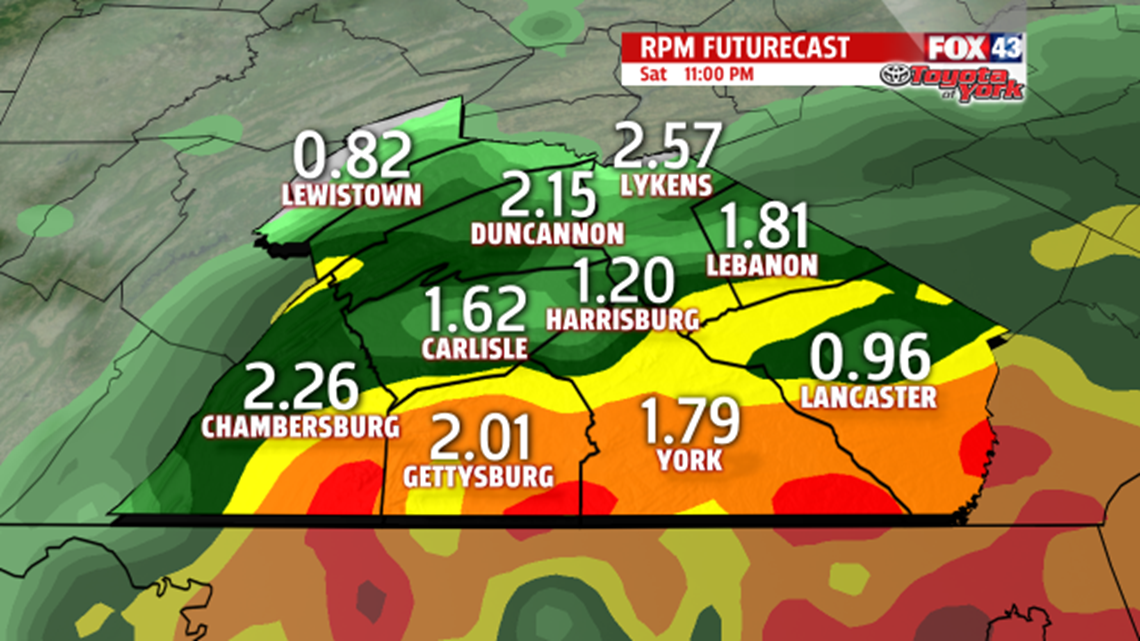
tropical moisture, some locally heavy downpours are possible, so some areas of flooding cannot be ruled out. This will be especially true for urban areas and small creeks and streams. Highs are in the lower to middle 80s both days.
STORM CHANCES REMAIN: The pattern remains unsettled through early next week, though there will be dry time. Expect a daily chance for showers and thunderstorms Monday through Thursday. Highs are a bit above seasonable averages. Readings are in the lower to middle 80s through this time frame.
Have a great weekend!