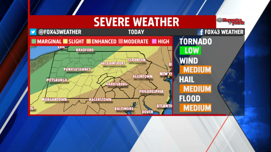
STRONG STORMS
It’s a hazy, hot, and humid Tuesday for you. Highs today jump quickly to the lower 90s. A cold front slips through during the late afternoon, and this will fire showers and thunderstorms from noon until about 6PM. Storms will contain heavy downpours, with some potentially producing damaging winds and hail.

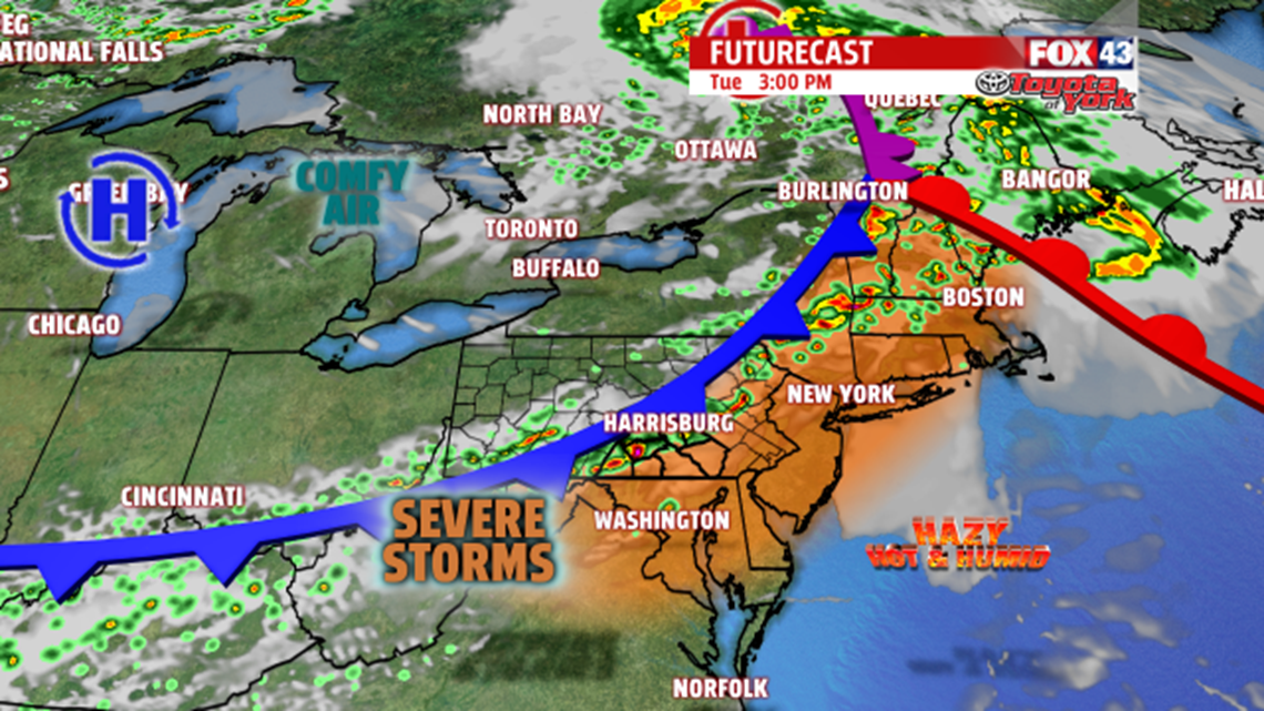
We’re under an enhanced risk for severe weather today, with damaging winds a real threat in any storms that fire. Stay alert for rapidly changing conditions today. Storms are gone by 6PM and we begin to clear and cool.

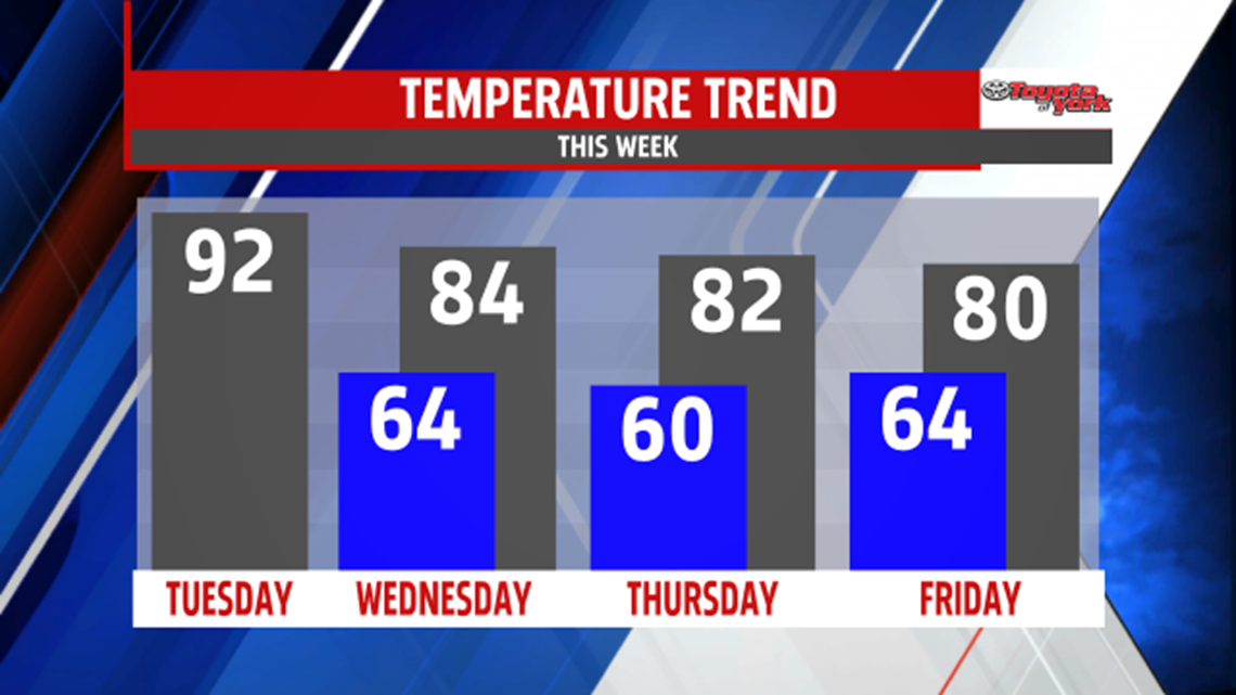
REST OF THE WEEK
The cold front helps bring in lower humidity and less heat for mid-week. Wednesday is a mostly sunny day with highs in the middle 80s. Thursday, we’re doing lower 80s, but clouds and humidity slowly build back in. Showers and storms arrive late. Friday, we’re only near 80° with scattered showers and thunderstorms for the day.

WEEKEND
The weekend looks a bit unsettled. Mostly cloudy skies prevail as our next system slides through. Highs are held in the middle 70s. Expect scattered showers and a few thunderstorms.
Have a tremendous Tuesday!
“The quickest way to double your money is to fold it over and put it back in your pocket.” – Will Rogers