

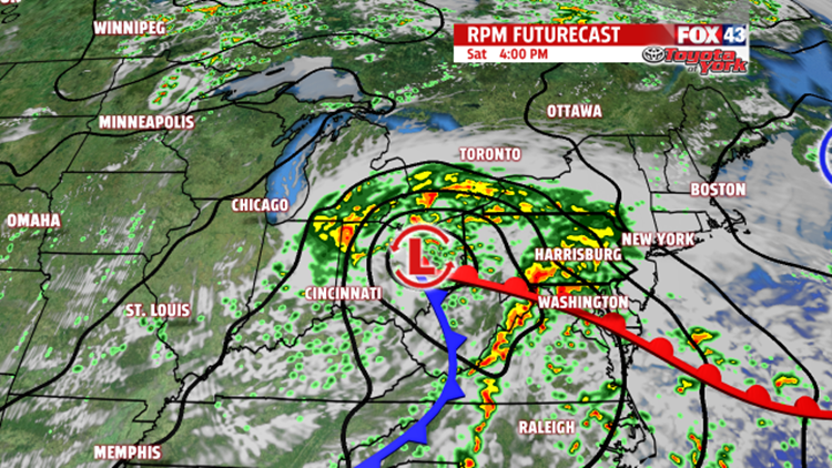


RAIN ARRIVES LATE TONIGHT: A developing storm system out to the west continues to track our way this evening. As it does so, it’s tapping into plenty of moisture to fuel heavy rainfall on Saturday. In the meantime, through the evening only a few sprinkles are expected. Clouds thicken overnight, and the rain arrives by daybreak Saturday morning. Overnight low temperatures fall into the lower to middle 60s.

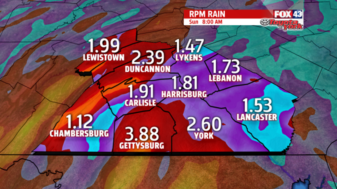
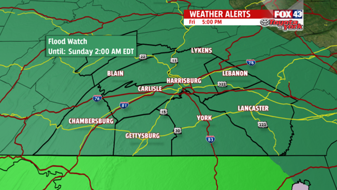
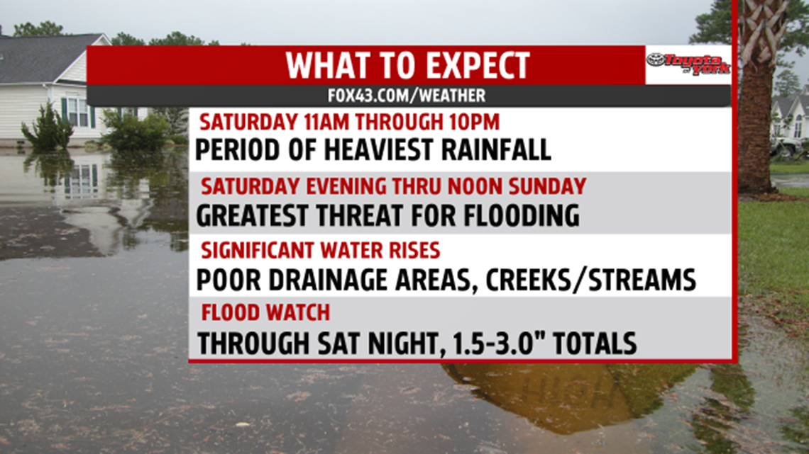
HEAVIEST RAIN SATURDAY: Through the early morning hours Saturday, rain quickly overspreads and winds pick up. It turns heavy late in the morning, and the heaviest lasts through Saturday evening. Between the hours of 10 P.M. Saturday to 2 A.M. Sunday, the rain gradually tapers. Total rainfall amounts range for 1.5 to 3 inches. Locally heavier amounts are possible. Significant water rises are expected to affect poor drainage areas, creeks, and streams. Though river levels will jump as well, flooding of those arteries is not expected at this time. Keep in mind the flooding threat lingers through about noon on Sunday even though we dry out Saturday night. That’s because any flooded roads, creeks, or streams will need time for the excess water to subside. Due to the heavy rain and strong winds, it’s a very cool day. Expect high temperatures to be stuck in the 60s.
DRYING BUT SLOWLY WARMING: Skies are dry by daybreak on Sunday, though a leftover shower or two is possible through the course of the day. Skies are mostly cloudy as well. Temperatures are not nearly as cool, but still below seasonable averages. Readings reach the lower to middle 70s. Monday the sunshine returns and further helps the region dry out. The added sunshine warms us as well. Temperatures reach the upper 70s to lower 80s.
RAIN CHANCES REMAIN: The chance for more showers and thunderstorms quickly returns. Our next system arrives Tuesday, and this is where our highest threat for showers and thunderstorms is expected. A stray shower or thunderstorm could linger into early Wednesday, but the day should be mainly dry. Expect afternoon high temperatures in the lower to middle 80s. Thursday brings partly cloudy skies, but Friday looks like the day our next storm system creeps into the area. Highs fall from near 80 degrees Thursday and into the 70s for Friday depending on how just how wet of a day it is.
Have a great weekend!
