


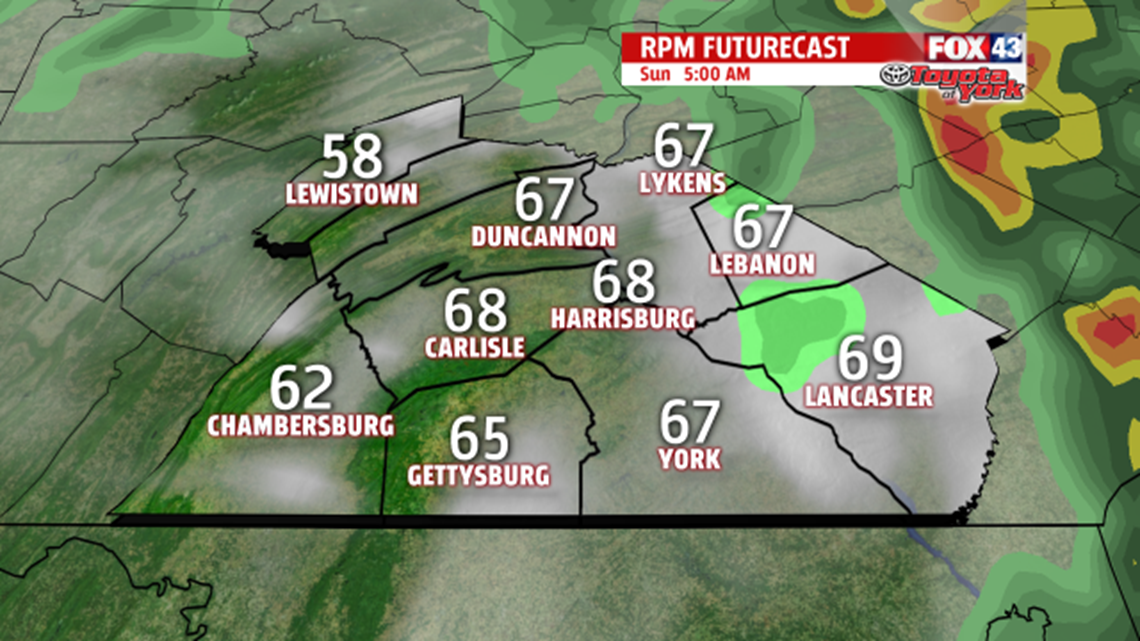
RAIN TAPERS TONIGHT: Clusters of light to moderate rain showers continue to develop and move across the region this evening. Some heavier pockets are still likely before all is said and done, but they will not be as widespread as earlier Saturday. Otherwise, it’s a gradual drying trend through the night. By daybreak, expect only an isolated shower or two. Temperatures barely budge through the night, and remain in the upper 50s to middle 60s.


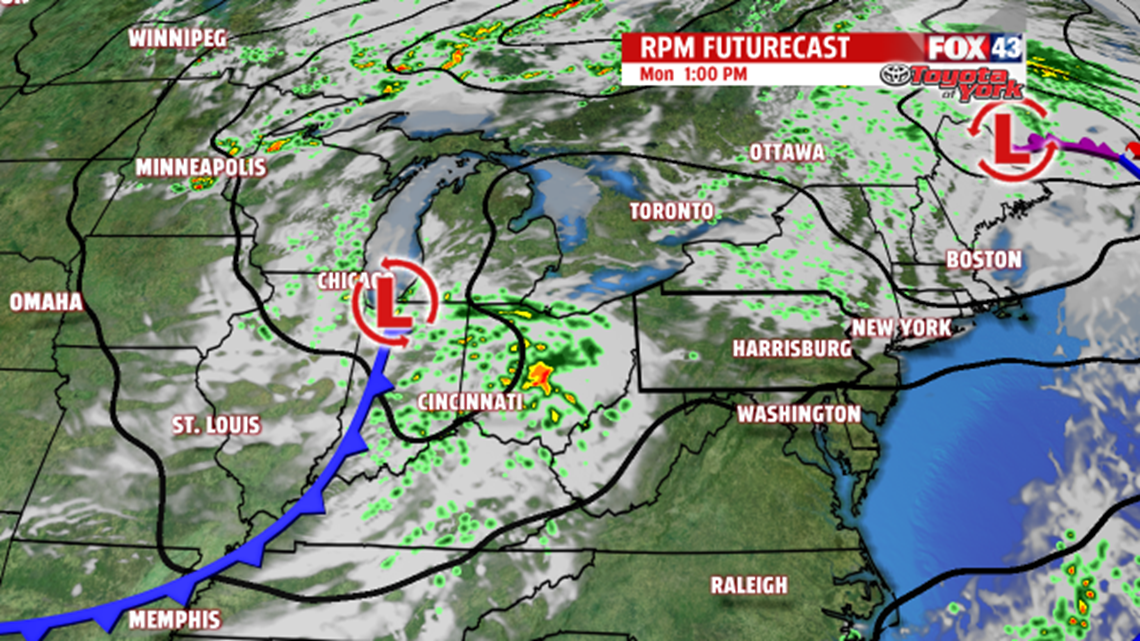
RAIN CHANCES REMAIN: The chance for more showers and thunderstorms quickly returns. Our next system arrives Tuesday, and this is where our highest threat for showers and thunderstorms is expected. A stray shower or thunderstorm could linger into early Wednesday, but the day should be mainly dry. Expect afternoon high temperatures in the lower to middle 80s. Thursday brings partly cloudy skies, but Friday looks like the day our next storm system creeps into the area. Highs are near 80 degrees both Thursday and Friday. Saturday, the 4th of July, brings clouds and an isolated thunderstorm chance. It’s warm with temperatures in the lower to middle 80s.
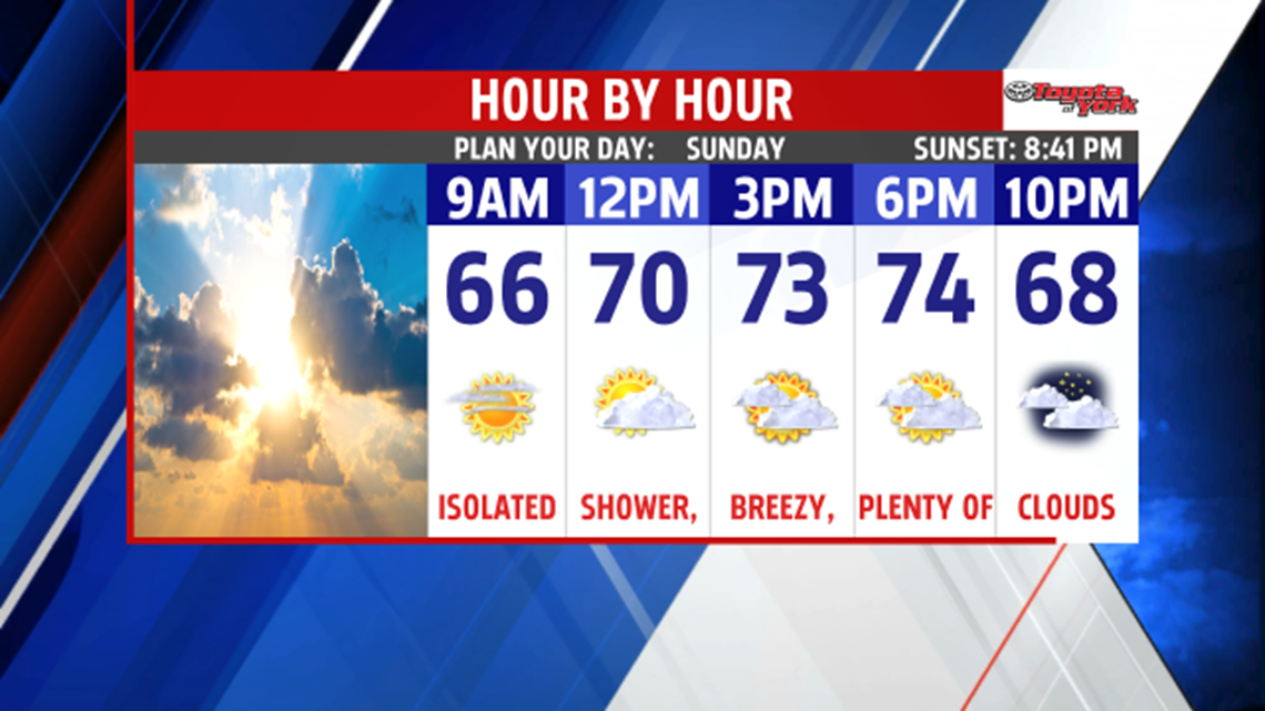
Enjoy the rest of your weekend!
