

TUESDAY EVENING STORM THREAT
Strong to severe storms will continue into the late evening. The Storm Prediction Center keeps us in a SLIGHT risk.

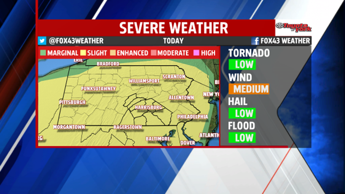
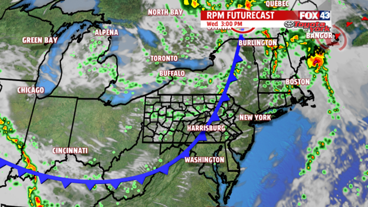
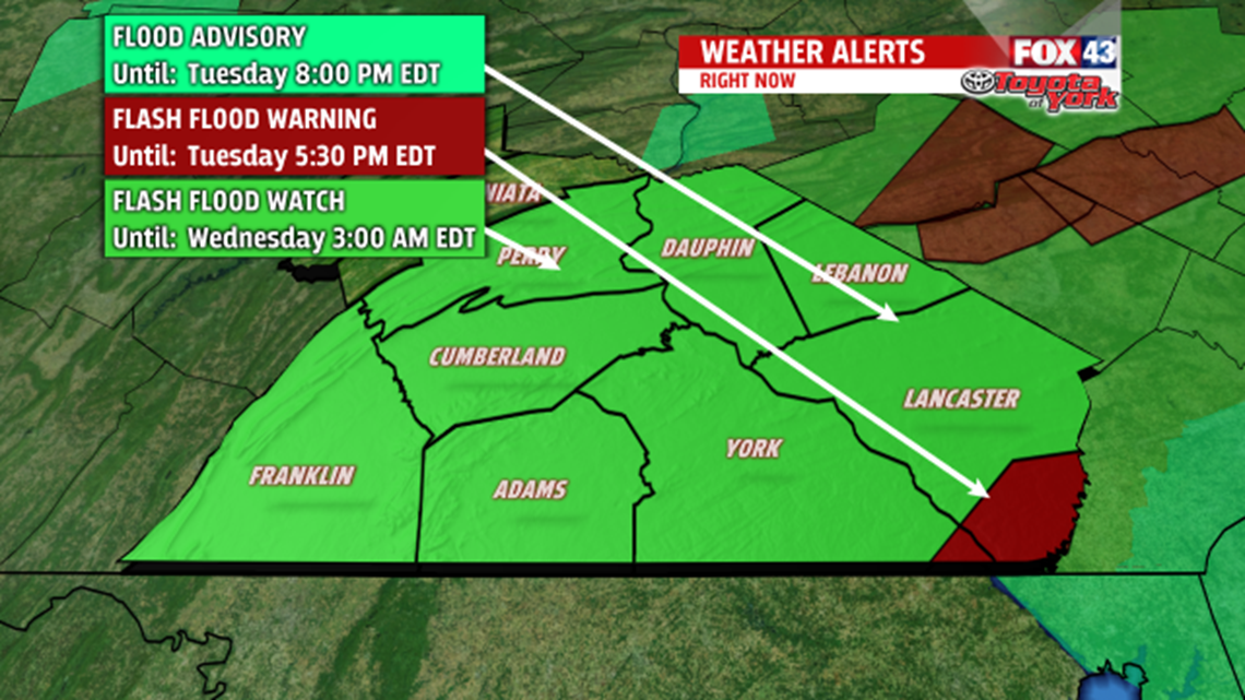
A cold front, along with a strong piece of energy, coming from the Ohio Valley, will help to keep a line of strong storms together into the evening hours. Damaging winds of at least 60mph are possible. There is a small tornado threat too. In addition, the line of storms will produce very heavy rainfall, which may lead to flash flooding. Flash Flood Watch is in effect for the entire area until 3AM. With recent heavy rainfall, it won’t take much to see quick rises on area creeks and streams to rise rapidly. If you see water levels rising, seek higher ground immediately! Severe Thunderstorm Watch continues through 8pm.

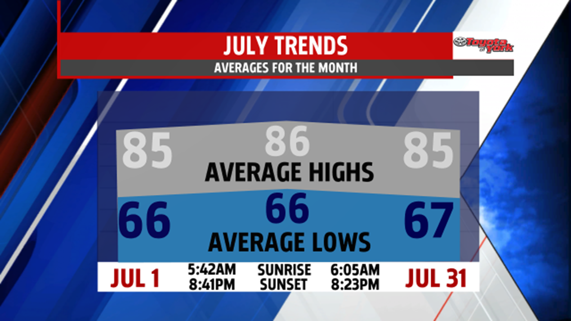
The first day of July comes in much quieter than the end of June. Here is a look at the high and low averages, as well as, the sunrise and sunset times for the month.

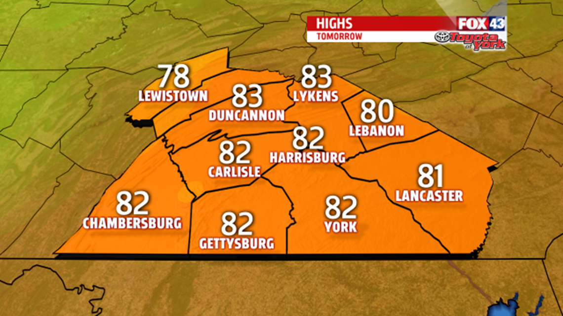
There may be a lingering shower for the morning drive, otherwise, partly to mostly cloudy skies will start the day. You’ll still notice the humidity during the day but once a second cold front sweeps across the area late in the day, drier air will funnel in and lower the dew points. It could trigger a stray shower or thunderstorm but chances are low. Highs will warm to the low 80s with a westerly breeze around 5 to 15mph. High pressure builds in helping the front settle to our south. It is close enough to keep an isolated storm threat around for our southern counties on Thursday. The high will strengthen bringing a nice end to the week with partly cloudy skies and highs around 80.


Have a great week!
