

STAY ALERT THIS AFTERNOON AND EVENING
The Storm Prediction Center has elevated us to an ENHANCED RISK for severe weather this afternoon. This means we have a pretty good chance for storms to get pretty nasty.

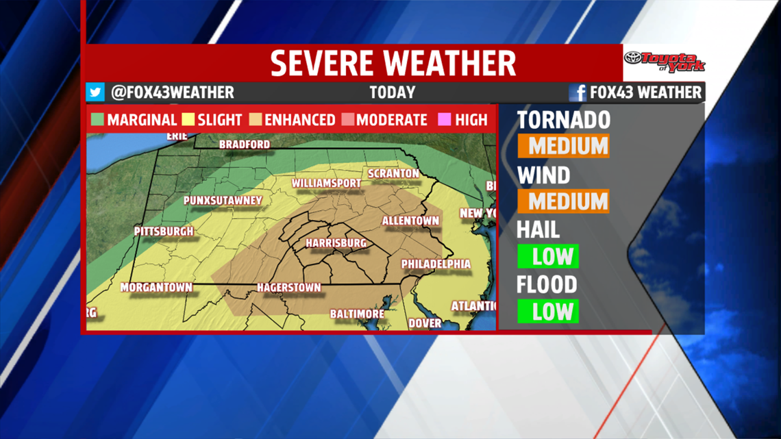
Strong to severe thunderstorms with damaging winds, and possibly, a few tornadoes are expected for the area. Of course, heavy downpours may lead to isolated flash flooding too. Low pressure at the surface, enhanced by upper level energy, will track across the area later today. With the expected heating of the day, and a tremendous amount of moisture in the air, it is very reasonable to expect the potential for bowing segments with damaging winds gusts. In addition, low level shear near the warm front is enough to mention the threat for tornadoes too.
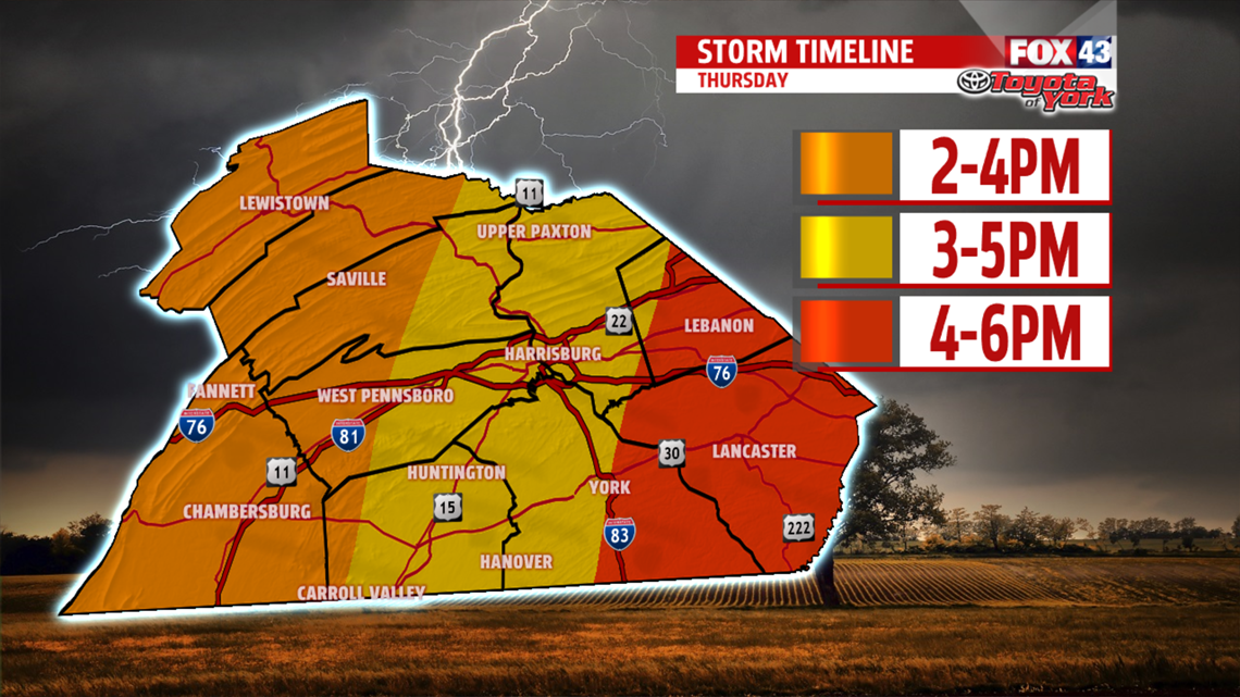
Timeframe for severe weather will be between 2pm and 8pm. Stay alert and be ready to take cover if threatening weather should approach. If you are heading out to the U.S. Women’s Open, have a game plan on where to go and what to do, storms approach.

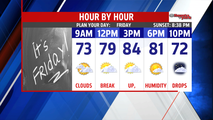
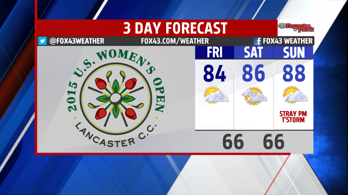
The front will not push through until very late tonight so clouds, fog some moisture may linger into the very early morning hours. Lows will drop the upper 60s as high pressure builds in providing somewhat drier air. This will also dew points to slowly drop through the morning hours but especially during the day Friday. More sunshine breaks through as the day wares on. While we will warm to the low 80s, it will be a few degrees below average but we will certainly get a much welcomed break from the oppressive humidity the past few days. We will also enjoy a break from the rain for a few days. We are looking at more sunshine to start the weekend and warmer temperatures. Clouds do build back in a bit by Sunday and it looks to be warmer in the upper 80s. There is still the possibility for a late shower or thunderstorm but timing of the energy is still in question.

HUMIDITY & STORMS RETURN
Early next week, the humidity starts to climb once again. We will also being dealing showers and thunderstorms each day as several disturbances ride through the upper level flow. Timing of these waves still a big question. Temperatures start out warm the mid to upper 80s but are expected to drop a few degrees each day.
Stay alert this evening and have a wonderful day!
