


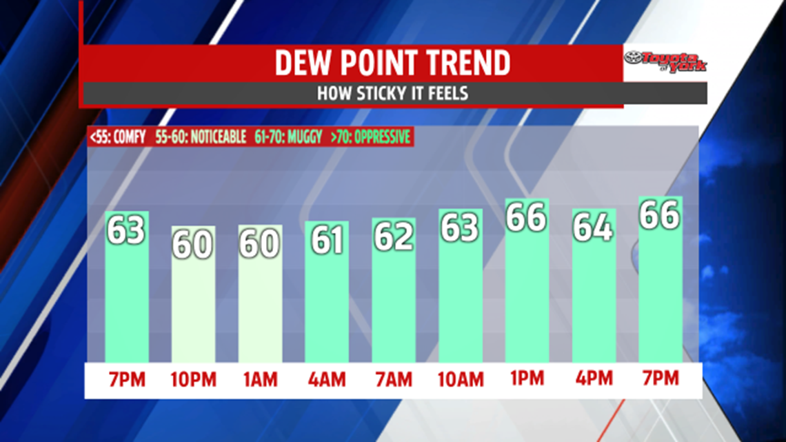
WEEKEND STAYS WARM AND DRY: After a toasty but seasonable Saturday, Sunday is a similar day. The evening remains pleasant under partly clear skies. Through tonight, the humidity continues to slowly nudge up. Overnight low temperatures are in the lower to middle 60s. A mixture of clouds and sunshine is expected for Sunday, but a shower or thunderstorm could try to sneak into the forecast. Most areas, however, stay dry. It’s another very warm, summer day with afternoon temperatures in the lower to middle 80s throughout the region.


EARLY WEEK RAIN CHANCES: Our next cold front approaches late Monday through Tuesday. Though the first half of Monday stays dry, shower and thunderstorm chances are back during the afternoon and evening hours. Highs are warm and muggy Monday, with readings in the lower to middle 80s. Tuesday, scattered showers and thunderstorms are expected to continue. The rain threat keeps temperatures a few degrees cooler, but the mugginess remains.

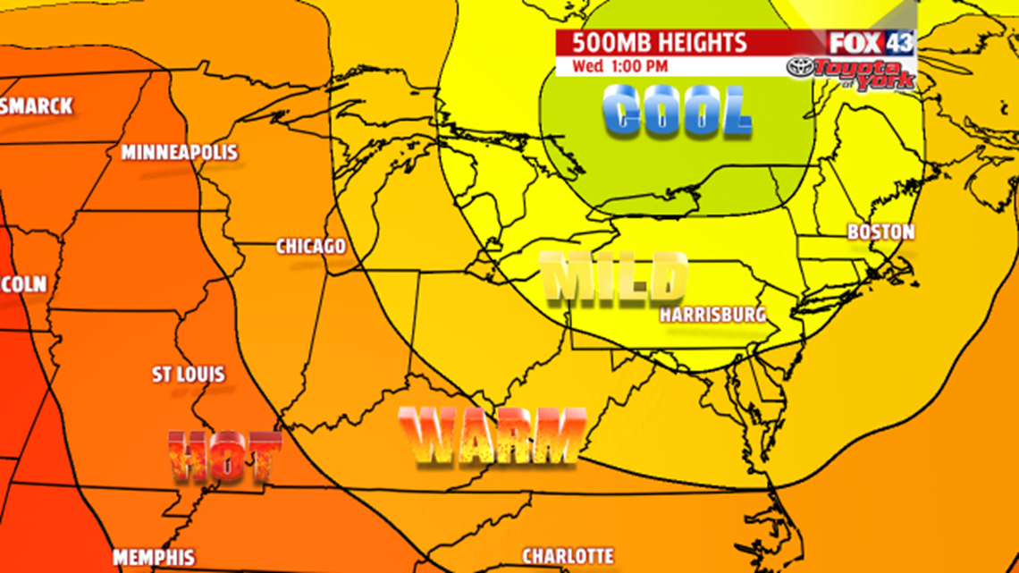
BRIEF MIDWEEK COOLING: Models are indicating a cool pool of air sliding into the region for the middle of the week. It’s sunnier and less humid through this stretch. Highs are near 80 degrees Wednesday, and fall into the middle to upper 70s Thursday! Skies are partly sunny Thursday, but the clouds break up by Friday. The cool air begins to retreat, so highs climb back into the lower 80s. Saturday, a weak cold front brings the chance for a couple thunderstorms. It’s a warmer and more humid day with afternoon temperatures in the middle 80s.
Enjoy the rest of your weekend!
