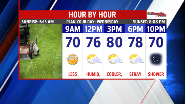

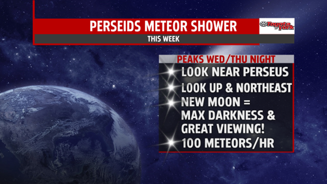
BRIEF MIDWEEK COOLING: After a warm and muggy start to the week, some changes briefly arrive. A cool pool of air settles over the region for the middle of the week. It’s sunnier and less humid beginning today! Cooler air aloft helps to bubble up some clouds, and there is a stray shower chance. Otherwise, it’s a cooler and wonderful day with highs in the middle 70s to 80 degrees. Tonight is a clear and comfortable night. It’s perfect to view the Perseids meteor shower! Overnight lows are in the middle 50s to near 60 degrees. Abundant sunshine is expected for Thursday. Temperatures are similar to today, with highs in the upper 70s to near 80 degrees.

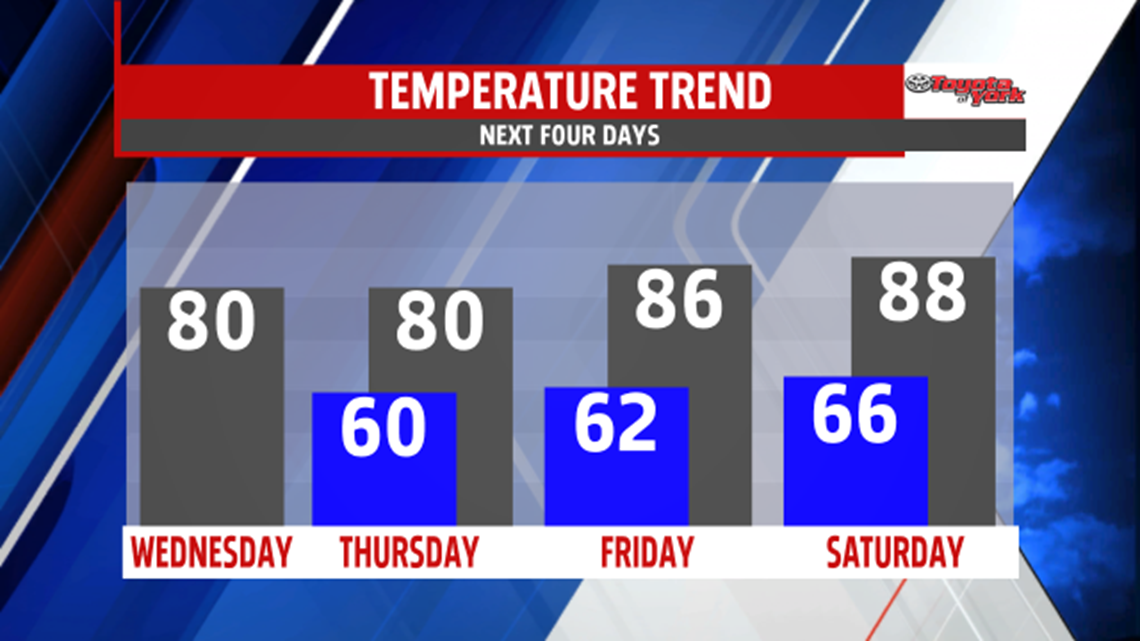
WEEKEND WARMING: Friday the cool air begins to retreat, so afternoon temperatures jump back into the lower to middle 80s. There is still plenty of sunshine. Saturday, a weak cold front brings the chance for a couple thunderstorms. It’s a warmer and more humid day with afternoon temperatures in the middle to upper 80s. Sunday is dry but still humid. Highs remain in the middle to upper 80s.
HEAT RETURNS: Next week, the heat builds back into our region. There’s plenty of sunshine Monday. It’s hot and humid as temperatures approach 90 degrees. We make another go at 90 degrees Tuesday, but there are more clouds and the chance for a couple thunderstorms.
Have a great Wednesday!