


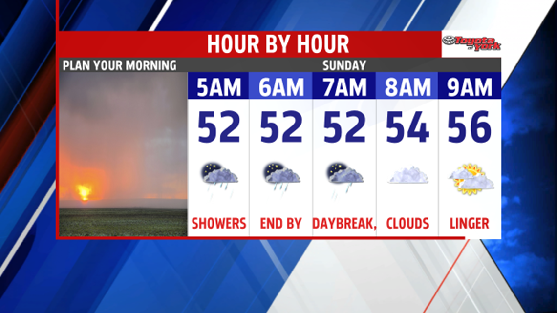

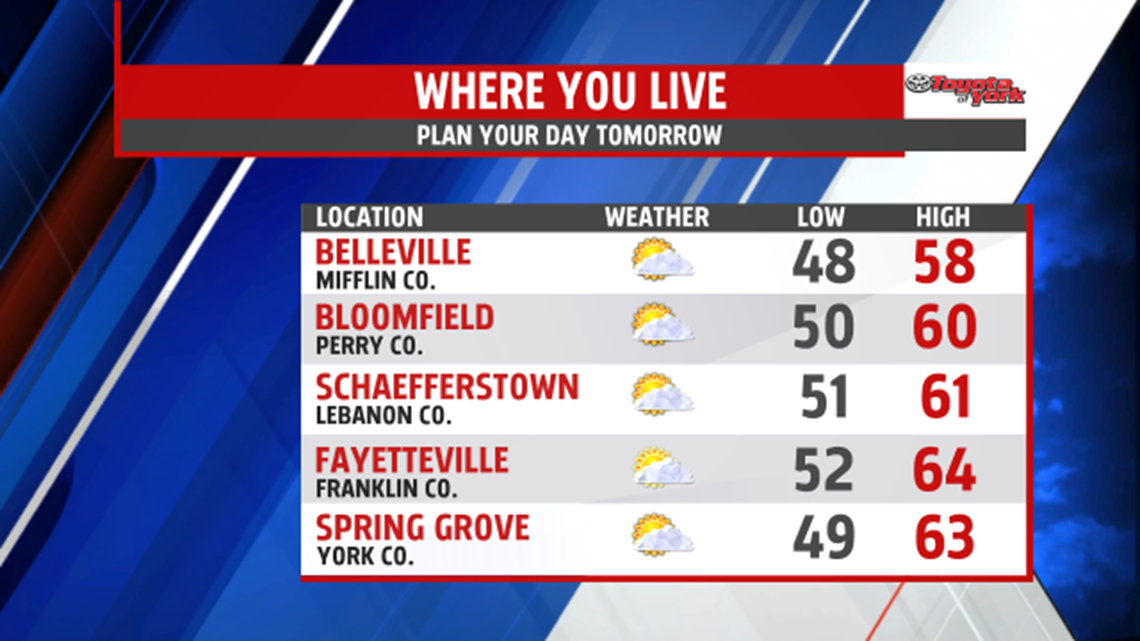
SHOWERS TONIGHT: Clouds continue to sit over our region, and showers arrive too. Through the evening hours and during the night a cold front crosses through, and it brings scattered showers to the region. Overnight low temperatures are milder, in the upper 40s to lower 50s. An early shower lingers Sunday around daybreak, but most are dry by that time. The clouds are slow to clear through the morning. Breezes pick up across the region too. Afternoon high temperatures are in the upper 50s to lower 60s.

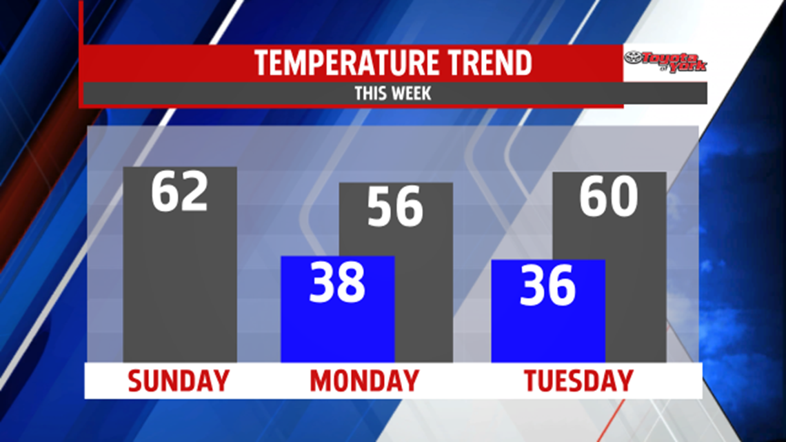
WEEK STARTS DRY: Monday sunshine is back, with readings in the middle 50s. Tuesday remains dry, but clouds filter in later during the day ahead of our next storm system. High temperatures reach the upper 50s to lower 60s.
MIDWEEK RAIN: Rain is in store for the middle of the week. The rain arrives Wednesday, and lasts through the night. Some showers likely linger into the early part of Thursday. Highs are near 60 on Wednesday, and then highs are in the lower to middle 60s Thursday. By Friday and Saturday, the sunshine is back. Another chilly air mass arrives too. This knocks high temperatures into the lower to middle 50s. The Halloween forecast looks dry and seasonably chilly for now!
Enjoy the rest of the weekend!
