

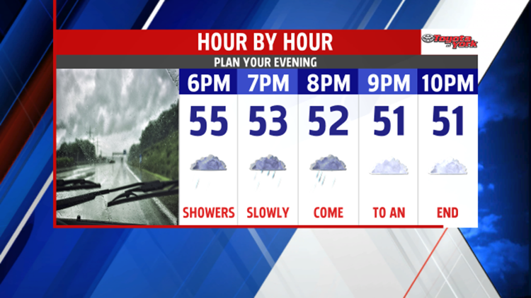


SHOWERS END: An area of low pressure continues to bring damp and dreary conditions to the area. Foggy and drizzly pockets along with spotty showers continue through the rest of the day. During the evening, the brunt of the rainfall comes to an end. Aside from a few drops, the overnight period brings clouds and foggy spots. Overnight low temperatures are in the upper 40s to lower 50s.


END OF WEEK CHILL: On Friday, some sunshine returns for the morning. Chilly air aloft slides in during the afternoon, and this brings some clouds. Highs are seasonable in the middle 50s. The chilliest of the air sits overtop of us through Saturday. Expect plenty of clouds, and a few lake effect sprinkles and flakes could make it into our northwestern most areas. Highs are very chilly, in the middle to upper 40s. More sunshine returns for both Sunday and Monday. Temperatures moderate into the 50s Sunday and near 60 degrees on Monday. Clouds thicken a bit for Tuesday.
Have a great night!
