


Today, we'll have thick, grey clouds all day.
The steadiest rain will fall from 2-8 P.M. Otherwise, just expect scattered showers.

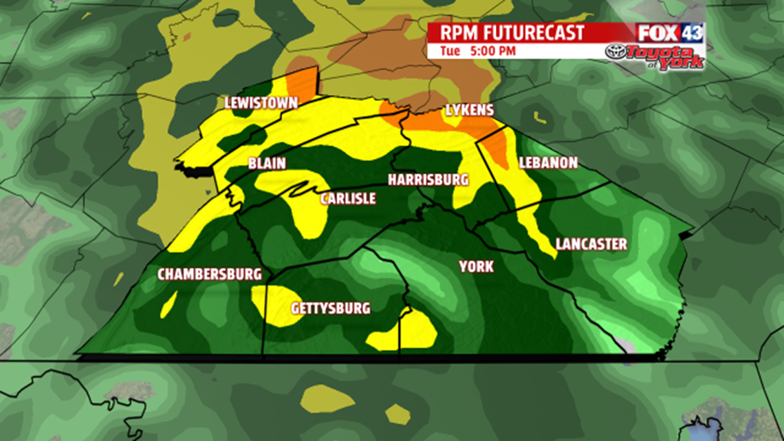
Most of us will get rainfall totals of a half of an inch to an inch. A few spots will get over an inch.
The clouds and showers hold our temperatures in the 50s all day.
The showers end after midnight.
After some morning clouds on Wednesday, sunshine returns by the afternoon. Highs in the low 60s also return.
More clouds and showers return on Thursday, but we’ll still have highs in the low 60s.
These clouds and showers come with a cold front.
On Friday, we start out with lots of sunshine. Then, you’ll notice more clouds in the afternoon skies. As cold air enters higher up, it will cause these afternoon clouds—a very typical setup for this time of year.
This cold air really settles in on Saturday.
After a high of 54 on Friday, we make it to only 48 on Saturday.
Also on Saturday, we’ll see some lake-effect sprinkles. If you happen to live in the mountains to the north and west of Harrisburg, you'll see some lake-effect flurries or snow showers.
An area of high pressure will start taking over our weather on Sunday. This brings partly sunny skies, and it helps lift our high back to the mid 50s.
Then, up to 60 on Monday as that area of high pressure sending us warmer airflow from the south. We’ll also have sunny skies, too.
Sunshine and 60s continue next Tuesday.
