

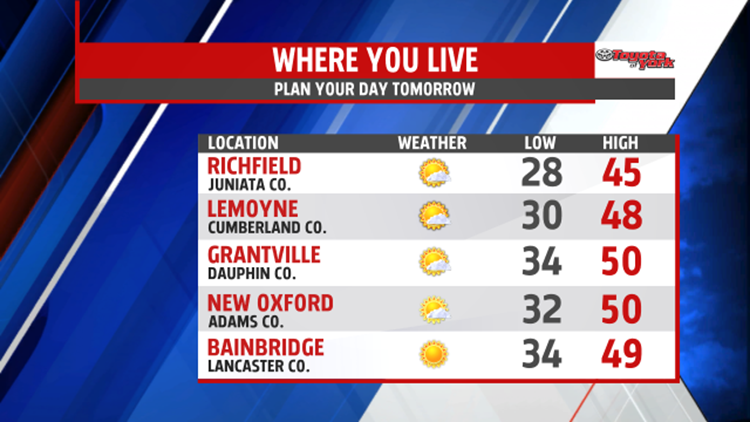


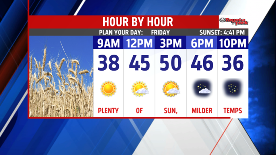
NICE WEEKEND: A cool pool of air sitting over top of the region continues to bring clouds and a seasonable chill to the Lower Susquehanna River Valley this afternoon. It slowly slides northeast through the rest of the day and into the evening hours. As this occurs, skies clear and the winds gradually lighten. It’s a chilly night, with mostly clear skies. Overnight lows fall into the upper 20s to middle 30s. High pressure takes control of our weather heading into the weekend. Friday is a mostly sunny day, with temperatures a bit milder too. Expect afternoon highs in the middle 40s to near 50 degrees.

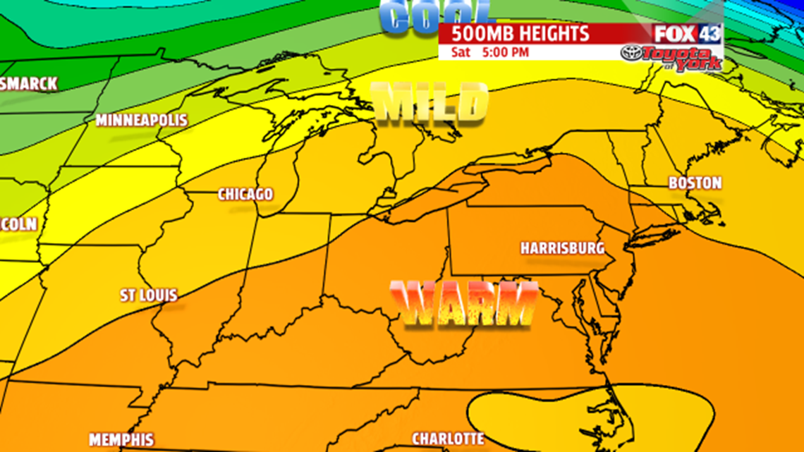
NICE WEEKEND: High pressure remains in full control of our weather through the weekend. This means ample sunshine continues. Temperatures warm above average after cold starts during the morning. Highs are in the lower to middle 50s Saturday, and then in the middle 50s Sunday.
STAYING SUNNY: The nice stretch of weather lasts into early next week as well. Plenty of sunshine is expected Monday and Tuesday. Highs remain above seasonal averages in the lower 50s.
WATCHING SHOWER CHANCES: We’ll be keeping an eye on our next system for the middle of the week. For now, it looks to just pass us to the south on Wednesday and Thursday. However, some showers could try to sneak into the forecast for one or both of those days. We’ll monitor the potential for showers over the next several days. Highs are expected to remain a bit above seasonal averages.
Have a great night!
