

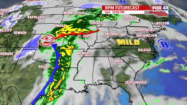

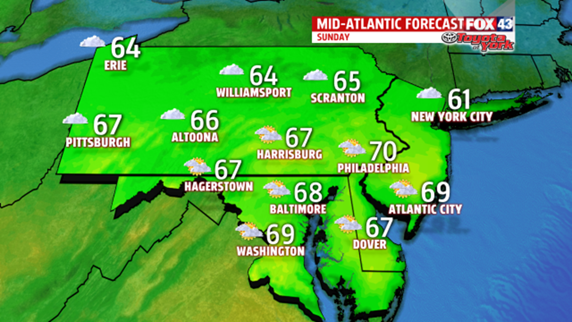
RECORD-BREAKING HIGHS: The unseasonably mild trend continues into the middle of December, and we are looking the possibility of record-breaking high temperatures for Sunday and Monday! High pressure off the east coast is helping to bring additional warm flow up from the south. The record high for Sunday is 63 degrees set in Harrisburg back in 1948. Once the patchy morning fog clears and the sun makes intermittent appearances, the forecast high may top that by a few degrees! On Monday, we will come close to possibly tie the record set back in 1927 at 64 degrees. These temperatures are well above normal for this time of year, compared to the the typical highs in the low 40s.
THE WEEK AHEAD: Our weather pattern turns a bit more active in the week ahead. Rain arrives Monday afternoon and sticks around through the evening commute. Winds will be a bit breezy too. Temperatures are only slightly cooler Tuesday and Wednesday as we dry out with highs in the mid 50s under mostly sunny skies.

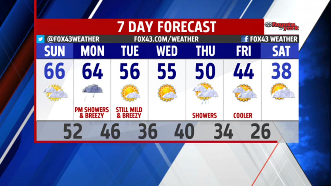
COOLER LATE WEEK: A return of more seasonable conditions is likely by the week’s end. An area of low pressure will quickly slide from the Upper Midwest to the Great Lakes, pushing a cold front through our area on Thursday. We should get cloudy skies and a few afternoon showers – but the bigger story is the cooler air mass that moves in behind the front for the weekend. We are cooler on Friday with highs in the mid 40s. After such a mild start to the week, it will certainly feel chilly by the weekend with highs in the upper 30s to near 40.
Have a great rest of your weekend!
