

SUNSHINE AND CALMER CONDITIONS SUNDAY
After a brisk start to the weekend, high pressure builds in and brings back full sunshine, a calmer wind and slightly warmer temperatures. It should be a much nicer second half to the weekend. High pressure drifts to the east. As it does, it shifts our flow to the southwest, which will pull in more moisture and milder air. Clouds will increase Sunday night into Monday. A cold front is expected late, so we should remain dry for the bulk of the day but come evening, light showers will be possible. Rain showers may continue overnight but end late morning Tuesday. Not a lot of rain expected. Highs Monday will rise to the upper 40s, but should get into the mid 50s Tuesday.

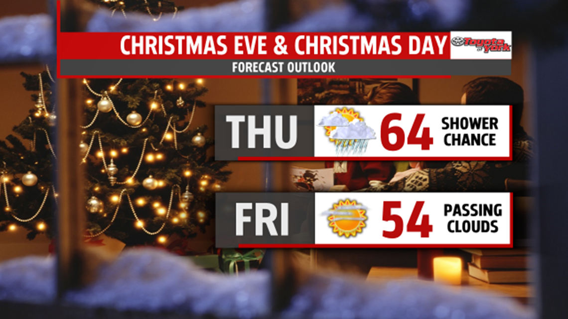
HOLIDAY WARMTH!
No chance of a white Christmas for us this year. Temperatures will be 20 degrees or more above average by Christmas Eve. We will be dealing with the threat for rain showers not snow showers. We sneak into the upper 50s to near 60, midweek, with showers arriving towards early evening and more to come for the eve of the holiday. Temperatures on Christmas Eve will reach well into the 60s. We could see records broke for some. Christmas day should be dry and temperatures will cool down a bit behind the front but will still average 10 to 15 degrees above average.

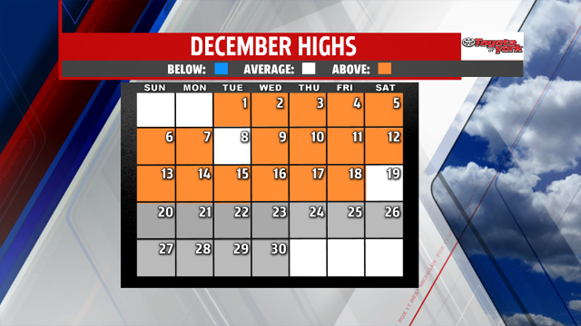
DECEMBER WARMTH!
So far December 2015 is the warmest of all time. No day so far has been below average, including today! The white box shows where the high was right on average but the orange boxes are days with above average high temperatures.

Have a terrific weekend!
Meteorologist, MaryEllen Pann
