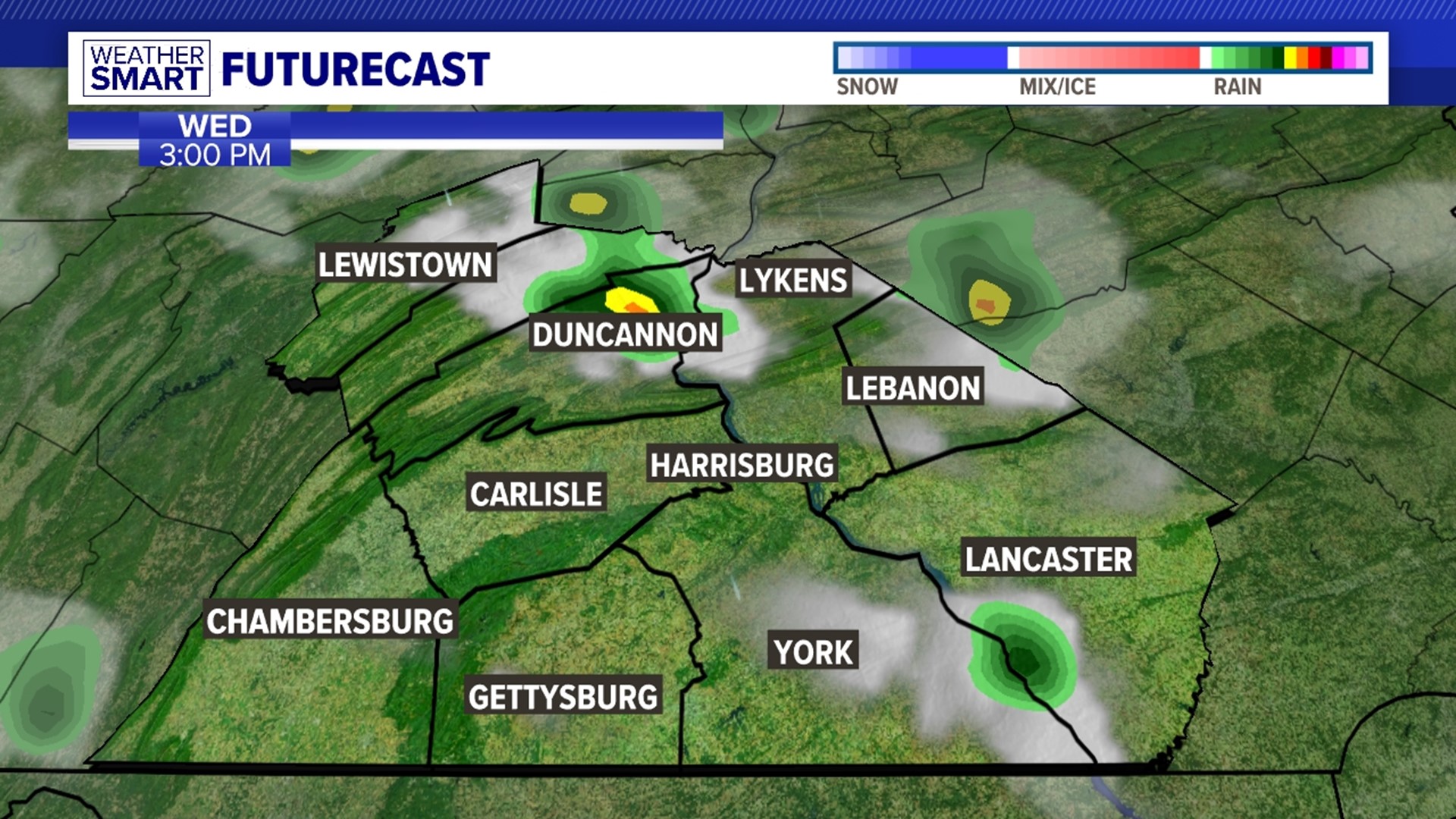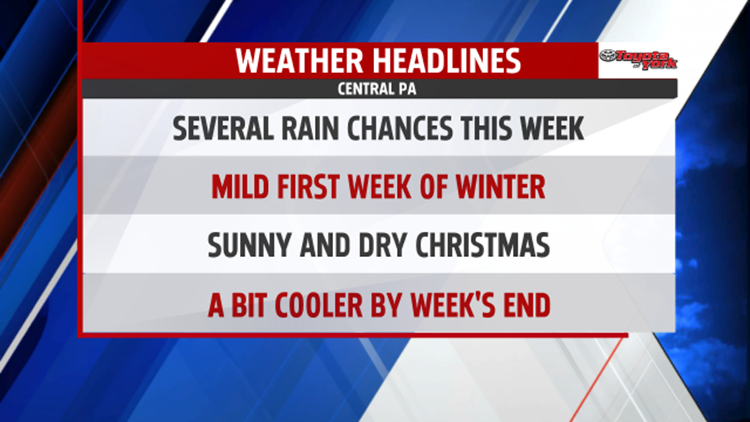

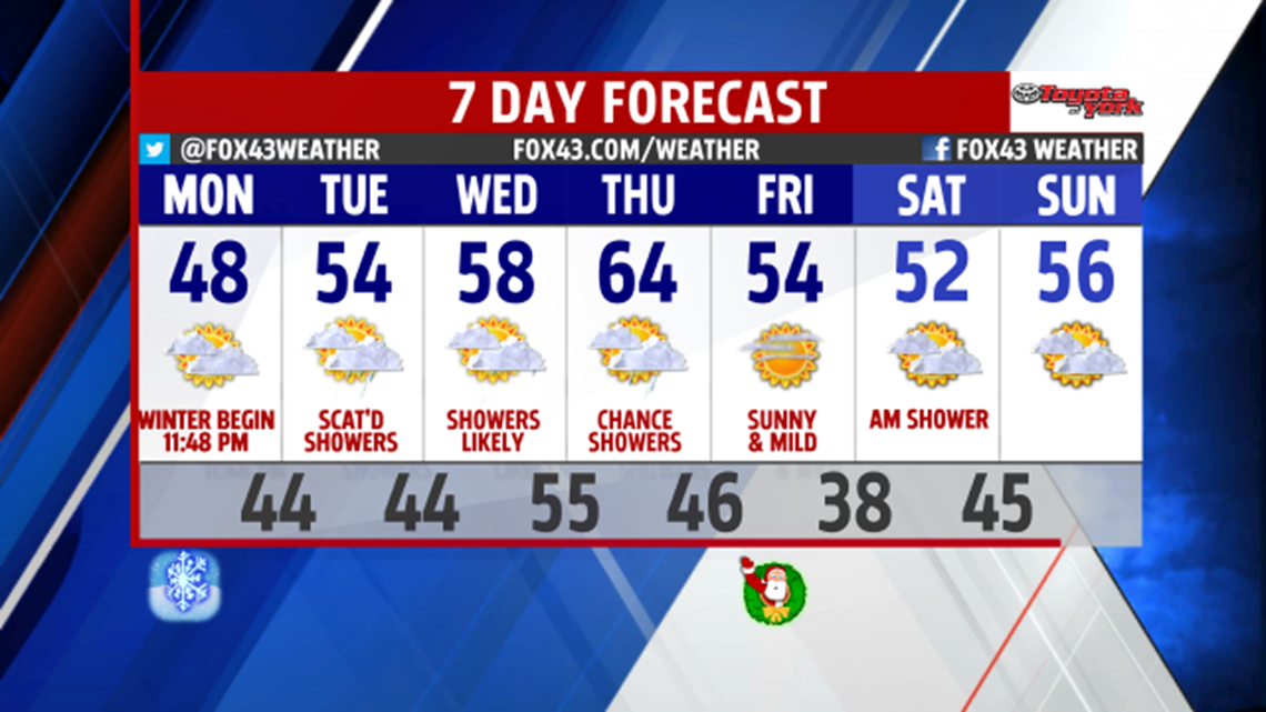
MILD & RAINY START: An active weather pattern brings mild air and rain back into our region in the week ahead. Although it doesn’t feel like it yet, the Winter solstice officially begins at 11:48 PM Monday night. Monday begins our warming trend into Christmas Eve as high pressure off the mid-Atlantic coast provides a southwesterly flow of mild air into much of the central Appalachians, Ohio Valley, and Great Lakes regions. Highs on Monday will reach into the upper 40s. With milder and moist air in place, a chance of showers is possible overnight into Tuesday morning as low pressure moves in from the Midwest. Temperatures don’t budge much Monday night with lows only in the mid 40s and an afternoon high on Tuesday around 55 degrees.

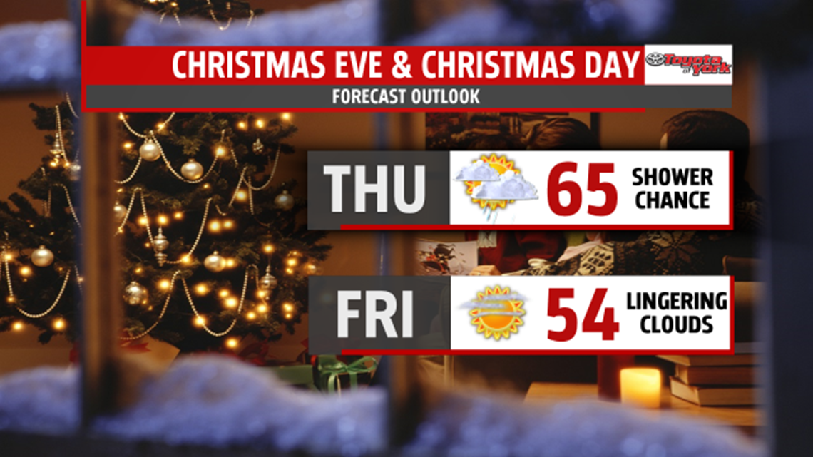
HOLIDAY WEATHER: The week remains unsettled with another system approaching on Wednesday and Thursday. Temperatures continue to stay mild in the mid to upper 50s, with near record-breaking highs on Thursday in the mid-60s… that’s around 20 degrees above average for this time of year! A cold front should clear us out Thursday afternoon, but we still remain on the mild side with highs in the low to mid 50s on Christmas Day, dry, and under mostly sunny skies.

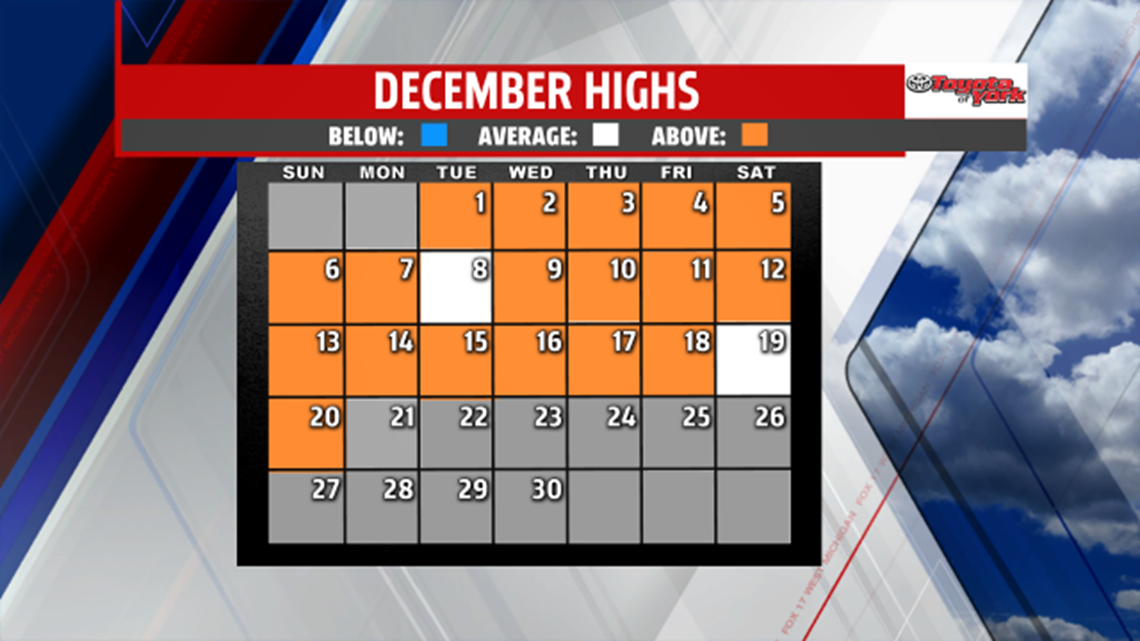
CLIMATE UPDATE: December continues to be the warmest of all time. We haven’t had any day this month with temperatures falling below average. This image shows dates in which have been above average (in orange), and those that have been recorded right on average (in white). The trend in the week ahead will add even more orange (above average) to this image!
Have a great week!