

GET READY FOR A BIG SNOW
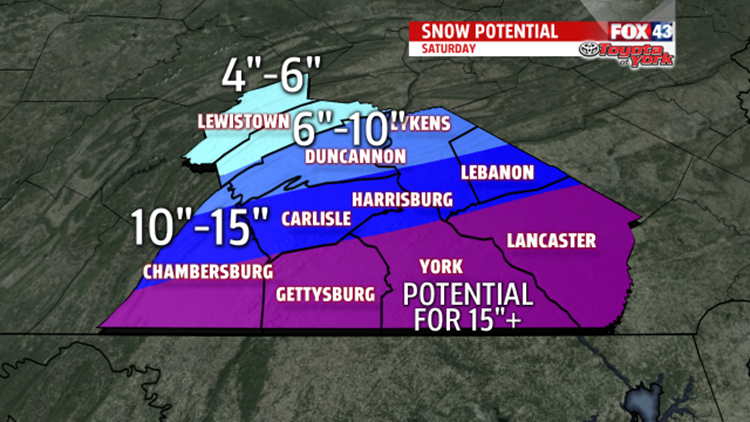
WINTER STORM WARNING In effect this evening until Sunday morning. This means we are expecting quite a bit of snow. In fact, much of the area may see double digit snow accumulations. The heaviest snow will fall early Saturday. We could pick up 5 to 7” of snow in 3 hours, so it will be intense. There is a small chance we may even hear thunder. From the Turnpike south, we could see over 15” of snow. There will be areas that approach two feet of snow. Farther north, amounts drop to 6 to 10” of snow. This will be a daily record snow for the airport if we get over 9.5”, which is the record from 1982, and it is looking very likely we will break the record.

The warning was expanded to included Mifflin and Juanita Counties. However, there may still be a sharp cut off from the heavier snow amounts to the south to much less across these counties and points nearby. It will still be enough to need a plow!
Timing is still looking around 5pm to the south. Snow spreads north through the evening and picks up in intensity overnight.
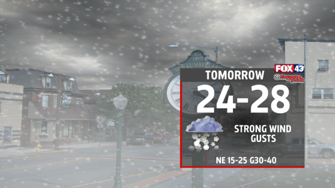
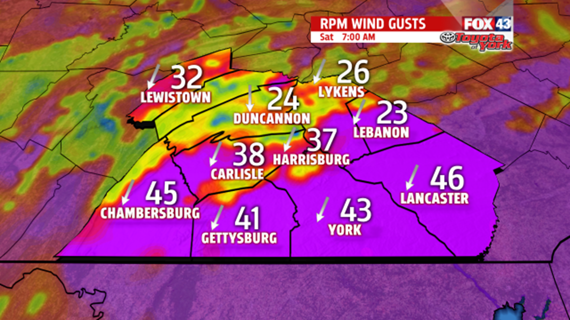
Conditions will deteriorate rapidly. It will be very dangerous to be on the roads. Winds will create a lot of blowing and drifting of snow. Across Lancaster County points nearby, winds will approach blizzard conditions, making traveling very dangerous and nearly impossible. Winds will on average across the area, will be 15-20 mph with gusts of 35-30 mph. However, farther east across Lancaster County, they may be higher than 30mph.

Be sure to send in your pictures, totals, and current conditions to Facebook and Twitter. It helps us greatly!
FACEBOOK: MaryEllen Pann Fox43
TWITTER: @MaryEllenFox43
SUNSHINE RETURNS
By Sunday, storm is pulling away and high pressure builds in for a couple of days. The breeze will hang on for the second half of the weekend, creating wind chills of teens and 20’s. Actual highs should warm to the upper 20s to low 30s.
Monday, another beautiful day but a very cold start in the teens. We’ll rebound to the low 30’s in the afternoon. Winds will be much lighter, if not calm.
Next quick moving system comes in Tuesday. Not a lot of moisture associated with it. In fact, looks pretty weak for much more than a few rain or snow showers. Temperatures ahead of the front will warm to the mid 30s but fall back once again for Wednesday, as colder air returns. Pattern is quiet through the rest of the week.
Have a safe and warm weekend!
MaryEllen Pann
Chief Meteorologists, FOX43
