COLDER TO END THE WEEK
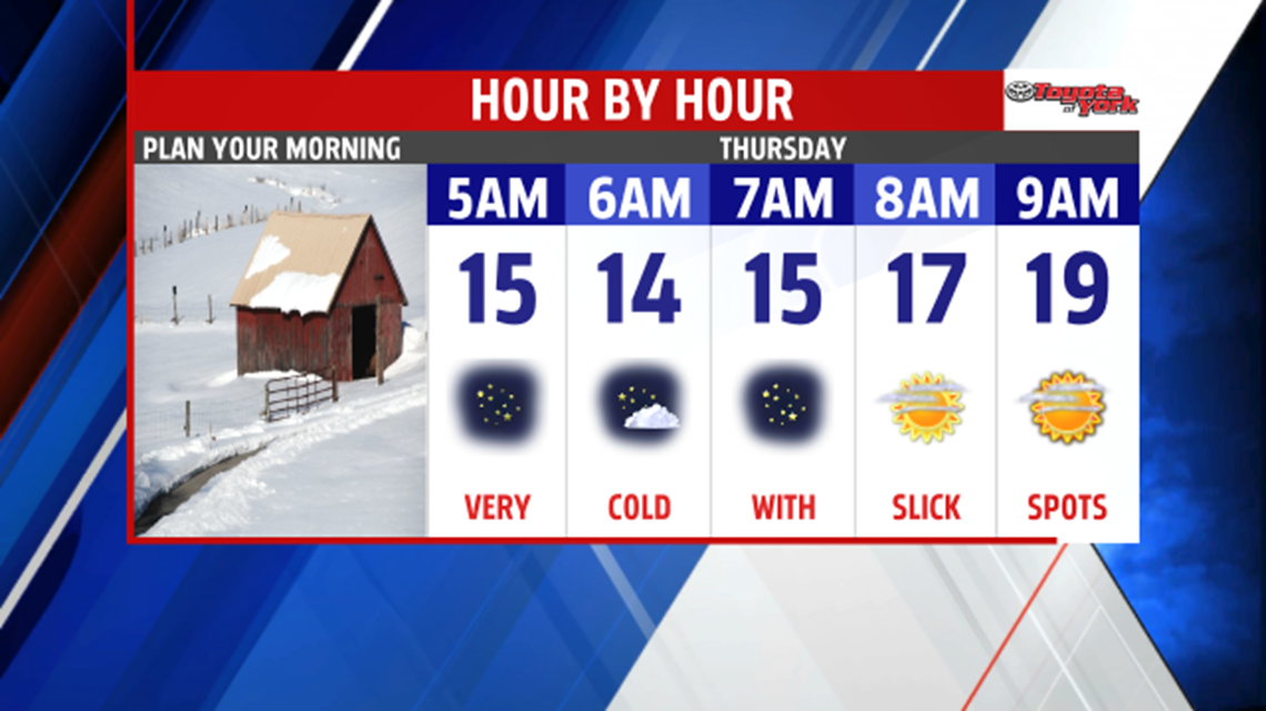
Tonight, temperatures will plummet quickly below freezing once the sun sets at 5:20pm. The melting from today will re-freeze causing icy areas. Be careful. At night, the road will look wet but is likely a sheet of ice. Clear skies tonight, high pressure in control, and a light to calm wind will lead to morning lows in the teens.

It will be a colder but seasonable end to the week. Sunshine diminishes as clouds increase and thicken by the afternoon. Highs will be held in the mid 30s. A clipper passes by well north but drags a cold front through the area by Friday morning. Winds will be brisk out of the northwest causing Lake Effect snow showers to get going. We could see a few flurries or light snow showers early morning, especially in our northwest counties. Highs to end the week will reach the mid 30s.