

A CHILLY FRIDAY FOLLOWED BY MILDER AIR
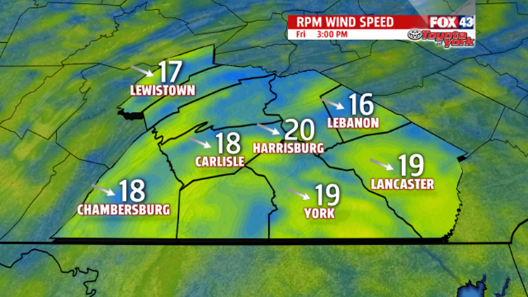
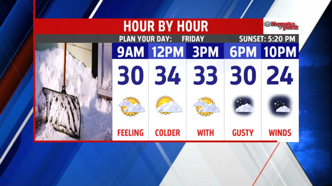
Clouds are in place across the area at this hour and will remain overnight. They will keep temperatures from dropping as much as they did last night. Lows will range from the low to upper 20s, so no single digits or teens for the morning. Clipper sides through early and may produce a few snow flurries or light snow showers for parts of the area. Temperatures only rise to the low to mid 30s, and brisk winds will reinforce the colder air, keeping temps from warming much more.

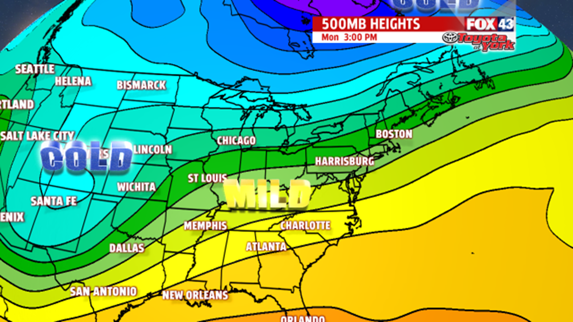
High pressure builds in late Friday night and calms with winds, while clearing the skies too. This will allow for one more morning in the upper teens before milder air spreads in across the area. Ridge of high pressure aloft and at the surface will allow temperatures to warm up. Despite a cold morning, plenty of sunshine and a light breeze, helps warm us to the upper 30s to near 40 degrees. Sunday, we’ll get a boost to the mid 40s with the help of a southwesterly flow and plenty of sunshine. An approaching frontal system will weaken as it moves east, and only produce a few stray late day showers. Ahead of the front, temperatures should warm to the mid and upper 40s. The front sags south then moves back north as a warm front Tuesday. Temperatures may be held to the low to mid 40s due to cloud cover.
STRONG COLD FRONT BRINGS BACK COLD AIR
On Wednesday, a strong cold front will swing through the area producing rain showers. Temperatures will be very warm in the low 50s. Once it moves east, much colder, more seasonal air spreads in for the end of the week.


MaryEllen Pann,
Chief Meteorologist
