

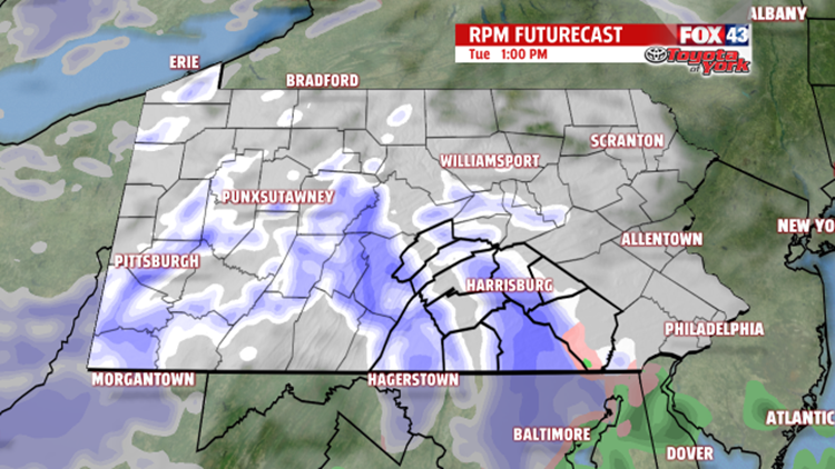

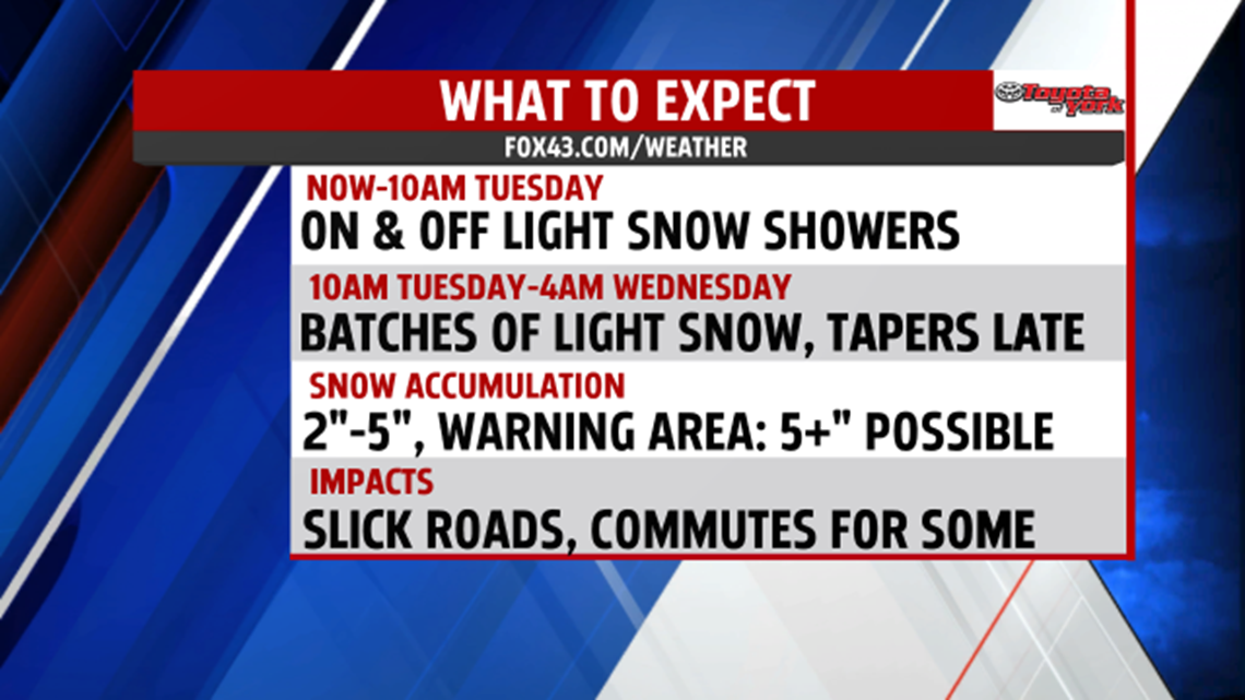

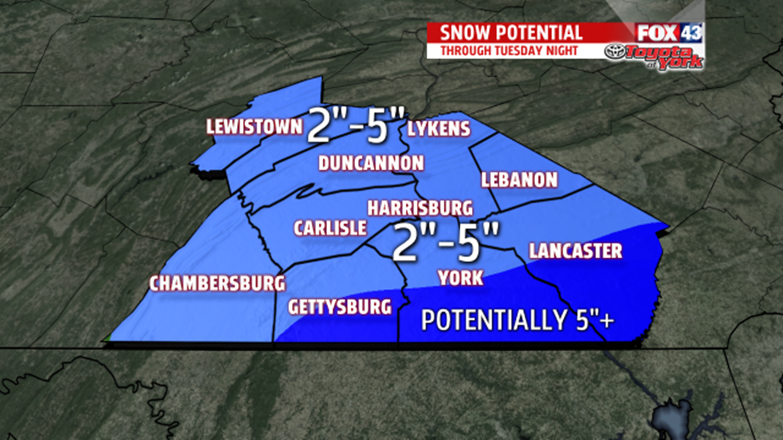
SNOWY TUESDAY: On and off snow showers continue this morning as a weak, moisture starved system slowly pushes through. Expect the periods of light snow to continue through Tuesday, with breaks working in at times. The commutes Tuesday are expected to be affected for parts of the area depending on when and where any snow bands develop. Banding is possible during the afternoon, mainly to the south and eastern parts of the region, and it brings the potential for a few more inches. Most of the area should see at least a couple inches, with the extra possible to the southeast depending on the banding. Slick roads could make for tricky travel at times. Highs are in the lower to middle 30s on Tuesday. Snow showers taper through the evening to flurries. Lows are in the 20s.
CLOUDS & COLD: Cold air settles in Wednesday, making for a cloudy day. Flurries are likely, especially the west and northwestern parts of the region. Highs are in the upper 20s to lower 30s Wednesday. A little more sun sneaks in Thursday, but skies are still fairly cloudy. Expect readings in the middle to upper 20s.

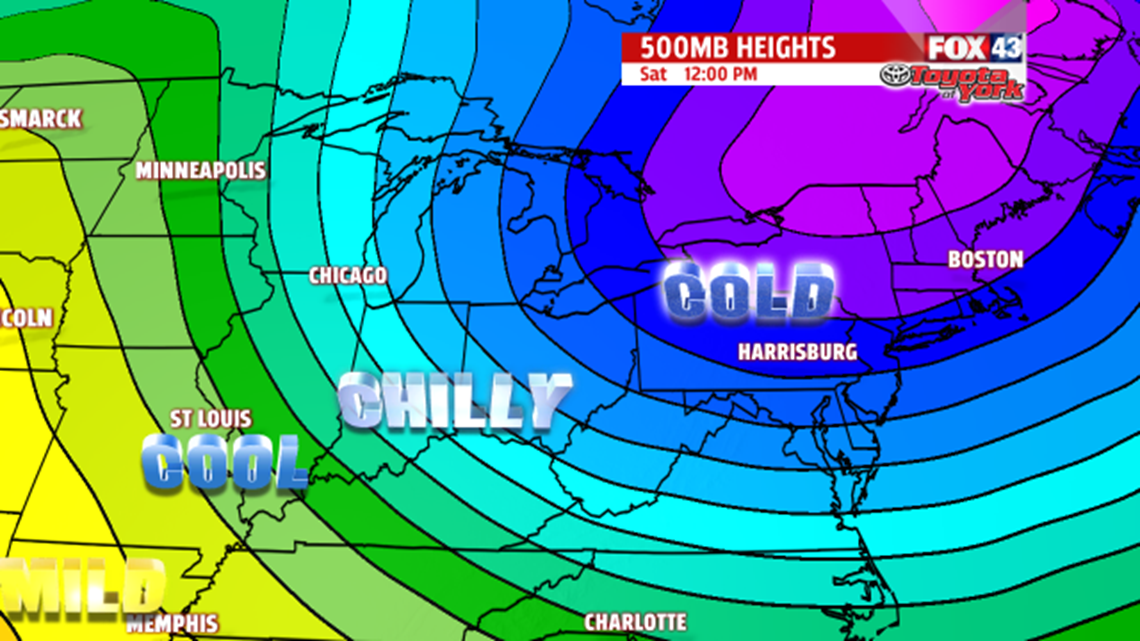
EVEN COLDER WEEKEND: A wave of energy moves through Friday and brings the chance for some snow showers. Temperatures begin to fall Friday, with readings in the middle 20s. The weekend brings some of the coldest air we’ve seen so far this season. Expect highs in the teens and lows in the single digits! On Monday temperatures moderate into the 20s, and a weak storm system approaches. This brings the chance for some snow showers.
Have a great Tuesday!
